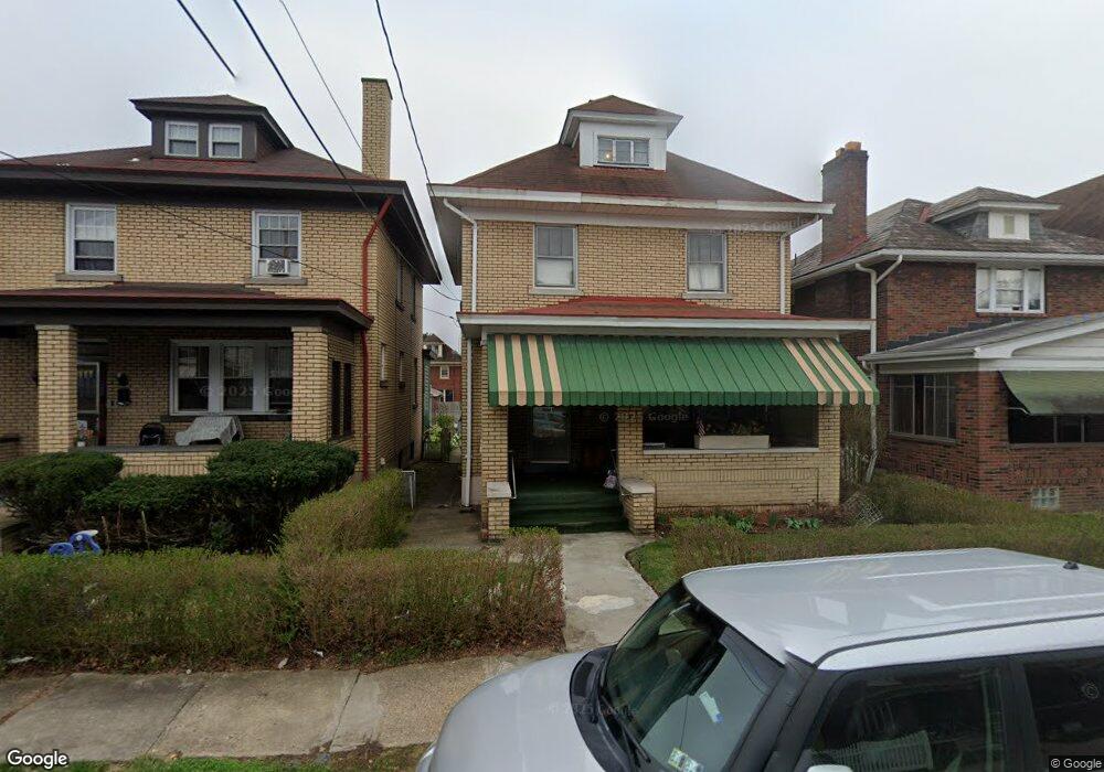
1011 2nd St Mc Kees Rocks, PA 15136
McKees Rocks NeighborhoodEstimated Value: $96,000 - $102,000
3
Beds
1
Bath
1,879
Sq Ft
$53/Sq Ft
Est. Value
About This Home
This home is located at 1011 2nd St, Mc Kees Rocks, PA 15136 and is currently estimated at $99,333, approximately $52 per square foot. 1011 2nd St is a home located in Allegheny County with nearby schools including Sto-Rox Upper Elementary School, Sto-Rox Primary Center, and Sto-Rox Junior/Senior High School.
Ownership History
Date
Name
Owned For
Owner Type
Purchase Details
Closed on
Oct 3, 2025
Sold by
Farrell Briceland Parkinson Exr and Parkinson Russell J Est
Bought by
C C J P Holdings L L C and Ccjp Holdings L L C
Current Estimated Value
Purchase Details
Closed on
Mar 6, 2024
Sold by
Parkinson Harold Nevins
Bought by
Parkinson Russell Jay
Purchase Details
Closed on
Mar 2, 2024
Sold by
Parkinson Russell Jay and Parkinson Harold Nevins
Bought by
Parkinson Russell Jay
Purchase Details
Closed on
Feb 9, 1993
Bought by
Parkinson Russell Jay & Harold Nevins Pa
Create a Home Valuation Report for This Property
The Home Valuation Report is an in-depth analysis detailing your home's value as well as a comparison with similar homes in the area
Home Values in the Area
Average Home Value in this Area
Purchase History
| Date | Buyer | Sale Price | Title Company |
|---|---|---|---|
| C C J P Holdings L L C | $40,000 | -- | |
| Parkinson Russell Jay | -- | -- | |
| Parkinson Russell Jay | $2,400 | -- | |
| Parkinson Russell Jay & Harold Nevins Pa | $48,700 | -- |
Source: Public Records
Tax History Compared to Growth
Tax History
| Year | Tax Paid | Tax Assessment Tax Assessment Total Assessment is a certain percentage of the fair market value that is determined by local assessors to be the total taxable value of land and additions on the property. | Land | Improvement |
|---|---|---|---|---|
| 2025 | $1,407 | $33,400 | $10,300 | $23,100 |
| 2024 | $1,407 | $33,400 | $10,300 | $23,100 |
| 2023 | $1,351 | $33,400 | $10,300 | $23,100 |
| 2022 | $1,307 | $33,400 | $10,300 | $23,100 |
| 2021 | $158 | $33,400 | $10,300 | $23,100 |
| 2020 | $1,277 | $33,400 | $10,300 | $23,100 |
| 2019 | $1,277 | $33,400 | $10,300 | $23,100 |
| 2018 | $158 | $33,400 | $10,300 | $23,100 |
| 2017 | $1,246 | $33,400 | $10,300 | $23,100 |
| 2016 | $158 | $33,400 | $10,300 | $23,100 |
| 2015 | $158 | $33,400 | $10,300 | $23,100 |
| 2014 | $1,163 | $33,400 | $10,300 | $23,100 |
Source: Public Records
Map
Nearby Homes
- 916 2nd St
- 912 1/2 2nd St
- 211 Bruce St
- 827 1/2 Frank St
- 828 Frank St
- 334 Russellwood Ave
- 764 Mary St
- 841 Railroad St
- 420 Broadway Ave
- 416 Grove St
- 108 Greydon Ave
- 110 Greydon Ave
- 112 Greydon Ave
- 114 Greydon Ave
- 122 Greydon Ave
- 120 Greydon Ave
- 1140 Taggart St
- 733 Mary St
- 533 Woodward Ave
- 1236 Church Ave