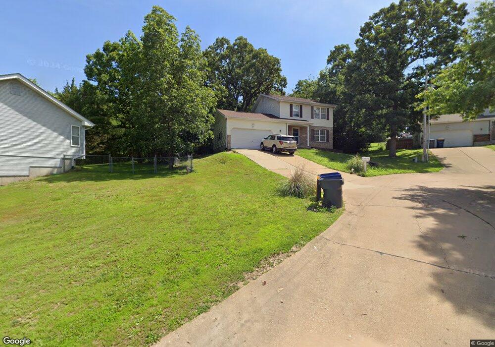
1011 Cathy Cir Saint Clair, MO 63077
Estimated Value: $231,000 - $272,000
3
Beds
1
Bath
1,536
Sq Ft
$165/Sq Ft
Est. Value
About This Home
This home is located at 1011 Cathy Cir, Saint Clair, MO 63077 and is currently estimated at $253,898, approximately $165 per square foot. 1011 Cathy Cir is a home located in Franklin County with nearby schools including St. Clair Elementary School, Edgar Murray Elementary School, and St. Clair Junior High School.
Ownership History
Date
Name
Owned For
Owner Type
Purchase Details
Closed on
Aug 8, 2006
Sold by
Gaszak Gregory J and Gaszak Regenia F
Bought by
Buckthorpe Clayton F and Buckthorpe Amanda M
Current Estimated Value
Home Financials for this Owner
Home Financials are based on the most recent Mortgage that was taken out on this home.
Original Mortgage
$99,261
Outstanding Balance
$67,403
Interest Rate
9.75%
Mortgage Type
Assumption
Estimated Equity
$186,495
Create a Home Valuation Report for This Property
The Home Valuation Report is an in-depth analysis detailing your home's value as well as a comparison with similar homes in the area
Home Values in the Area
Average Home Value in this Area
Purchase History
| Date | Buyer | Sale Price | Title Company |
|---|---|---|---|
| Buckthorpe Clayton F | -- | None Available |
Source: Public Records
Mortgage History
| Date | Status | Borrower | Loan Amount |
|---|---|---|---|
| Open | Buckthorpe Clayton F | $99,261 |
Source: Public Records
Tax History
| Year | Tax Paid | Tax Assessment Tax Assessment Total Assessment is a certain percentage of the fair market value that is determined by local assessors to be the total taxable value of land and additions on the property. | Land | Improvement |
|---|---|---|---|---|
| 2025 | $2,165 | $32,140 | $0 | $0 |
| 2024 | $2,165 | $27,673 | $0 | $0 |
| 2023 | $1,698 | $27,673 | $0 | $0 |
| 2022 | $1,894 | $30,715 | $0 | $0 |
| 2021 | $1,891 | $30,715 | $0 | $0 |
| 2020 | $1,763 | $27,482 | $0 | $0 |
| 2019 | $1,749 | $27,482 | $0 | $0 |
| 2018 | $1,718 | $26,670 | $0 | $0 |
| 2017 | $1,715 | $26,670 | $0 | $0 |
| 2016 | $1,600 | $24,844 | $0 | $0 |
| 2015 | $1,483 | $24,844 | $0 | $0 |
| 2014 | $1,483 | $24,859 | $0 | $0 |
Source: Public Records
Map
Nearby Homes
- 1008 Cathy Cir
- 0 Crescent Lake Rd Unit MIS25079528
- 830 Walton St
- 45 E Oak St
- 235 E Oak St
- 330 Young St
- 325 Iris Ct
- 322 Cart Path Ln
- 614 T-Box Dr
- 208 Mosley Ave
- 5 Lots Mosley Ave
- 445 Lakeshore Dr
- 100 E North St
- 0 Gravois Rd Unit 11555468
- 111 Wrenwood Dr
- 440 Lake Shore Dr
- 347 Roller Rd
- 1420 Sandpiper Dr
- 605 N Main St
- 390 Highway Dr
- 1012 Cathy Cir
- 1010 Cathy Cir
- 1301 Neff Rd
- 1009 Cathy Cir
- 1275 Cynthia Ln
- 1283 Bardot St
- 1013 Sara Jane Ln
- 1290 Michelle Dr
- 1307 Neff Rd
- 1290 Cynthia Ln
- 1277 Bardot St
- 1007 Sara Jane Ln
- 1014 Sara Jane Ln
- 1271 Bardot St
- 1280 Diane St
- 1265 Cynthia Ln
- 1313 Neff Rd
- 1280 Michelle Dr
- 1270 Cynthia Ln
- 1006 Sara Jane Ln
Your Personal Tour Guide
Ask me questions while you tour the home.