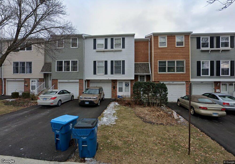
1011 Denham Place Unit 1 Schaumburg, IL 60194
West Schaumburg NeighborhoodEstimated Value: $304,000 - $344,000
3
Beds
2
Baths
1,686
Sq Ft
$190/Sq Ft
Est. Value
About This Home
This home is located at 1011 Denham Place Unit 1, Schaumburg, IL 60194 and is currently estimated at $319,628, approximately $189 per square foot. 1011 Denham Place Unit 1 is a home located in Cook County with nearby schools including Neil Armstrong Elementary School, Dwight D Eisenhower Junior High School, and Hoffman Estates High School.
Ownership History
Date
Name
Owned For
Owner Type
Purchase Details
Closed on
Aug 16, 1999
Sold by
Continental Community Bank & Trust Co
Bought by
Ray Divyesh B and Ray Kalpana D
Current Estimated Value
Home Financials for this Owner
Home Financials are based on the most recent Mortgage that was taken out on this home.
Original Mortgage
$99,880
Interest Rate
7.25%
Purchase Details
Closed on
Mar 31, 1994
Sold by
Cameron Alan R
Bought by
Maywood Proviso State Bank
Purchase Details
Closed on
Dec 27, 1993
Sold by
Maywood Proviso State Bank
Bought by
Cameron Alan R
Home Financials for this Owner
Home Financials are based on the most recent Mortgage that was taken out on this home.
Original Mortgage
$72,763
Interest Rate
7.31%
Mortgage Type
FHA
Create a Home Valuation Report for This Property
The Home Valuation Report is an in-depth analysis detailing your home's value as well as a comparison with similar homes in the area
Home Values in the Area
Average Home Value in this Area
Purchase History
| Date | Buyer | Sale Price | Title Company |
|---|---|---|---|
| Ray Divyesh B | $125,000 | -- | |
| Maywood Proviso State Bank | -- | -- | |
| Cameron Alan R | -- | Equity Title |
Source: Public Records
Mortgage History
| Date | Status | Borrower | Loan Amount |
|---|---|---|---|
| Previous Owner | Ray Divyesh B | $99,880 | |
| Previous Owner | Cameron Alan R | $72,763 |
Source: Public Records
Tax History Compared to Growth
Tax History
| Year | Tax Paid | Tax Assessment Tax Assessment Total Assessment is a certain percentage of the fair market value that is determined by local assessors to be the total taxable value of land and additions on the property. | Land | Improvement |
|---|---|---|---|---|
| 2024 | $5,724 | $20,502 | $3,001 | $17,501 |
| 2023 | $5,945 | $22,000 | $3,000 | $19,000 |
| 2022 | $5,945 | $22,000 | $3,000 | $19,000 |
| 2021 | $4,588 | $15,174 | $2,835 | $12,339 |
| 2020 | $4,516 | $15,174 | $2,835 | $12,339 |
| 2019 | $4,511 | $16,860 | $2,835 | $14,025 |
| 2018 | $4,376 | $18,026 | $2,475 | $15,551 |
| 2017 | $4,307 | $18,026 | $2,475 | $15,551 |
| 2016 | $4,969 | $18,026 | $2,475 | $15,551 |
| 2015 | $3,405 | $14,035 | $2,160 | $11,875 |
| 2014 | $3,383 | $14,035 | $2,160 | $11,875 |
| 2013 | $3,279 | $14,035 | $2,160 | $11,875 |
Source: Public Records
Map
Nearby Homes
- 1020 Denham Place Unit 1
- 1912 Finchley Ct Unit 3
- 1103 Southbridge Ln
- 1121 Southbridge Ln
- 808 Bishop Ct Unit 2
- 775 Harmon Blvd
- 1698 Pebble Beach Dr
- 1375 Rebecca Dr Unit 318
- 1901 Kingsley Dr
- 1475 Rebecca Dr Unit 217
- 1475 Crowfoot Cir S
- 700 N Hundley St
- 2216 Andover Ct
- 604 N Brookdale Dr
- 1415 N Oakmont Rd
- 2312 Hyde Ct
- 2201 Brittany Ct Unit 20
- 1685 Cornell Dr
- 1672 Cornell Dr
- 454 Willington Dr
- 1005 Denham Place
- 1013 Denham Place Unit 1
- 1009 Denham Place
- 1007 Denham Place
- 1015 Denham Place Unit 1
- 1017 Denham Place Unit 1
- 1010 Denham Place
- 1014 Denham Place Unit 1
- 1016 Denham Place
- 1908 Cheltenham Place
- 1920 Hastings Ct
- 1922 Hastings Ct Unit 3
- 1924 Hastings Ct Unit 3
- 1018 Denham Place Unit 1
- 1918 Hastings Ct Unit 3
- 1926 Hastings Ct Unit 3
- 1928 Hastings Ct
- 1910 Cheltenham Place
- 1912 Cheltenham Place