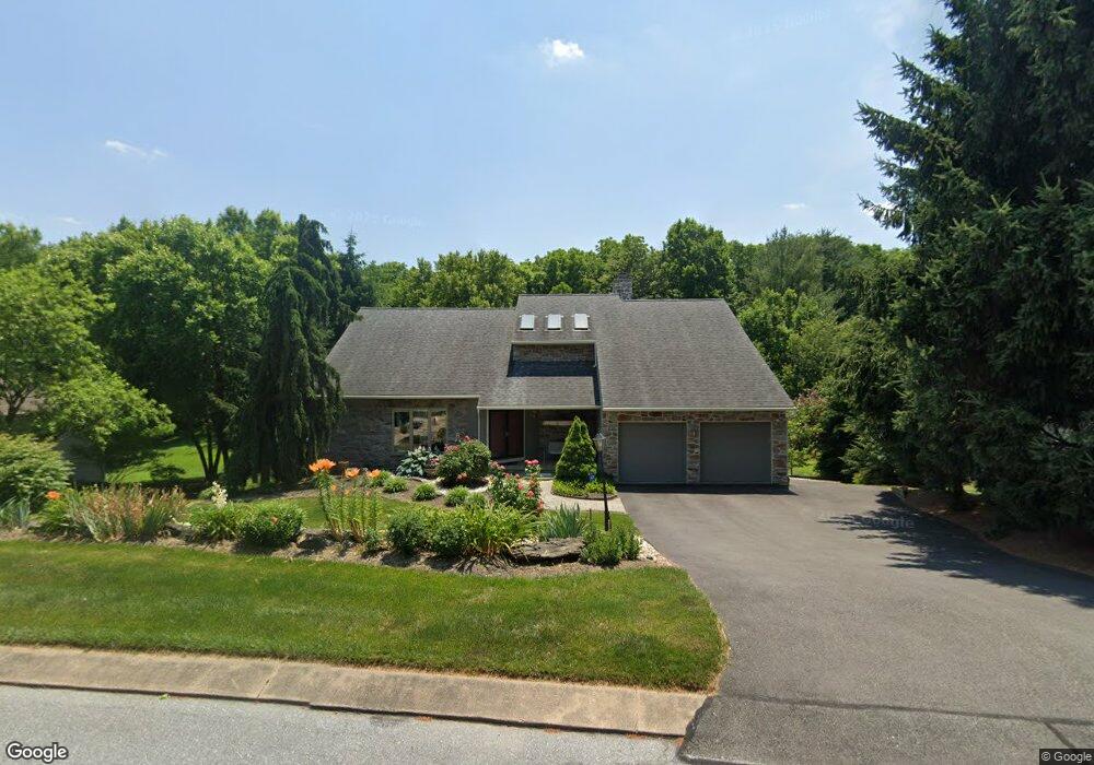
1011 Fieldstone Ct Lancaster, PA 17603
Blue Rock NeighborhoodEstimated Value: $486,756 - $570,000
3
Beds
3
Baths
1,959
Sq Ft
$273/Sq Ft
Est. Value
About This Home
This home is located at 1011 Fieldstone Ct, Lancaster, PA 17603 and is currently estimated at $534,189, approximately $272 per square foot. 1011 Fieldstone Ct is a home located in Lancaster County with nearby schools including Central Manor Elementary School, Manor Middle School, and Penn Manor High School.
Ownership History
Date
Name
Owned For
Owner Type
Purchase Details
Closed on
Nov 14, 2002
Sold by
Yim Jin Kun and Yim Ki Chun
Bought by
Bagdasarian Mikhail B and Bagdasarian Nelli E
Current Estimated Value
Home Financials for this Owner
Home Financials are based on the most recent Mortgage that was taken out on this home.
Original Mortgage
$165,000
Outstanding Balance
$21,352
Interest Rate
6.03%
Estimated Equity
$512,837
Create a Home Valuation Report for This Property
The Home Valuation Report is an in-depth analysis detailing your home's value as well as a comparison with similar homes in the area
Home Values in the Area
Average Home Value in this Area
Purchase History
| Date | Buyer | Sale Price | Title Company |
|---|---|---|---|
| Bagdasarian Mikhail B | $215,000 | -- |
Source: Public Records
Mortgage History
| Date | Status | Borrower | Loan Amount |
|---|---|---|---|
| Open | Bagdasarian Mikhail B | $165,000 |
Source: Public Records
Tax History Compared to Growth
Tax History
| Year | Tax Paid | Tax Assessment Tax Assessment Total Assessment is a certain percentage of the fair market value that is determined by local assessors to be the total taxable value of land and additions on the property. | Land | Improvement |
|---|---|---|---|---|
| 2025 | $5,717 | $261,800 | $80,800 | $181,000 |
| 2024 | $5,717 | $261,800 | $80,800 | $181,000 |
| 2023 | $5,717 | $261,800 | $80,800 | $181,000 |
| 2022 | $5,609 | $261,800 | $80,800 | $181,000 |
| 2021 | $5,352 | $256,300 | $80,800 | $175,500 |
| 2020 | $5,352 | $256,300 | $80,800 | $175,500 |
| 2019 | $5,203 | $256,300 | $80,800 | $175,500 |
| 2018 | $4,083 | $256,300 | $80,800 | $175,500 |
| 2017 | $5,023 | $207,000 | $56,000 | $151,000 |
| 2016 | $5,023 | $207,000 | $56,000 | $151,000 |
| 2015 | $1,034 | $207,000 | $56,000 | $151,000 |
| 2014 | $3,527 | $207,000 | $56,000 | $151,000 |
Source: Public Records
Map
Nearby Homes
- 1027 Keystone Dr
- 1016 Keystone Dr
- 204 Scarborough Ln
- 30 Oakgrove Ln
- 12 Knollwood Rd
- 53 Knollwood Rd
- 39 Manor Oaks Dr
- 249 Letort Rd
- 1077 Monticello Ln
- 352 Knollwood Rd
- 1053 Williamsburg Rd
- 109 Village Dr
- Sloane II Plan at Wynfield at Millersville
- Colton II Plan at Wynfield at Millersville
- 102 Village Dr
- Adalee Plan at Wynfield at Millersville
- 105 Village Dr
- 32 S Duke St
- 31 S Duke St
- 50 Briargate Place
- 1013 Fieldstone Ct
- 1009 Fieldstone Ct
- 1015 Fieldstone Ct
- 1007 Fieldstone Ct
- 1012 Fieldstone Ct
- 1010 Fieldstone Ct
- 1005 Fieldstone Ct
- 1017 Fieldstone Ct
- 1008 Fieldstone Ct
- 1014 Fieldstone Ct
- 1041 Hearthstone Rd
- 1006 Fieldstone Ct
- 1043 Hearthstone Rd
- 1003 Fieldstone Ct
- 130 Bridle Cir
- 110 Bridle Cir
- 1004 Fieldstone Ct
- 1018 Fieldstone Ct
- 1001 Fieldstone Ct
- 1002 Fieldstone Ct