Estimated Value: $86,857 - $215,000
Studio
1
Bath
1,128
Sq Ft
$137/Sq Ft
Est. Value
About This Home
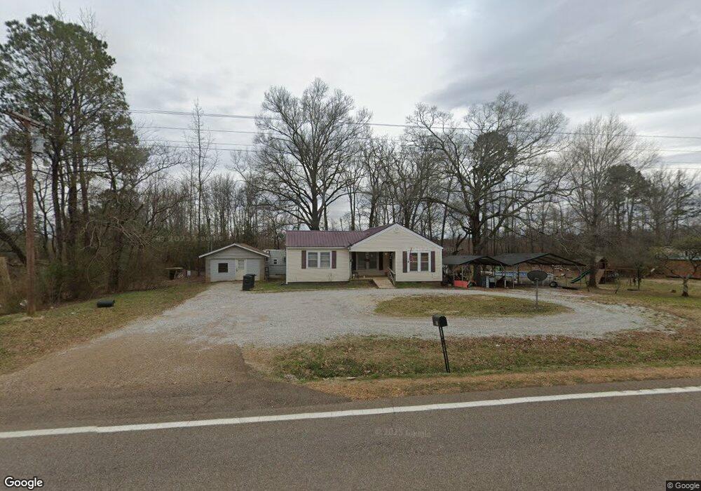
This home is located at 1011 Highway 57 E, Ramer, TN 38367 and is currently estimated at $154,214, approximately $136 per square foot. 1011 Highway 57 E is a home located in McNairy County with nearby schools including Ramer Elementary School, Michie Elementary School, and Selmer Elementary School.
Ownership History
Date
Name
Owned For
Owner Type
Purchase Details
Closed on
Jun 27, 2013
Sold by
Teague Sue
Bought by
Cummings Doris
Current Estimated Value
Home Financials for this Owner
Home Financials are based on the most recent Mortgage that was taken out on this home.
Original Mortgage
$19,396
Outstanding Balance
$13,980
Interest Rate
3.79%
Mortgage Type
Commercial
Estimated Equity
$140,234
Purchase Details
Closed on
Jun 2, 2011
Sold by
Brown Deborah
Bought by
Teague Sue
Purchase Details
Closed on
Feb 18, 2009
Sold by
Teague Sue
Bought by
Brown Deborah
Purchase Details
Closed on
May 13, 1997
Bought by
Brown Debbie Teague Sue
Create a Home Valuation Report for This Property
The Home Valuation Report is an in-depth analysis detailing your home's value as well as a comparison with similar homes in the area
Purchase History
| Date | Buyer | Sale Price | Title Company |
|---|---|---|---|
| Cummings Doris | $19,396 | -- | |
| Teague Sue | -- | -- | |
| Brown Deborah | -- | -- | |
| Brown Debbie Teague Sue | $25,000 | -- |
Source: Public Records
Mortgage History
| Date | Status | Borrower | Loan Amount |
|---|---|---|---|
| Open | Cummings Doris | $19,396 |
Source: Public Records
Tax History
| Year | Tax Paid | Tax Assessment Tax Assessment Total Assessment is a certain percentage of the fair market value that is determined by local assessors to be the total taxable value of land and additions on the property. | Land | Improvement |
|---|---|---|---|---|
| 2025 | $250 | $15,875 | $2,500 | $13,375 |
| 2024 | $250 | $15,875 | $2,500 | $13,375 |
| 2023 | $250 | $15,875 | $2,500 | $13,375 |
| 2022 | $250 | $15,875 | $2,500 | $13,375 |
| 2021 | $184 | $9,000 | $1,800 | $7,200 |
| 2020 | $184 | $9,000 | $1,800 | $7,200 |
| 2019 | $184 | $9,000 | $1,800 | $7,200 |
| 2018 | $184 | $9,000 | $1,800 | $7,200 |
| 2017 | $184 | $9,000 | $1,800 | $7,200 |
| 2016 | $181 | $9,000 | $1,800 | $7,200 |
| 2015 | $188 | $9,000 | $1,800 | $7,200 |
| 2014 | $172 | $8,225 | $2,000 | $6,225 |
Source: Public Records
Map
Nearby Homes
- 0 Dell Arbor Dr
- 6907 U S 45
- 82 Shane Ln
- 7749 Highway 45 S
- 34 Gravel Hill Rd
- 404 Highway 57 W
- 6052 U S 45
- 8453 Hwy 45 S Hwy
- 225 Sticine Rd
- 833 N Prather Rd
- 833 N Prather Rd
- 4769 Pleasant Site Rd
- 0 Luther Ingle Rd
- 1304 Luther Ingle Rd
- 211 Mary Jene Cove
- 3285 Tennessee 57
- 254 Michie Rd
- 1934 Tennessee 142
- 1934 Highway 142
- 442 Tennessee 142
- 961 Highway 57 E
- 986 Highway 57 E
- 1039 Highway 57 E
- 961 Tennessee 57
- 962 Highway 57 E
- 951 Highway 57 E
- 00 New Hope Rd
- 901 Highway 57 E
- 926 Highway 57 E
- 926 Tennessee 57
- 1127 Highway 57 E
- 861 Highway 57 E
- 882 Highway 57 E
- 677 Burns Rd
- 841 Highway 57 E
- 840 Highway 57 E
- 83 Woodland Cir
- 777 Tennessee 57
- 101 New Hope Rd
- 595 Burns Rd
Your Personal Tour Guide
Ask me questions while you tour the home.