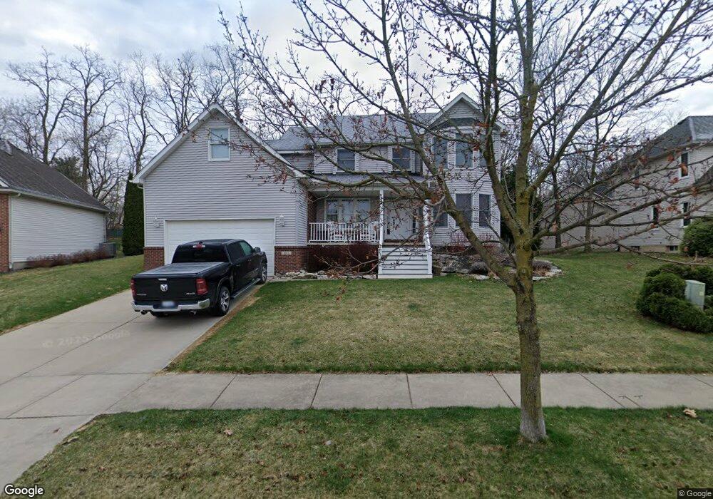
1011 Lincoln Dr Unit 14 Brighton, MI 48116
Estimated Value: $485,000 - $508,000
4
Beds
3
Baths
2,202
Sq Ft
$225/Sq Ft
Est. Value
About This Home
This home is located at 1011 Lincoln Dr Unit 14, Brighton, MI 48116 and is currently estimated at $496,247, approximately $225 per square foot. 1011 Lincoln Dr Unit 14 is a home located in Livingston County with nearby schools including Hilton Road Elementary School, Scranton Middle School, and Brighton High School.
Ownership History
Date
Name
Owned For
Owner Type
Purchase Details
Closed on
Oct 24, 2022
Sold by
Princinsky Stephen
Bought by
Princinsky Family Trust and Princinsky
Current Estimated Value
Purchase Details
Closed on
Oct 20, 2022
Sold by
Princinsky Stephen
Bought by
Princinsky Family Trust
Purchase Details
Closed on
Apr 27, 2004
Sold by
Mcguinty Mark V and Mcguinty Pamela Ann
Bought by
Mcguinty Mark V and Mcguinty Pamela Ann
Home Financials for this Owner
Home Financials are based on the most recent Mortgage that was taken out on this home.
Original Mortgage
$274,250
Interest Rate
6.8%
Mortgage Type
New Conventional
Purchase Details
Closed on
Feb 15, 2002
Sold by
Advance Craft Home Builders Inc
Bought by
Lasarge Mark V and Mcguinty Pamela Ann
Home Financials for this Owner
Home Financials are based on the most recent Mortgage that was taken out on this home.
Original Mortgage
$214,300
Interest Rate
5.62%
Create a Home Valuation Report for This Property
The Home Valuation Report is an in-depth analysis detailing your home's value as well as a comparison with similar homes in the area
Home Values in the Area
Average Home Value in this Area
Purchase History
| Date | Buyer | Sale Price | Title Company |
|---|---|---|---|
| Princinsky Family Trust | -- | None Listed On Document | |
| Princinsky Family Trust | -- | -- | |
| Mcguinty Mark V | -- | -- | |
| Lasarge Mark V | $53,000 | -- |
Source: Public Records
Mortgage History
| Date | Status | Borrower | Loan Amount |
|---|---|---|---|
| Previous Owner | Mcguinty Mark V | $274,250 | |
| Previous Owner | Lasarge Mark V | $214,300 |
Source: Public Records
Tax History Compared to Growth
Tax History
| Year | Tax Paid | Tax Assessment Tax Assessment Total Assessment is a certain percentage of the fair market value that is determined by local assessors to be the total taxable value of land and additions on the property. | Land | Improvement |
|---|---|---|---|---|
| 2025 | $5,950 | $238,800 | $0 | $0 |
| 2024 | $4,600 | $232,800 | $0 | $0 |
| 2023 | $4,379 | $208,200 | $0 | $0 |
| 2022 | $5,494 | $152,200 | $0 | $0 |
| 2021 | $5,373 | $166,500 | $0 | $0 |
| 2020 | $5,344 | $161,600 | $0 | $0 |
| 2019 | $5,295 | $152,200 | $0 | $0 |
| 2018 | $4,761 | $139,300 | $0 | $0 |
| 2017 | $4,671 | $139,700 | $0 | $0 |
| 2016 | $4,637 | $134,500 | $0 | $0 |
| 2014 | $3,774 | $120,400 | $0 | $0 |
| 2012 | $3,774 | $103,990 | $0 | $0 |
Source: Public Records
Map
Nearby Homes
- 6240 Northridge Hills Dr
- 6252 Northridge Hills Dr Unit 66
- 1075 Long Leaf Ct Unit 9
- 6277 Northridge Woods Dr
- 1041 Fairway Trails Dr
- 790 Fairway Trails Dr
- 1048 Pinewood Ct Unit 40
- 978 Oak Ridge Cir
- 1025 Pinewood Ct Unit 30
- 1016 Pinewood Ct Unit 48
- 840 Woodridge Hills Dr
- 796 Devonshire Blvd
- 935 Mildred J Ct Unit 30
- 1242 Baywood Cir
- 1324 Peppergrove Dr
- 840 Heatheridge Ct Unit 16
- 57 Wyndam Ln
- 413 Water Tower Cir Unit 97
- 36 Pinemont Dr
- 399 Spring Brooke Dr
- 1005 Lincoln Dr Unit 15
- 1017 Lincoln Dr Unit 13
- 1014 Lincoln Dr Unit 37
- 999 Lincoln Dr Unit 16
- 1008 Lincoln Dr Unit 36
- 954 Alpine Dr
- 950 Alpine Dr
- 958 Alpine Dr
- 1000 Lincoln Dr Unit 35
- 940 Alpine Dr
- 8149 Alyssa Dr
- 1044 Lincoln Dr Unit 38
- 993 Lincoln Dr Unit 17
- 1041 Lincoln Dr Unit 9
- 968 Alpine Dr
- 906 Alpine Dr
- 1363 Seward Ct Unit 41
- 1381 Seward Ct Unit 40
- 1029 Welles Ct Unit 11
- 1050 Lincoln Dr Unit 39