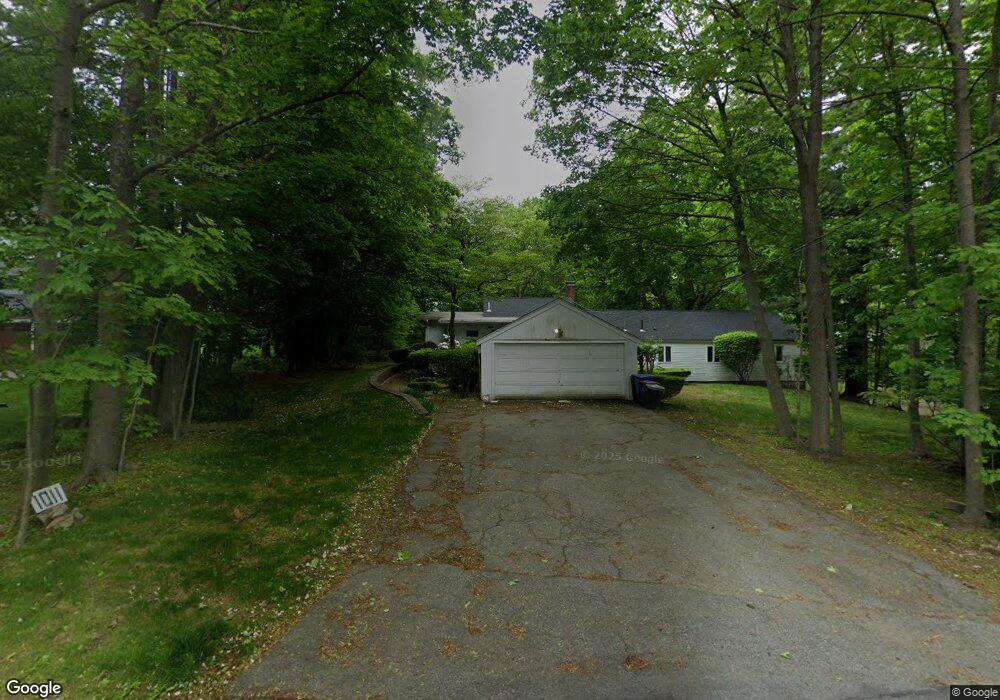
1011 Metropolitan Ave Milton, MA 02186
Brush Hill NeighborhoodEstimated Value: $760,000 - $1,084,000
4
Beds
2
Baths
2,395
Sq Ft
$412/Sq Ft
Est. Value
About This Home
This home is located at 1011 Metropolitan Ave, Milton, MA 02186 and is currently estimated at $985,547, approximately $411 per square foot. 1011 Metropolitan Ave is a home located in Norfolk County with nearby schools including Milton High School, Boston Renaissance Charter Public School, and Boston Preparatory Charter Public School.
Ownership History
Date
Name
Owned For
Owner Type
Purchase Details
Closed on
May 1, 2020
Sold by
Ruth Romberg T 2017
Bought by
Romberg Roselyn M and Hardy Douglas S
Current Estimated Value
Purchase Details
Closed on
Nov 15, 2017
Sold by
Romberg Ruth
Bought by
Ruth Romberg T 2017
Purchase Details
Closed on
Aug 29, 1989
Sold by
Wolfe Edwin H
Bought by
Romberg Theodore E
Home Financials for this Owner
Home Financials are based on the most recent Mortgage that was taken out on this home.
Original Mortgage
$226,000
Interest Rate
9.67%
Mortgage Type
Purchase Money Mortgage
Create a Home Valuation Report for This Property
The Home Valuation Report is an in-depth analysis detailing your home's value as well as a comparison with similar homes in the area
Home Values in the Area
Average Home Value in this Area
Purchase History
| Date | Buyer | Sale Price | Title Company |
|---|---|---|---|
| Romberg Roselyn M | $500,000 | None Available | |
| Ruth Romberg T 2017 | -- | -- | |
| Romberg Theodore E | $282,500 | -- |
Source: Public Records
Mortgage History
| Date | Status | Borrower | Loan Amount |
|---|---|---|---|
| Previous Owner | Romberg Theodore E | $177,500 | |
| Previous Owner | Romberg Theodore E | $226,000 |
Source: Public Records
Tax History
| Year | Tax Paid | Tax Assessment Tax Assessment Total Assessment is a certain percentage of the fair market value that is determined by local assessors to be the total taxable value of land and additions on the property. | Land | Improvement |
|---|---|---|---|---|
| 2025 | $9,196 | $829,200 | $512,700 | $316,500 |
| 2024 | $8,590 | $786,600 | $488,300 | $298,300 |
| 2023 | $8,488 | $744,600 | $465,300 | $279,300 |
| 2022 | $8,511 | $682,500 | $465,300 | $217,200 |
| 2021 | $8,503 | $647,600 | $440,700 | $206,900 |
| 2020 | $8,336 | $635,400 | $422,300 | $213,100 |
| 2019 | $8,151 | $618,400 | $410,000 | $208,400 |
| 2018 | $8,235 | $596,300 | $388,500 | $207,800 |
| 2017 | $7,709 | $568,500 | $370,000 | $198,500 |
| 2016 | $7,628 | $565,000 | $370,000 | $195,000 |
| 2015 | $8,831 | $633,500 | $436,300 | $197,200 |
Source: Public Records
Map
Nearby Homes
- 6 Kinsale Ln
- 5 Kinsale Ln
- 49 Summit St
- 16 Prospect St
- 350 Blue Hill Ave
- 200 Robbins St
- 405 Blue Hill Ave
- 0 Truman Pkwy
- 58 Adanac Rd
- 722 Truman Hwy
- 180 Dana Ave
- 755-759 Truman Pkwy
- 58 Oak St
- 79 Maple St Unit 3
- 75-77 Belnel Rd
- 34 Oak St Unit 103
- 34 Oak St Unit 302
- 702 Blue Hill Ave
- 2 Garfield Ave Unit 1
- 485 Blue Hills Pkwy Unit 10
- 4 Summit St
- 10 Summit St
- 1021 Metropolitan Ave
- 1000 Metropolitan Ave
- 16 Summit St
- 7 Summit St
- 999 Metropolitan Ave
- 998 Metropolitan Ave
- 20 Summit St
- 11 Summit St
- 35 Lochland Rd
- 29 Lochland Rd
- 15 Summit St
- 1024 Metropolitan Ave
- 25 Lochland Rd
- 24 Summit St
- 1031 Metropolitan Ave
- 19 Summit St
- 995 Metropolitan Ave
- 985 Metropolitan Ave