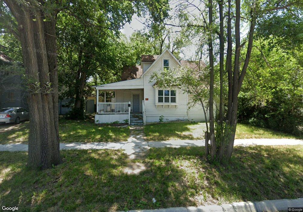
1011 SW Munson Ave Topeka, KS 66604
Historic Holliday Park NeighborhoodEstimated Value: $82,837 - $119,000
4
Beds
3
Baths
1,672
Sq Ft
$60/Sq Ft
Est. Value
About This Home
This home is located at 1011 SW Munson Ave, Topeka, KS 66604 and is currently estimated at $100,959, approximately $60 per square foot. 1011 SW Munson Ave is a home located in Shawnee County with nearby schools including Lowman Hill Elementary School, Robinson Middle School, and Topeka High School.
Ownership History
Date
Name
Owned For
Owner Type
Purchase Details
Closed on
Feb 14, 2022
Sold by
Ragsdale Jeffery S
Bought by
Dinh Arnold C
Current Estimated Value
Purchase Details
Closed on
Sep 21, 2016
Sold by
Rusnak Robert F and Rusnak Barbara G
Bought by
Ragsdale Jeff
Purchase Details
Closed on
Jun 12, 2009
Sold by
Carter Woodrow W and Carter Leisa D
Bought by
Visionbank
Purchase Details
Closed on
Jan 13, 2005
Sold by
Lundberg Gary Brett and Lundberg Mindi J
Bought by
Carter Woodrow W and Carter Lesia D
Home Financials for this Owner
Home Financials are based on the most recent Mortgage that was taken out on this home.
Original Mortgage
$361,369
Interest Rate
5.8%
Mortgage Type
Purchase Money Mortgage
Create a Home Valuation Report for This Property
The Home Valuation Report is an in-depth analysis detailing your home's value as well as a comparison with similar homes in the area
Home Values in the Area
Average Home Value in this Area
Purchase History
| Date | Buyer | Sale Price | Title Company |
|---|---|---|---|
| Dinh Arnold C | -- | None Listed On Document | |
| Ragsdale Jeff | -- | Lawyers Title Of Topeka Inc | |
| Visionbank | -- | None Available | |
| Carter Woodrow W | -- | Kansas Secured Title | |
| Carter Woodrow W | -- | Kansas Secured Title |
Source: Public Records
Mortgage History
| Date | Status | Borrower | Loan Amount |
|---|---|---|---|
| Previous Owner | Carter Woodrow W | $361,369 |
Source: Public Records
Tax History Compared to Growth
Tax History
| Year | Tax Paid | Tax Assessment Tax Assessment Total Assessment is a certain percentage of the fair market value that is determined by local assessors to be the total taxable value of land and additions on the property. | Land | Improvement |
|---|---|---|---|---|
| 2025 | $479 | $3,904 | -- | -- |
| 2023 | $479 | $3,507 | $0 | $0 |
| 2022 | $441 | $3,277 | $0 | $0 |
| 2021 | $341 | $2,415 | $0 | $0 |
| 2020 | $325 | $2,346 | $0 | $0 |
| 2019 | $392 | $2,748 | $0 | $0 |
| 2018 | $379 | $2,668 | $0 | $0 |
| 2017 | $380 | $2,668 | $0 | $0 |
| 2014 | $502 | $3,398 | $0 | $0 |
Source: Public Records
Map
Nearby Homes
- 1020 SW 11th St
- 1031 SW Clay St
- 1200 SW Taylor St
- 1021 SW Polk St
- 1301 SW Fillmore St Unit Main Floor Apt. 12
- 1300 SW Fillmore St
- 710 SW 13th St
- 1281 SW Buchanan St
- 1225 SW Throop St
- 1255 SW Tyler St
- 1224 SW Garfield Ave
- 1415 SW Fillmore St
- 817 SW Tyler St
- 0 SW Buchanan St
- 603 SW 8th St
- 731 SW Lincoln St
- 711 SW Buchanan St
- 1504 SW Polk St
- 1015 SW 16th St
- 1216 SW College Ave
- 1015 SW Munson Ave
- 1163 SW Fillmore St
- 1169 SW Fillmore St
- 1019 SW Munson Ave
- 1168 SW Clay St
- 1173 SW Fillmore St
- 1170 SW Clay St
- 1164 SW Clay St
- 1177 SW Fillmore St
- 1172 SW Clay St
- 1114 SW Clay St
- 1111 SW Fillmore St
- 1176 SW Clay St
- 1178 SW Clay St
- 1181 SW Fillmore St
- 1180 SW Clay St
- 1185 SW Fillmore St
- 1013 SW 11th St
- 1184 SW Clay St
- 1112 SW Clay St