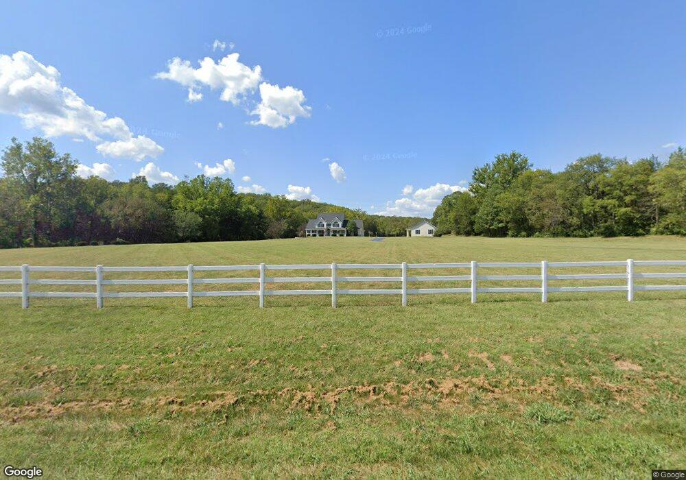
10115 Woodland Rd Festus, MO 63028
Estimated Value: $370,000 - $884,133
5
Beds
6
Baths
4,470
Sq Ft
$154/Sq Ft
Est. Value
About This Home
This home is located at 10115 Woodland Rd, Festus, MO 63028 and is currently estimated at $689,378, approximately $154 per square foot. 10115 Woodland Rd is a home located in Jefferson County with nearby schools including Hillsboro Primary School, Hillsboro Elementary School, and Hillsboro Middle Elementary School.
Ownership History
Date
Name
Owned For
Owner Type
Purchase Details
Closed on
Apr 30, 2012
Sold by
Mullins Tim and Mullins Lelia
Bought by
Warden Dennis J and Warden Julia K
Current Estimated Value
Home Financials for this Owner
Home Financials are based on the most recent Mortgage that was taken out on this home.
Original Mortgage
$417,000
Outstanding Balance
$290,730
Interest Rate
4.11%
Mortgage Type
New Conventional
Estimated Equity
$398,648
Create a Home Valuation Report for This Property
The Home Valuation Report is an in-depth analysis detailing your home's value as well as a comparison with similar homes in the area
Home Values in the Area
Average Home Value in this Area
Purchase History
| Date | Buyer | Sale Price | Title Company |
|---|---|---|---|
| Warden Dennis J | -- | Ust |
Source: Public Records
Mortgage History
| Date | Status | Borrower | Loan Amount |
|---|---|---|---|
| Open | Warden Dennis J | $417,000 |
Source: Public Records
Tax History Compared to Growth
Tax History
| Year | Tax Paid | Tax Assessment Tax Assessment Total Assessment is a certain percentage of the fair market value that is determined by local assessors to be the total taxable value of land and additions on the property. | Land | Improvement |
|---|---|---|---|---|
| 2025 | $5,161 | $88,900 | $9,200 | $79,700 |
| 2024 | $5,161 | $83,000 | $9,200 | $73,800 |
| 2023 | $5,161 | $83,000 | $9,200 | $73,800 |
| 2022 | $5,248 | $83,000 | $9,200 | $73,800 |
| 2021 | $5,610 | $83,000 | $9,200 | $73,800 |
| 2020 | $5,192 | $74,500 | $8,400 | $66,100 |
| 2019 | $5,191 | $74,500 | $8,400 | $66,100 |
| 2018 | $5,191 | $74,500 | $8,400 | $66,100 |
| 2017 | $4,930 | $74,500 | $8,400 | $66,100 |
| 2016 | $4,715 | $70,000 | $8,400 | $61,600 |
| 2015 | $4,261 | $70,000 | $8,400 | $61,600 |
| 2013 | $4,261 | $68,100 | $7,600 | $60,500 |
Source: Public Records
Map
Nearby Homes
- 1 Appomattox Ridge
- 3333 Ketha Cir
- 9822 Woodland Rd
- 3532 Ketha Heights
- 0 Hwy A 62 Acres Unit 20012897
- 2812 Heather Wood Lane (Lot 39 - Vacant Lot)
- 2724 Niagara Falls Ct
- 132 Blue Ridge Trace
- 10537 Victoria Falls Dr
- 9448 Ponderosa Ln
- 2303 Garden Ln
- 4 Cedar Creek
- 176 Pancho Villa Dr
- 1926 Belmont Dr
- 9365 Elm Loop Dr
- 0 Bailey School Rd
- 18 Meadow Ridge
- 1102 Stone Henge Ct
- 1808 Hawk Pointe Dr
- 00 Harrison Lake Rd
- 10091 Woodland Rd
- 10005 Woodland Rd
- 10199 Woodland Rd
- 10200 Woodland Rd
- 2879 Johnston Ridge
- 2880 Johnston Ridge
- 10260 Woodland Rd
- 500 Whiskey Ridge
- 2874 Johnston Ridge
- 2875 Johnston Ridge
- 7 Appomattox Ridge
- 10270 Woodland Rd
- 17 Appomattox Ridge
- 2866 Johnston Ridge
- 10 Appomattox Ridge
- 2863 Johnston Ridge
- 10009 Woodland Rd
- 2 Appomattox Ridge
- 8 Appomattox Ridge
- 10283 Woodland Rd