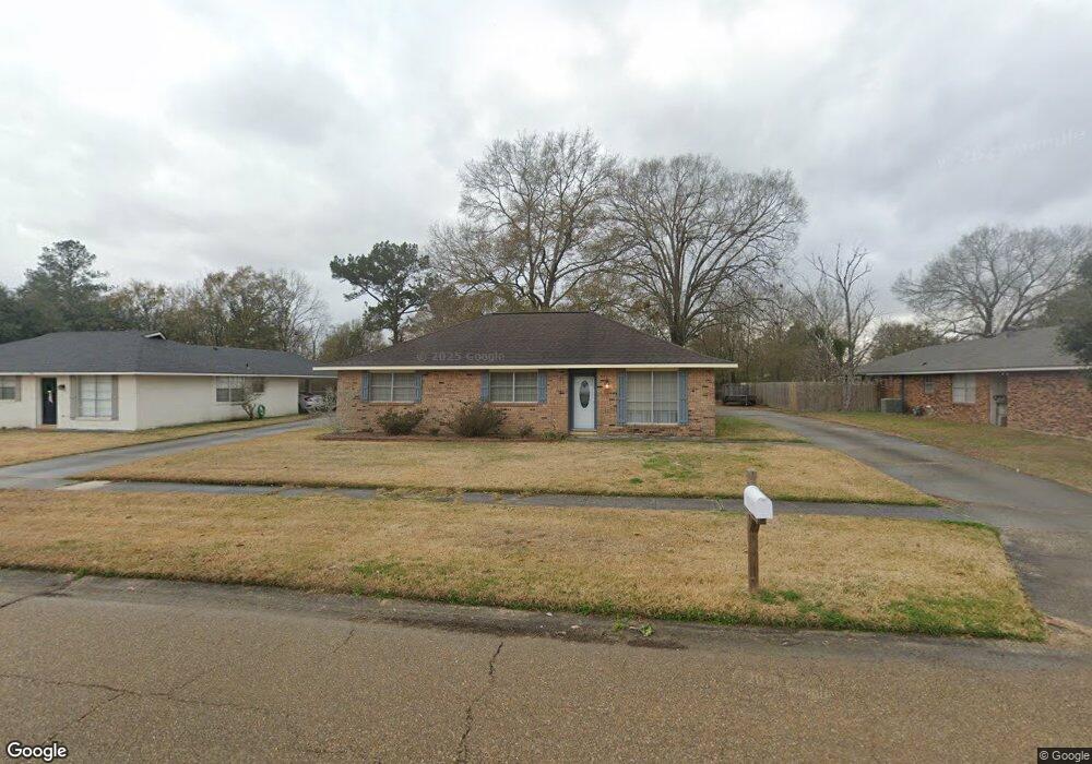
10117 E Brookside Dr Baton Rouge, LA 70818
Estimated Value: $203,571 - $257,000
Studio
--
Bath
1,632
Sq Ft
$145/Sq Ft
Est. Value
About This Home
This home is located at 10117 E Brookside Dr, Baton Rouge, LA 70818 and is currently estimated at $236,643, approximately $145 per square foot. 10117 E Brookside Dr is a home located in East Baton Rouge Parish with nearby schools including Bellingrath Hills Elementary School, Central Intermediate School, and Tanglewood Elementary School.
Ownership History
Date
Name
Owned For
Owner Type
Purchase Details
Closed on
Mar 29, 2013
Sold by
Bassett Carol D S and Trahan Kathy S S
Bought by
Thomas Travis B
Current Estimated Value
Home Financials for this Owner
Home Financials are based on the most recent Mortgage that was taken out on this home.
Original Mortgage
$100,000
Outstanding Balance
$46,439
Interest Rate
3.56%
Mortgage Type
New Conventional
Estimated Equity
$190,204
Purchase Details
Closed on
Nov 30, 2000
Sold by
Stubbs Dewitt
Bought by
Bassett Carol Diane Stubbs and Trahan Kathy Sue Stubbs
Create a Home Valuation Report for This Property
The Home Valuation Report is an in-depth analysis detailing your home's value as well as a comparison with similar homes in the area
Home Values in the Area
Average Home Value in this Area
Purchase History
| Date | Buyer | Sale Price | Title Company |
|---|---|---|---|
| Thomas Travis B | $125,000 | -- | |
| Bassett Carol Diane Stubbs | -- | -- |
Source: Public Records
Mortgage History
| Date | Status | Borrower | Loan Amount |
|---|---|---|---|
| Open | Thomas Travis B | $100,000 |
Source: Public Records
Tax History
| Year | Tax Paid | Tax Assessment Tax Assessment Total Assessment is a certain percentage of the fair market value that is determined by local assessors to be the total taxable value of land and additions on the property. | Land | Improvement |
|---|---|---|---|---|
| 2024 | $1,454 | $18,768 | $2,000 | $16,768 |
| 2023 | $1,460 | $17,140 | $2,000 | $15,140 |
| 2022 | $2,296 | $17,140 | $2,000 | $15,140 |
| 2021 | $2,296 | $17,140 | $2,000 | $15,140 |
| 2020 | $2,253 | $17,140 | $2,000 | $15,140 |
| 2019 | $1,880 | $13,850 | $2,000 | $11,850 |
| 2018 | $1,859 | $13,850 | $2,000 | $11,850 |
| 2017 | $1,859 | $13,850 | $2,000 | $11,850 |
| 2016 | $316 | $9,703 | $2,000 | $7,703 |
| 2015 | $691 | $12,500 | $2,000 | $10,500 |
| 2014 | $667 | $12,500 | $2,000 | $10,500 |
| 2013 | -- | $12,500 | $2,000 | $10,500 |
Source: Public Records
Map
Nearby Homes
- 9729 Banway Dr
- 14607 Forest Grove Ave
- 8925 Flanagans Way
- 17468 Wax Rd
- 8725 Flanagans Way
- 8525 Flanagans Way
- 8325 Flanagans Way
- 14482 Bon Dickey Dr
- 9986 Couret Dr
- 13952 Grand Settlement Blvd
- 10136 Grayton Dr
- 13985 Highgrove Ave
- 9974 Stonewater Dr
- 8600 Sullivan Rd
- 9964 Stone Water Dr
- 14790 Wax Rd
- 8135 Lavender Dr
- 8128 Lavender Dr
- 14321 Sparkle Ave
- 11115 Sullivan Rd
- 10117 E Brookside Dr
- 10129 E Brookside Dr
- 10105 E Brookside Dr
- 10131 E Brookside Dr
- 10041 E Brookside Dr
- 10143 E Brookside Dr
- 10112 E Brookside Dr
- 10039 E Brookside Dr
- 10207 E Brookside Dr
- 10027 E Brookside Dr
- 10112 W Brookside Dr
- 10040 W Brookside Dr
- 10219 E Brookside Dr
- 10015 E Brookside Dr
- 10122 W Brookside Dr
- 10030 W Brookside Dr
- 10132 W Brookside Dr
- 10020 W Brookside Dr
- 10003 E Brookside Dr
- 10221 E Brookside Dr
Your Personal Tour Guide
Ask me questions while you tour the home.