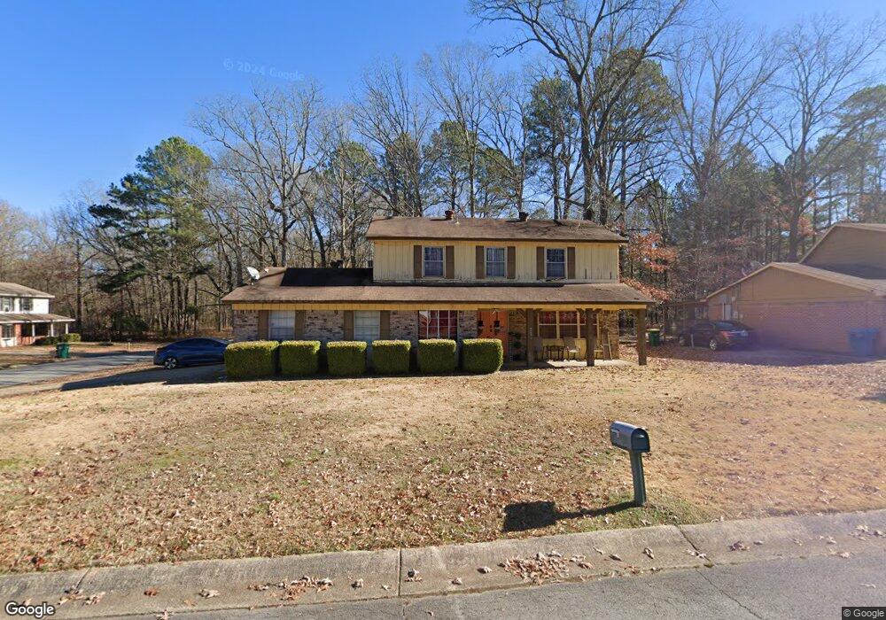
10117 Independence Ln Little Rock, AR 72209
Upper Baseline NeighborhoodEstimated Value: $115,511 - $190,000
--
Bed
2
Baths
1,669
Sq Ft
$92/Sq Ft
Est. Value
About This Home
This home is located at 10117 Independence Ln, Little Rock, AR 72209 and is currently estimated at $154,378, approximately $92 per square foot. 10117 Independence Ln is a home located in Pulaski County with nearby schools including Watson Elementary School, Cloverdale Middle School, and Little Rock Southwest High School.
Ownership History
Date
Name
Owned For
Owner Type
Purchase Details
Closed on
Dec 31, 2024
Sold by
Bryant Carmenlita D and Autry Marcus M
Bought by
Bryant Carmenlita D
Current Estimated Value
Purchase Details
Closed on
Mar 24, 2003
Sold by
Prowell Tomi and Prowell Bobbie E
Bought by
Bryant Carmenlita
Home Financials for this Owner
Home Financials are based on the most recent Mortgage that was taken out on this home.
Original Mortgage
$90,782
Interest Rate
5.77%
Mortgage Type
Purchase Money Mortgage
Purchase Details
Closed on
Mar 7, 2003
Sold by
Lavender Kenneth Ray and Lavender Patricia A
Bought by
Prowell Bobbie E and Prowell Tomi
Home Financials for this Owner
Home Financials are based on the most recent Mortgage that was taken out on this home.
Original Mortgage
$90,782
Interest Rate
5.77%
Mortgage Type
Purchase Money Mortgage
Create a Home Valuation Report for This Property
The Home Valuation Report is an in-depth analysis detailing your home's value as well as a comparison with similar homes in the area
Home Values in the Area
Average Home Value in this Area
Purchase History
| Date | Buyer | Sale Price | Title Company |
|---|---|---|---|
| Bryant Carmenlita D | -- | None Listed On Document | |
| Bryant Carmenlita D | -- | None Listed On Document | |
| Bryant Carmenlita | $92,000 | First National Title | |
| Prowell Bobbie E | $53,000 | First National Title |
Source: Public Records
Mortgage History
| Date | Status | Borrower | Loan Amount |
|---|---|---|---|
| Previous Owner | Bryant Carmenlita | $90,782 |
Source: Public Records
Tax History Compared to Growth
Tax History
| Year | Tax Paid | Tax Assessment Tax Assessment Total Assessment is a certain percentage of the fair market value that is determined by local assessors to be the total taxable value of land and additions on the property. | Land | Improvement |
|---|---|---|---|---|
| 2025 | $1,276 | $22,200 | $3,000 | $19,200 |
| 2024 | $1,170 | $22,200 | $3,000 | $19,200 |
| 2023 | $1,170 | $22,200 | $3,000 | $19,200 |
| 2022 | $1,117 | $22,200 | $3,000 | $19,200 |
| 2021 | $1,071 | $15,190 | $4,300 | $10,890 |
| 2020 | $688 | $15,190 | $4,300 | $10,890 |
| 2019 | $688 | $15,190 | $4,300 | $10,890 |
| 2018 | $713 | $15,190 | $4,300 | $10,890 |
| 2017 | $713 | $15,190 | $4,300 | $10,890 |
| 2016 | $1,109 | $15,840 | $3,000 | $12,840 |
| 2015 | $1,069 | $15,840 | $3,000 | $12,840 |
| 2014 | $1,069 | $15,247 | $3,000 | $12,247 |
Source: Public Records
Map
Nearby Homes
- 10407 Republic Ln
- 5817 Drexel Ave
- 5823 Liberty Cove
- 22 Old Glory Ct
- 00 Lovett Dr
- 5300 Southboro Ct
- 000 Geyer Springs Rd
- 6711 Woodfield Rd
- 6313 Senate Dr
- 10001 Warren Dr
- 6611 Fairfield Dr
- 9220 Reck Rd
- 8616 Dreher Ln
- 8600 Dreher Ln
- 3938 Wooddale Dr
- 4028 Arapaho Trail
- 8511 Dreher Ln
- 5709 Chaucer Ln
- 9901 Eva Ln
- 5505 Chaucer Ln
- 10123 Independence Ln
- 10205 Independence Ln
- 10103 Independence Ln
- 5400 Drexel Ave
- 5421 Drexel Ave
- 10124 Independence Ln
- 10104 Independence Ln
- 10209 Independence Ln
- 10204 Independence Ln
- 10023 Independence Ln
- 5424 Drexel Ave
- 10215 Independence Ln
- 10210 Independence Ln
- 10024 Independence Ln
- 10019 Independence Ln
- 10201 Republic Ln
- 10123 Republic Ln
- 10203 Republic Ln
- 10216 Independence Ln
- 10223 Independence Ln