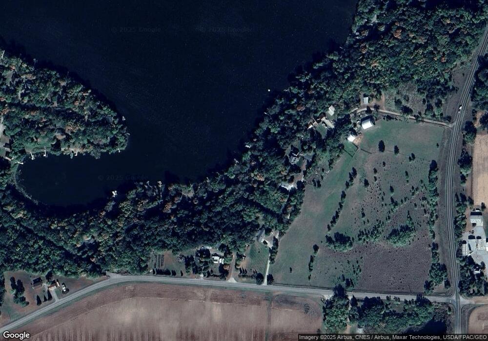
10117 Newton Ave NW Southside Township, MN 55382
Estimated Value: $228,000 - $286,000
1
Bed
1
Bath
496
Sq Ft
$528/Sq Ft
Est. Value
About This Home
This home is located at 10117 Newton Ave NW, Southside Township, MN 55382 and is currently estimated at $261,717, approximately $527 per square foot. 10117 Newton Ave NW is a home located in Wright County with nearby schools including Annandale Elementary School, Annandale Middle School, and Annandale Senior High School.
Ownership History
Date
Name
Owned For
Owner Type
Purchase Details
Closed on
Sep 9, 2020
Sold by
Leonard Kiann N and Leonard Kiann Noel
Bought by
Williamson Jay and Williamson Donna
Current Estimated Value
Purchase Details
Closed on
Apr 17, 2017
Sold by
Sinanni Chnstopher J and Sinanni Tanya L
Bought by
Leonard Kiann N and Leonard Jason M
Purchase Details
Closed on
Aug 10, 2004
Sold by
Glavin Theodore M and Glavin Beverly L
Bought by
Sirianni Christopher J and Sirianni Tanya L
Create a Home Valuation Report for This Property
The Home Valuation Report is an in-depth analysis detailing your home's value as well as a comparison with similar homes in the area
Home Values in the Area
Average Home Value in this Area
Purchase History
| Date | Buyer | Sale Price | Title Company |
|---|---|---|---|
| Williamson Jay | $200,000 | Central Land Ttl Guarantee C | |
| Leonard Kiann N | $155,000 | Central Land Title | |
| Sirianni Christopher J | $123,000 | -- |
Source: Public Records
Tax History Compared to Growth
Tax History
| Year | Tax Paid | Tax Assessment Tax Assessment Total Assessment is a certain percentage of the fair market value that is determined by local assessors to be the total taxable value of land and additions on the property. | Land | Improvement |
|---|---|---|---|---|
| 2025 | $1,848 | $222,700 | $137,400 | $85,300 |
| 2024 | $1,788 | $219,500 | $137,400 | $82,100 |
| 2023 | $1,802 | $217,200 | $134,900 | $82,300 |
| 2022 | $1,714 | $200,700 | $130,300 | $70,400 |
| 2021 | $1,556 | $162,200 | $97,800 | $64,400 |
| 2020 | $1,568 | $139,800 | $78,600 | $61,200 |
| 2019 | $1,670 | $138,500 | $0 | $0 |
| 2018 | $1,304 | $143,100 | $0 | $0 |
| 2017 | $1,290 | $110,400 | $0 | $0 |
| 2016 | $1,248 | $0 | $0 | $0 |
| 2015 | $1,000 | $0 | $0 | $0 |
| 2014 | -- | $0 | $0 | $0 |
Source: Public Records
Map
Nearby Homes
- 13934 101st St NW
- 13943 102nd St NW
- 10368 Oliver Ave NW
- 13496 Campfire Cir
- 11780 103rd St NW
- 2060 Clearwater Forest Dr
- 7939 Lake John Dr
- 7620 Lake John Dr
- 14XXX County Road 44
- 7610 Lake John Dr
- 0 80th St NW
- 7560 Lake John Dr
- 7550 Lake John Dr
- 7581 Lake John Dr
- 7541 Lake John Dr
- 7551 Lake John Dr
- 11559 Kramer Ave NW
- 11571 Kramer Ave NW
- 7425 Nevens Ave NW
- 10848 Porter Ave NW
- 10113 Newton Ave NW
- 10105 Newton Ave NW
- 10131 Newton Ave NW
- 10099 Newton Ave NW
- 10087 Newton Ave NW
- 10141 Newcomb Ave NW
- 10049 Newcomb Ave NW
- 10049 Unit#4 10049 Unit#4 Newton-Avenue-nw
- 10049 10049 Newton-Avenue-nw
- 10049 Unit 10049 Unit#4 Newton-Avenue-nw
- 10049 Unit Newton Ave NW Unit 4
- 10049 Newton Ave NW Unit 5
- 10049 Newton Ave NW Unit 1
- 10049 Newton Ave NW Unit 2
- 10049 Unit#4 Newton Ave NW Unit 4
- 10049 Newton Ave NW Unit 3
- 13208 100th St NW
- 10173 Newcomb Ave NW
- 10235 Newton Ave NW
- 13297 102nd St NW
