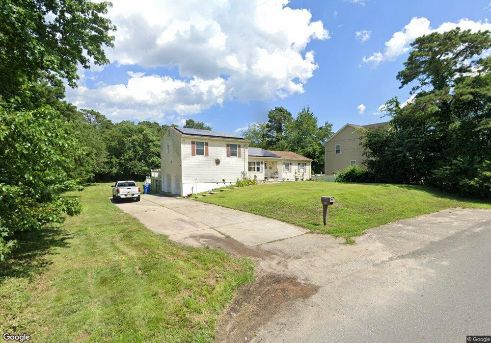
1012 Cumberland Blvd Toms River, NJ 08757
Manchester Township NeighborhoodEstimated Value: $603,000 - $629,000
4
Beds
3
Baths
1,756
Sq Ft
$349/Sq Ft
Est. Value
About This Home
This home is located at 1012 Cumberland Blvd, Toms River, NJ 08757 and is currently estimated at $612,975, approximately $349 per square foot. 1012 Cumberland Blvd is a home located in Ocean County with nearby schools including Manchester Township High School and Ocean County Christian Academy.
Ownership History
Date
Name
Owned For
Owner Type
Purchase Details
Closed on
Jan 21, 2020
Sold by
Lacass Bruce and Schweizer Jennifer C
Bought by
Schweizer Jennifer
Current Estimated Value
Purchase Details
Closed on
Feb 19, 2015
Sold by
Jackson Daniel and Jackson Judith
Bought by
Lacass Bruce and Schweizer Jennifer
Purchase Details
Closed on
Aug 8, 1998
Sold by
Barkhorn Carol A and Sheredos Robert
Bought by
Jackson Daniel
Create a Home Valuation Report for This Property
The Home Valuation Report is an in-depth analysis detailing your home's value as well as a comparison with similar homes in the area
Home Values in the Area
Average Home Value in this Area
Purchase History
| Date | Buyer | Sale Price | Title Company |
|---|---|---|---|
| Schweizer Jennifer | -- | Servicelink | |
| Lacass Bruce | $216,000 | Agent For Old Republic Natl | |
| Jackson Daniel | $5,000 | -- |
Source: Public Records
Tax History Compared to Growth
Tax History
| Year | Tax Paid | Tax Assessment Tax Assessment Total Assessment is a certain percentage of the fair market value that is determined by local assessors to be the total taxable value of land and additions on the property. | Land | Improvement |
|---|---|---|---|---|
| 2025 | $6,633 | $535,700 | $305,800 | $229,900 |
| 2024 | $6,296 | $270,200 | $86,800 | $183,400 |
| 2023 | $5,985 | $270,200 | $86,800 | $183,400 |
| 2022 | $5,985 | $270,200 | $86,800 | $183,400 |
| 2021 | $5,855 | $270,200 | $86,800 | $183,400 |
| 2020 | $5,701 | $270,200 | $86,800 | $183,400 |
| 2019 | $6,284 | $245,000 | $85,400 | $159,600 |
| 2018 | $6,260 | $245,000 | $85,400 | $159,600 |
| 2017 | $6,284 | $245,000 | $85,400 | $159,600 |
| 2016 | $6,208 | $245,000 | $85,400 | $159,600 |
| 2015 | $6,093 | $245,000 | $85,400 | $159,600 |
| 2014 | $5,968 | $245,000 | $85,400 | $159,600 |
Source: Public Records
Map
Nearby Homes
- 1908 9th Ave
- 501 Cumberland Blvd
- 1816 7th Ave
- 21 B Cedar St Unit D
- 2041 Broadway Blvd
- 2132 Fifth Ave
- 2117 Broadway Blvd
- 5 Chestnut St Unit C
- 1816 5th Ave
- 9 B Chestnut St Unit D
- 1601 Beacon St
- 5 Willow St Unit D
- 1613 Beacon St
- 3 Willow St Unit C
- 6 A Chestnut St
- 6 B Chestnut St
- 1732 Fifth Ave
- 2116 4th Ave
- 7 D Birch St Unit B
- 300 Morningside St
- 2001 10th Ave
- 2009 10th Ave
- 1100 Cumberland Blvd
- 1000 Cumberland Blvd
- 1940 11th Ave
- 1101 Cumberland Blvd
- 1941 10th Ave
- 2025 10th Ave
- 1112 Cumberland Blvd
- 912 Cumberland Blvd
- 2008 10th Ave
- 1940 10th Ave
- 1940 Commonwealth Blvd
- 1933 10th Ave
- 1932 11th Ave
- 900 Cumberland Blvd
- 2041 10th Ave
- 1932 Commonwealth Blvd
- 1925 11th Ave
- 2032 10th Ave