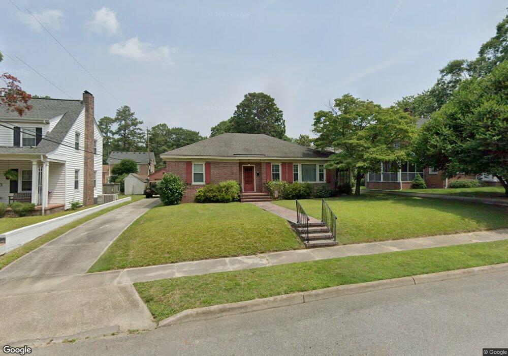
1012 Pennsylvania Ave Suffolk, VA 23434
Holy Neck NeighborhoodEstimated Value: $261,000 - $290,000
3
Beds
2
Baths
1,717
Sq Ft
$162/Sq Ft
Est. Value
About This Home
This home is located at 1012 Pennsylvania Ave, Suffolk, VA 23434 and is currently estimated at $277,590, approximately $161 per square foot. 1012 Pennsylvania Ave is a home located in Suffolk City with nearby schools including Elephant's Fork Elementary School, King's Fork Middle School, and King's Fork High School.
Ownership History
Date
Name
Owned For
Owner Type
Purchase Details
Closed on
Aug 13, 2024
Sold by
Burnham Anne Beth and Pulley Laura Presson
Bought by
Rhodes Sarah
Current Estimated Value
Home Financials for this Owner
Home Financials are based on the most recent Mortgage that was taken out on this home.
Original Mortgage
$223,000
Outstanding Balance
$220,515
Interest Rate
6.95%
Mortgage Type
New Conventional
Estimated Equity
$57,075
Create a Home Valuation Report for This Property
The Home Valuation Report is an in-depth analysis detailing your home's value as well as a comparison with similar homes in the area
Home Values in the Area
Average Home Value in this Area
Purchase History
| Date | Buyer | Sale Price | Title Company |
|---|---|---|---|
| Rhodes Sarah | $250,000 | Chicago Title |
Source: Public Records
Mortgage History
| Date | Status | Borrower | Loan Amount |
|---|---|---|---|
| Open | Rhodes Sarah | $223,000 |
Source: Public Records
Tax History Compared to Growth
Tax History
| Year | Tax Paid | Tax Assessment Tax Assessment Total Assessment is a certain percentage of the fair market value that is determined by local assessors to be the total taxable value of land and additions on the property. | Land | Improvement |
|---|---|---|---|---|
| 2024 | $3,472 | $255,100 | $64,400 | $190,700 |
| 2023 | $3,123 | $241,500 | $64,400 | $177,100 |
| 2022 | $2,446 | $224,400 | $58,500 | $165,900 |
| 2021 | $2,361 | $212,700 | $46,800 | $165,900 |
| 2020 | $2,108 | $189,900 | $46,800 | $143,100 |
| 2019 | $2,108 | $189,900 | $46,800 | $143,100 |
| 2018 | $2,125 | $182,600 | $46,800 | $135,800 |
| 2017 | $1,954 | $182,600 | $46,800 | $135,800 |
| 2016 | $2,224 | $182,600 | $46,800 | $135,800 |
| 2015 | $1,022 | $182,600 | $46,800 | $135,800 |
| 2014 | $1,022 | $182,600 | $46,800 | $135,800 |
Source: Public Records
Map
Nearby Homes
- 1013 Virginia Ave
- 916 Delaware Ave
- 921 Howard Place
- 117 Park Rd
- 708 Maryland Ave
- 205 Bosley Ave
- 812 Battery Ave
- 814 Battery Ave
- 717 Ashley Ave
- 211 S Broad St
- 707 Ashley Ave
- 309 Linden Ave
- 118 S Broad St
- 815 Kilby Ave
- 314 Linden Ave
- 308 Linden Ave
- 632 Brook Ave
- 207 Pitchkettle Rd
- 313 Saint James Ave
- 523 Mason Ave
- 1010 Pennsylvania Ave
- 1016 Pennsylvania Ave
- 1011 Virginia Ave
- 1008 Pennsylvania Ave
- 1009 Virginia Ave
- 1013 Pennsylvania Ave
- 1020 Pennsylvania Ave
- 1017 Pennsylvania Ave
- 1026 Pennsylvania Ave
- 1025 Virginia Ave
- 1005 Virginia Ave
- 1005 Pennsylvania Ave
- 405 Park Rd
- 1012 Delaware Ave
- 1028 Pennsylvania Ave
- 1020 Virginia Ave
- 1008 Delaware Ave
- 1002 Virginia Ave
- 1016 Delaware Ave
- 1006 Delaware Ave