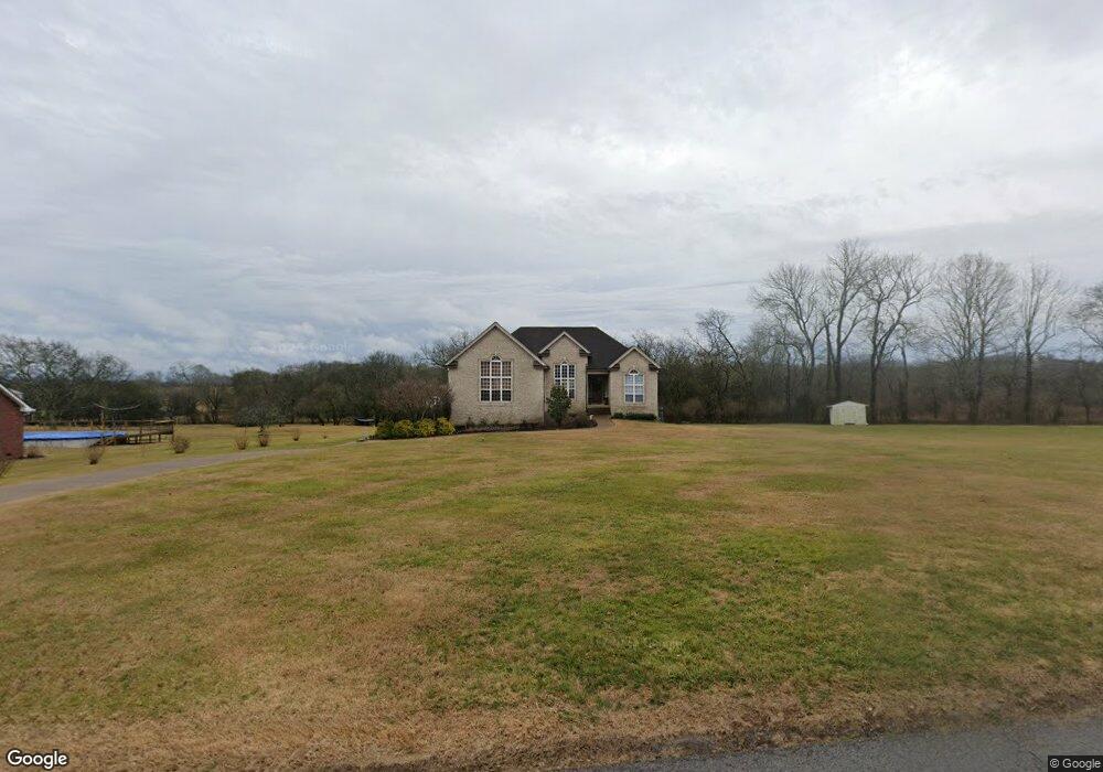
1012 Pruitt Ln Gallatin, TN 37066
Estimated Value: $549,000 - $643,000
--
Bed
3
Baths
2,340
Sq Ft
$252/Sq Ft
Est. Value
About This Home
This home is located at 1012 Pruitt Ln, Gallatin, TN 37066 and is currently estimated at $589,773, approximately $252 per square foot. 1012 Pruitt Ln is a home located in Sumner County with nearby schools including Benny C. Bills Elementary School, Joe Shafer Middle School, and Gallatin Senior High School.
Ownership History
Date
Name
Owned For
Owner Type
Purchase Details
Closed on
Jun 17, 2011
Sold by
Hammers Meshia
Bought by
Hammers Meshia and Hammers Josh
Current Estimated Value
Purchase Details
Closed on
Mar 11, 2011
Sold by
Embry Christian
Bought by
Hammers Meshia
Home Financials for this Owner
Home Financials are based on the most recent Mortgage that was taken out on this home.
Original Mortgage
$233,916
Outstanding Balance
$164,162
Interest Rate
5.25%
Mortgage Type
FHA
Estimated Equity
$425,611
Purchase Details
Closed on
Feb 29, 2008
Sold by
Louallen Builders Inc
Bought by
Embry Richard and Embry Christan
Home Financials for this Owner
Home Financials are based on the most recent Mortgage that was taken out on this home.
Original Mortgage
$303,598
Interest Rate
5.46%
Mortgage Type
VA
Create a Home Valuation Report for This Property
The Home Valuation Report is an in-depth analysis detailing your home's value as well as a comparison with similar homes in the area
Home Values in the Area
Average Home Value in this Area
Purchase History
| Date | Buyer | Sale Price | Title Company |
|---|---|---|---|
| Hammers Meshia | -- | Rudy Title & Escrow Llc | |
| Hammers Meshia | $240,000 | Rudy Title & Escrow Llc | |
| Embry Richard | $293,900 | Hallmark Title Company |
Source: Public Records
Mortgage History
| Date | Status | Borrower | Loan Amount |
|---|---|---|---|
| Open | Hammers Meshia | $233,916 | |
| Previous Owner | Embry Richard | $303,598 |
Source: Public Records
Tax History Compared to Growth
Tax History
| Year | Tax Paid | Tax Assessment Tax Assessment Total Assessment is a certain percentage of the fair market value that is determined by local assessors to be the total taxable value of land and additions on the property. | Land | Improvement |
|---|---|---|---|---|
| 2024 | $1,898 | $133,575 | $26,375 | $107,200 |
| 2023 | $2,051 | $91,075 | $16,350 | $74,725 |
| 2022 | $2,060 | $91,075 | $16,350 | $74,725 |
| 2021 | $2,060 | $91,075 | $16,350 | $74,725 |
| 2020 | $2,060 | $91,075 | $16,350 | $74,725 |
| 2019 | $2,060 | $0 | $0 | $0 |
| 2018 | $1,588 | $0 | $0 | $0 |
| 2017 | $1,588 | $0 | $0 | $0 |
| 2016 | $1,588 | $0 | $0 | $0 |
| 2015 | -- | $0 | $0 | $0 |
| 2014 | -- | $0 | $0 | $0 |
Source: Public Records
Map
Nearby Homes
- 1000 Pruitt Ln
- 110 Giles Ln
- 1017 Cabriolet Ct
- 1029 Robert Lee Dr
- 1067 Robert Lee Dr
- 732 Deshea Creek Rd
- 728 Deshea Creek Rd
- 147 Grandstand Blvd
- 1009 Cherokee Cove
- 0 Branham Mill Rd Unit RTC2887469
- 724 Deshea Creek Rd
- 2030 Highway 31 E
- 1000 Choctaw Cove
- 104 Branham Mill Rd
- 1030 Tiane Trail
- 1032 Tiane Trail
- 1004 Tiane Trail
- 1006 Tiane Trail
- 1008 Tiane Trail
- 1023 Tiane Trail
- 1026 Pruitt Ln
- 1030 Pruitt Ln
- 1017 Falcon Crest
- 1005 Pruitt Ln
- 1044 Pruitt Ln
- 1013 Falcon Crest
- 1052 Pruitt Ln
- 1074 E Martin Ln
- 1014 Falcon Crest
- 1450 Gibbs Ln
- 1009 Falcon Crest
- 1064 Pruitt Ln
- 1070 Martin Ln
- 1076 Pruitt Ln
- 1010 Falcon Crest
- 1005 Falcon Crest
- 501 Falcon Ct
- 1088 Pruitt Ln
- 1001 Falcon Crest
- 1066 E Martin Ln