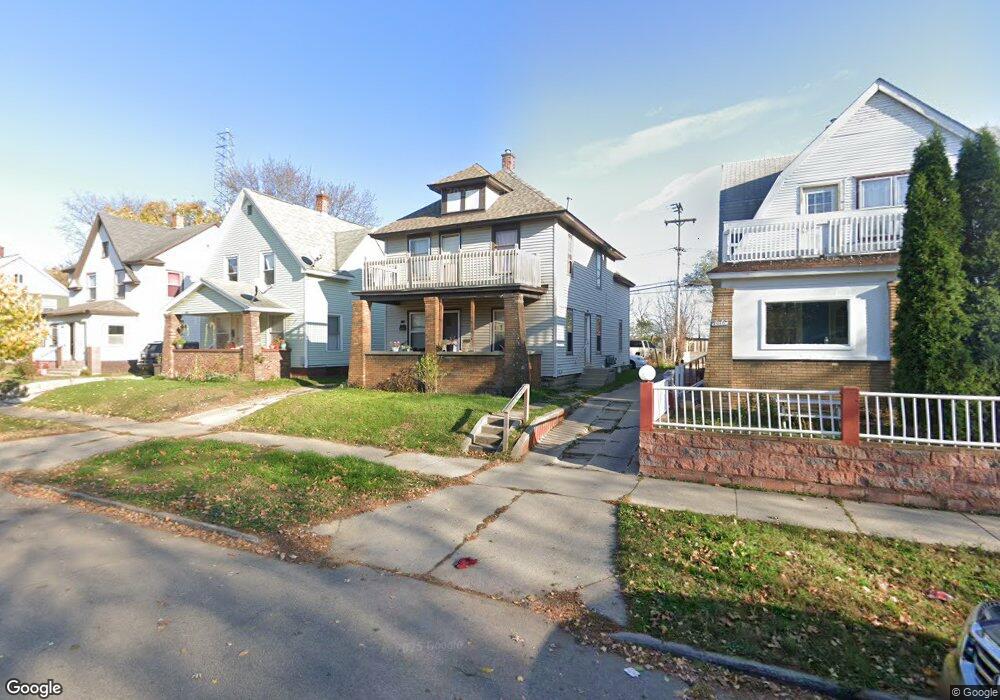
1012 Sheridan Ave SW Grand Rapids, MI 49503
Roosevelt Park NeighborhoodEstimated Value: $162,000 - $210,000
--
Bed
--
Bath
1,740
Sq Ft
$110/Sq Ft
Est. Value
About This Home
This home is located at 1012 Sheridan Ave SW, Grand Rapids, MI 49503 and is currently estimated at $191,674, approximately $110 per square foot. 1012 Sheridan Ave SW is a home located in Kent County with nearby schools including Cesar E. Chavez Elementary, Burton Middle School, and Union High School.
Ownership History
Date
Name
Owned For
Owner Type
Purchase Details
Closed on
Oct 8, 2021
Sold by
Manuel Duran
Bought by
1012 Sheridan Avenue Llc
Current Estimated Value
Purchase Details
Closed on
Aug 20, 1998
Sold by
Reyes Reyes D D and Reyes Duran M
Bought by
Duran Duran M and Duran M
Purchase Details
Closed on
Aug 18, 1988
Purchase Details
Closed on
Aug 24, 1987
Bought by
Duran Manuel Maria
Create a Home Valuation Report for This Property
The Home Valuation Report is an in-depth analysis detailing your home's value as well as a comparison with similar homes in the area
Home Values in the Area
Average Home Value in this Area
Purchase History
| Date | Buyer | Sale Price | Title Company |
|---|---|---|---|
| 1012 Sheridan Avenue Llc | -- | None Listed On Document | |
| Duran Manuel | -- | Kakaty Jay C | |
| Duran Duran M | $32,000 | -- | |
| -- | $26,500 | -- | |
| Duran Manuel Maria | $21,900 | -- |
Source: Public Records
Tax History Compared to Growth
Tax History
| Year | Tax Paid | Tax Assessment Tax Assessment Total Assessment is a certain percentage of the fair market value that is determined by local assessors to be the total taxable value of land and additions on the property. | Land | Improvement |
|---|---|---|---|---|
| 2025 | $1,388 | $87,600 | $0 | $0 |
| 2024 | $1,388 | $77,800 | $0 | $0 |
| 2023 | $1,377 | $65,700 | $0 | $0 |
| 2022 | $1,309 | $51,800 | $0 | $0 |
| 2021 | $1,275 | $46,300 | $0 | $0 |
| 2020 | $1,232 | $40,400 | $0 | $0 |
| 2019 | $1,262 | $36,800 | $0 | $0 |
| 2018 | $1,223 | $27,100 | $0 | $0 |
| 2017 | $1,193 | $24,100 | $0 | $0 |
| 2016 | $1,199 | $23,400 | $0 | $0 |
| 2015 | $1,143 | $23,400 | $0 | $0 |
| 2013 | -- | $23,500 | $0 | $0 |
Source: Public Records
Map
Nearby Homes
- 962 Sheridan Ave SW
- 543 Tenhaaf Ct SW
- 841 Oakland Ave SW
- 125 Hall St SW
- 730 Liberty St SW
- 721 Olympia St SW
- 601 High St SW
- 1265 Ionia Ave SW
- 26 Hall St SW
- 719 Coate Ct SW
- 757 Tulip St SW
- 540 New Ave SW
- 530 New Ave SW
- 436 Pleasant St SW
- 440 Pleasant St SW
- 444 Pleasant St SW
- 448 Pleasant St SW
- 513 Crofton St SW
- 452 Pleasant St SW
- 358 Fox St SW
- 1016 Sheridan Ave SW
- 1008 Sheridan Ave SW
- 1020 Sheridan Ave SW
- 1002 Sheridan Ave SW
- 1024 Sheridan Ave SW
- 1026 Sheridan Ave SW
- 0 Sheridan Ave SW
- 1015 Sheridan Ave SW
- 1009 Sheridan Ave SW
- 1023 Sheridan Ave SW
- 1023 Sheridan Ave SW Unit 2upper
- 1007 Sheridan Ave SW
- 1019 Sheridan Ave SW
- 1032 Sheridan Ave SW
- 958 Sheridan Ave SW
- 1001 Sheridan Ave SW
- 1025 Sheridan Ave SW
- 1021 Sheridan Ave SW
- 1021 Sheridan Ave SW
- 954 Sheridan Ave SW