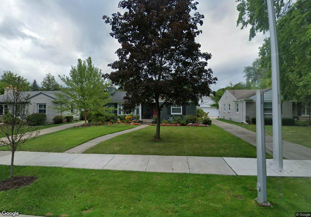
1012 Somerset Ave Grosse Pointe Park, MI 48230
Estimated Value: $280,858 - $321,000
--
Bed
--
Bath
1,123
Sq Ft
$268/Sq Ft
Est. Value
About This Home
This home is located at 1012 Somerset Ave, Grosse Pointe Park, MI 48230 and is currently estimated at $300,965, approximately $268 per square foot. 1012 Somerset Ave is a home located in Wayne County with nearby schools including George Defer Elementary School, Pierce Middle School, and Grosse Pointe South High School.
Ownership History
Date
Name
Owned For
Owner Type
Purchase Details
Closed on
Dec 11, 2020
Sold by
Hull Harry B and Hull Marla L
Bought by
Hull Harry Baron and Hull Marla L
Current Estimated Value
Purchase Details
Closed on
Jan 3, 2017
Sold by
Peck John M and Peck Deborah L
Bought by
Hull Marla L
Home Financials for this Owner
Home Financials are based on the most recent Mortgage that was taken out on this home.
Original Mortgage
$128,000
Outstanding Balance
$63,661
Interest Rate
4.08%
Mortgage Type
New Conventional
Estimated Equity
$237,304
Create a Home Valuation Report for This Property
The Home Valuation Report is an in-depth analysis detailing your home's value as well as a comparison with similar homes in the area
Home Values in the Area
Average Home Value in this Area
Purchase History
| Date | Buyer | Sale Price | Title Company |
|---|---|---|---|
| Hull Harry Baron | -- | None Available | |
| Hull Marla L | $160,000 | Chicago Title Agency Iinc |
Source: Public Records
Mortgage History
| Date | Status | Borrower | Loan Amount |
|---|---|---|---|
| Open | Hull Marla L | $128,000 |
Source: Public Records
Tax History Compared to Growth
Tax History
| Year | Tax Paid | Tax Assessment Tax Assessment Total Assessment is a certain percentage of the fair market value that is determined by local assessors to be the total taxable value of land and additions on the property. | Land | Improvement |
|---|---|---|---|---|
| 2025 | $2,472 | $145,300 | $0 | $0 |
| 2024 | $2,472 | $122,700 | $0 | $0 |
| 2023 | $2,361 | $110,800 | $0 | $0 |
| 2022 | $2,243 | $102,600 | $0 | $0 |
| 2021 | $4,423 | $101,200 | $0 | $0 |
| 2019 | $4,551 | $93,000 | $0 | $0 |
| 2018 | $2,139 | $82,700 | $0 | $0 |
| 2017 | $4,900 | $48,400 | $0 | $0 |
| 2016 | $4,615 | $80,400 | $0 | $0 |
| 2015 | $7,928 | $82,200 | $0 | $0 |
| 2013 | $7,680 | $78,100 | $0 | $0 |
| 2012 | $2,170 | $82,000 | $32,000 | $50,000 |
Source: Public Records
Map
Nearby Homes
- 1032 Beaconsfield Ave
- 74 Pointe Park Place Unit 311
- 54 Pointe Park Place Unit 208
- 1048 Lakepointe St Unit A
- 1058 Lakepointe St
- 976 Lakepointe St
- 1083 Lakepointe St
- 875 Balfour St
- 1148 Devonshire Rd
- 1254 Beaconsfield Ave
- 1308 Ashland St
- 814 Harcourt Rd Unit 816
- 908 Manistique St
- 847 Barrington Rd
- 2568 Alter Rd
- 1306 Beaconsfield Ave Unit 1308
- 877 Manistique St
- 2140 Alter Rd
- 709 Ashland St
- 14536 E Jefferson Ave
- 1010 Somerset Ave
- 1014 Somerset Ave
- 1008 Somerset Ave
- 1009 Balfour St
- 1013 Balfour St
- 1009 Somerset Ave
- 1007 Somerset Ave
- 1005 Balfour St
- 1011 Somerset Ave
- 1002 Somerset Ave
- 1017 Balfour St
- 1015 Somerset Ave
- 1003 Somerset Ave
- 1003 Balfour St
- 1019 Balfour St
- 1019 Somerset Ave
- 15501 E Jefferson Ave
- 1008 Nottingham Rd
- 1006 Nottingham Rd
- 1024 Somerset Ave