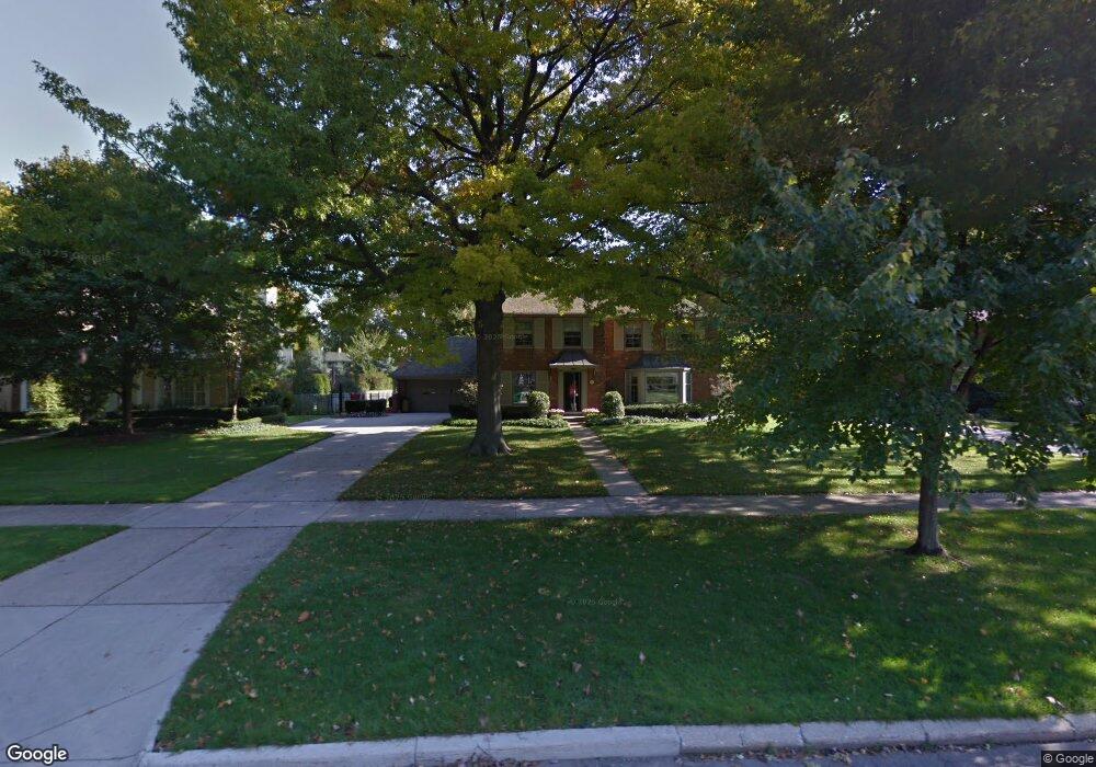
1012 Whittier Rd Grosse Pointe Park, MI 48230
Estimated Value: $704,000 - $886,000
--
Bed
1
Bath
2,636
Sq Ft
$294/Sq Ft
Est. Value
About This Home
This home is located at 1012 Whittier Rd, Grosse Pointe Park, MI 48230 and is currently estimated at $773,806, approximately $293 per square foot. 1012 Whittier Rd is a home located in Wayne County with nearby schools including George Defer Elementary School, Pierce Middle School, and Grosse Pointe South High School.
Ownership History
Date
Name
Owned For
Owner Type
Purchase Details
Closed on
Jun 20, 2006
Sold by
Prudential Relocation Inc
Bought by
Schrage Michael C
Current Estimated Value
Purchase Details
Closed on
Nov 23, 2005
Sold by
Schuldt John C and Schuldt Roberta W
Bought by
Prudential Relocation Inc
Purchase Details
Closed on
Jun 21, 2004
Sold by
Garr John T and Garr Sue D
Bought by
Schuldt John C
Create a Home Valuation Report for This Property
The Home Valuation Report is an in-depth analysis detailing your home's value as well as a comparison with similar homes in the area
Home Values in the Area
Average Home Value in this Area
Purchase History
| Date | Buyer | Sale Price | Title Company |
|---|---|---|---|
| Schrage Michael C | $530,000 | Metropolitan Title Company | |
| Prudential Relocation Inc | $597,500 | Metropolitan Title Company | |
| Schuldt John C | -- | Lamont Title Corporation |
Source: Public Records
Tax History Compared to Growth
Tax History
| Year | Tax Paid | Tax Assessment Tax Assessment Total Assessment is a certain percentage of the fair market value that is determined by local assessors to be the total taxable value of land and additions on the property. | Land | Improvement |
|---|---|---|---|---|
| 2025 | $5,609 | $314,200 | $0 | $0 |
| 2024 | $5,609 | $290,800 | $0 | $0 |
| 2023 | $5,356 | $265,200 | $0 | $0 |
| 2022 | $5,089 | $245,200 | $0 | $0 |
| 2021 | $10,034 | $241,700 | $0 | $0 |
| 2019 | $10,326 | $229,300 | $0 | $0 |
| 2018 | $4,852 | $211,700 | $0 | $0 |
| 2017 | $10,725 | $137,100 | $0 | $0 |
| 2016 | $10,071 | $212,000 | $0 | $0 |
| 2015 | $18,157 | $209,400 | $0 | $0 |
| 2013 | $17,590 | $178,700 | $0 | $0 |
| 2012 | $4,935 | $187,000 | $74,900 | $112,100 |
Source: Public Records
Map
Nearby Homes
- 1031 Kensington Ave
- 1036 Yorkshire Rd
- 854 Grand Marais St
- 792 Whittier Rd
- 1131 Audubon Rd
- 1200 Audubon Rd
- 814 Harcourt Rd Unit 816
- 43 Cranford Ln
- 45 Cranford Ln
- 16935 Maumee Ave
- 1148 Devonshire Rd
- 386 Notre Dame St
- 17012 Maumee Ave
- 25 Village Ln
- 616 Cadieux Rd
- 1056 Balfour St
- 387 Neff Rd
- 15501 E Jefferson Ave
- 497 Neff Rd
- 320 Neff Rd
- 1011 Kensington Ave
- 1014 Whittier Rd
- 1010 Whittier Rd
- 1009 Kensington Ave
- 1018 Whittier Rd
- 1007 Kensington Ave
- 1006 Whittier Rd
- 1015 Kensington Ave
- 1020 Whittier Rd
- 1011 Whittier Rd
- 1013 Whittier Rd
- 1004 Whittier Rd
- 1005 Kensington Ave
- 1015 Whittier Rd
- 1017 Kensington Ave
- 1017 Whittier Rd
- 1022 Whittier Rd
- 1002 Whittier Rd
- 1005 Whittier Rd
- 1019 Whittier Rd