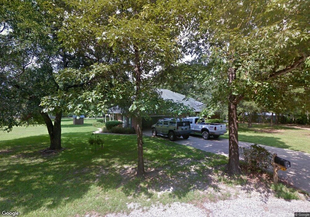
10120 Clearwater Rd Vancleave, MS 39565
Estimated Value: $266,000 - $419,000
3
Beds
2
Baths
2,400
Sq Ft
$132/Sq Ft
Est. Value
About This Home
This home is located at 10120 Clearwater Rd, Vancleave, MS 39565 and is currently estimated at $316,637, approximately $131 per square foot. 10120 Clearwater Rd is a home located in Jackson County with nearby schools including Vancleave Upper Elementary School, Vancleave Lower Elementary School, and Vancleave Middle School.
Ownership History
Date
Name
Owned For
Owner Type
Purchase Details
Closed on
Apr 29, 2013
Sold by
Mcclellan Mary and Mcclellan Gregory
Bought by
Vanderslice Gary W and Vanderslice Margaret E
Current Estimated Value
Home Financials for this Owner
Home Financials are based on the most recent Mortgage that was taken out on this home.
Original Mortgage
$183,612
Outstanding Balance
$129,464
Interest Rate
3.37%
Mortgage Type
FHA
Estimated Equity
$187,173
Create a Home Valuation Report for This Property
The Home Valuation Report is an in-depth analysis detailing your home's value as well as a comparison with similar homes in the area
Home Values in the Area
Average Home Value in this Area
Purchase History
| Date | Buyer | Sale Price | Title Company |
|---|---|---|---|
| Vanderslice Gary W | -- | Pilger Title Company |
Source: Public Records
Mortgage History
| Date | Status | Borrower | Loan Amount |
|---|---|---|---|
| Open | Vanderslice Gary W | $183,612 |
Source: Public Records
Tax History Compared to Growth
Tax History
| Year | Tax Paid | Tax Assessment Tax Assessment Total Assessment is a certain percentage of the fair market value that is determined by local assessors to be the total taxable value of land and additions on the property. | Land | Improvement |
|---|---|---|---|---|
| 2024 | $1,570 | $15,578 | $1,211 | $14,367 |
| 2023 | $1,570 | $15,578 | $1,211 | $14,367 |
| 2022 | $1,517 | $15,578 | $1,211 | $14,367 |
| 2021 | $1,525 | $15,651 | $1,211 | $14,440 |
| 2020 | $1,471 | $14,658 | $945 | $13,713 |
| 2019 | $1,451 | $14,658 | $945 | $13,713 |
| 2018 | $1,485 | $14,658 | $945 | $13,713 |
| 2017 | $1,516 | $14,658 | $945 | $13,713 |
| 2016 | $1,444 | $14,658 | $945 | $13,713 |
| 2015 | $1,248 | $129,400 | $9,010 | $120,390 |
| 2014 | $1,270 | $13,367 | $901 | $12,466 |
| 2013 | $1,218 | $13,367 | $901 | $12,466 |
Source: Public Records
Map
Nearby Homes
- 10200 Blossom St
- 9618 Paige Bayou Rd
- 10766 Johns Bayou Cir Unit DRO
- 11301 Johns Bayou Rd
- 1904 Kingslea Dr
- 2215 Brookside St Gautier Ms Dr
- 0 Boxwood
- 00 Martin Bluff Rd
- 2208 Highland Dr
- 1927 Shady Point Cir
- Tbd Stockton Cir
- 2217 Bayou View Cir
- Lot 5 Bayou View Cir
- 1917 Shady Point Cir
- Lots 27-28 Stockton Cir
- 0 Ms-57 Unit 4107638
- 0 Ms-57 Unit 4097649
- 0 Ms 57 Unit 4122608
- 0 Ms 57 Unit 4117591
- Lot 212 Longwood Dr
- 10121 Clearwater Rd
- 10124 Clearwater Rd
- 10112 Clearwater Rd
- 10201 Clearwater Rd
- 10113 Clearwater Rd
- 10200 Clearwater Rd
- 10204 Clearwater Rd
- 10109 Clearwater Rd
- 10100 Clearwater Rd
- 10217 Clearwater Rd
- 10221 Clearwater Rd
- 3612 Hawk Dr
- 10101 Clearwater Rd
- 0 Clearwater
- 3607 Hawk Dr
- 3601 Hawk Dr
- 3600 Hawk Dr
- 10440 Clearwater Rd
- 10305 Clearwater Rd
- 10400 Clearwater Rd