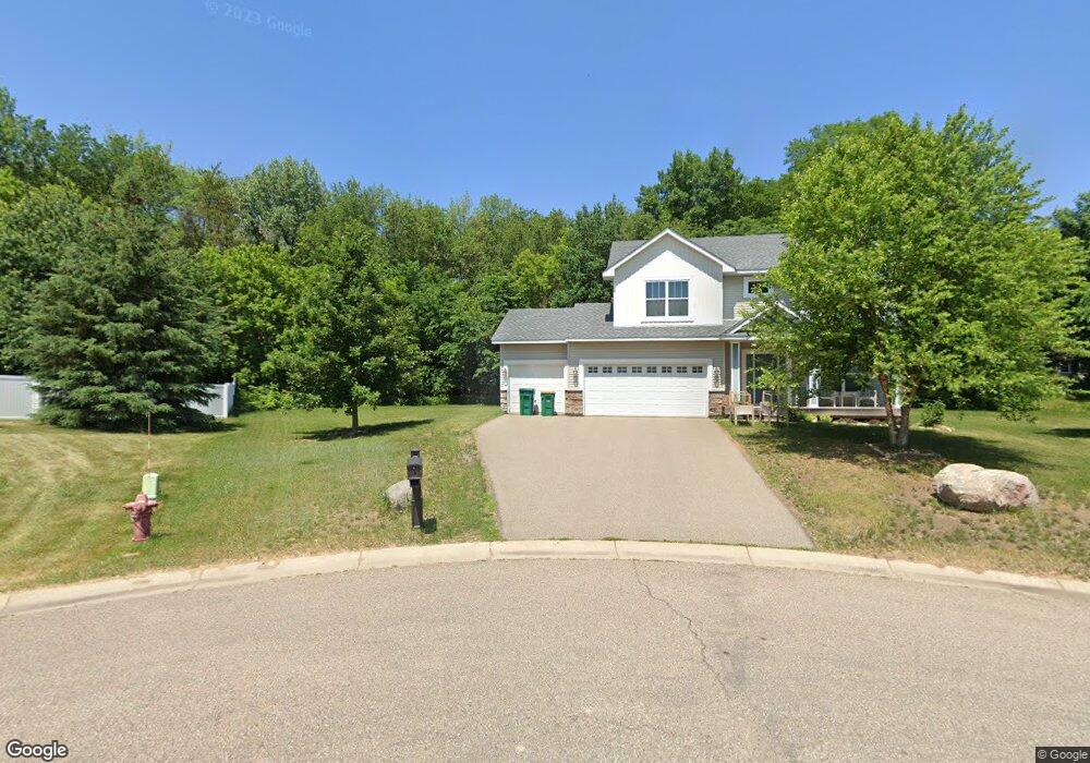
10120 Ponds Cir Elko New Market, MN 55020
Estimated Value: $469,566 - $587,000
3
Beds
3
Baths
2,174
Sq Ft
$235/Sq Ft
Est. Value
About This Home
This home is located at 10120 Ponds Cir, Elko New Market, MN 55020 and is currently estimated at $511,892, approximately $235 per square foot. 10120 Ponds Cir is a home with nearby schools including John F. Kennedy Elementary School, Mcguire Middle School, and Lakeville South High School.
Ownership History
Date
Name
Owned For
Owner Type
Purchase Details
Closed on
Aug 16, 2013
Sold by
Brandl/Anderson Homes Inc
Bought by
Frantsi Erik and Frantsi Amy R
Current Estimated Value
Home Financials for this Owner
Home Financials are based on the most recent Mortgage that was taken out on this home.
Original Mortgage
$294,550
Outstanding Balance
$213,331
Interest Rate
3.75%
Mortgage Type
FHA
Estimated Equity
$298,561
Purchase Details
Closed on
May 8, 2013
Sold by
Metro Land Llc
Bought by
Brandl/Anderson Homes Inc
Create a Home Valuation Report for This Property
The Home Valuation Report is an in-depth analysis detailing your home's value as well as a comparison with similar homes in the area
Home Values in the Area
Average Home Value in this Area
Purchase History
| Date | Buyer | Sale Price | Title Company |
|---|---|---|---|
| Frantsi Erik | $300,000 | Land Title Inc | |
| Brandl/Anderson Homes Inc | $55,900 | Land Title Inc |
Source: Public Records
Mortgage History
| Date | Status | Borrower | Loan Amount |
|---|---|---|---|
| Open | Frantsi Erik | $294,550 |
Source: Public Records
Tax History Compared to Growth
Tax History
| Year | Tax Paid | Tax Assessment Tax Assessment Total Assessment is a certain percentage of the fair market value that is determined by local assessors to be the total taxable value of land and additions on the property. | Land | Improvement |
|---|---|---|---|---|
| 2025 | $5,356 | $438,600 | $138,500 | $300,100 |
| 2024 | $5,826 | $412,700 | $129,500 | $283,200 |
| 2023 | $5,586 | $435,700 | $134,900 | $300,800 |
| 2022 | $4,634 | $439,900 | $129,700 | $310,200 |
| 2021 | $4,616 | $332,100 | $93,500 | $238,600 |
| 2020 | $4,660 | $330,600 | $90,800 | $239,800 |
| 2019 | $3,942 | $321,800 | $83,300 | $238,500 |
| 2018 | $3,860 | $0 | $0 | $0 |
| 2016 | $3,646 | $0 | $0 | $0 |
| 2014 | -- | $0 | $0 | $0 |
Source: Public Records
Map
Nearby Homes
- 26800 Dogwood Dr
- 9975 Kari Way
- 27241 Pete's Hill Trail
- 27231 Pete's Hill Trail
- 27120 Petes Hill Trail
- 27221 Pete's Hill Trail
- 27211 Pete's Hill Trail
- 26410 Woodcrest Ln
- 27130 Petes Hill Trail
- 27201 Pete's Hill Trail
- 27150 Pete's Hill Trail
- 27260 Pete's Hill Trail
- 26596 Drew Ave
- 9500 Main St
- 9486 Glenborough Dr
- 9815 Pinehurst Dr
- 9769 Pinehurst Ct
- 9727 Saint Andrews Dr
- 9390 Glenborough Dr
- 10922 E 270th St
- 10130 Ponds Way
- 26721 Woodcrest Ct
- 10100 Ponds Cir
- 10140 Ponds Cir
- 26716 Woodcrest Ct
- 10090 Ponds Cir
- 26705 Woodcrest Ct
- 10150 Ponds Way
- 10080 Ponds Way
- 10125 Ponds Way
- 26751 Xerxes Trail
- 26791 Woodcrest Ct
- 10095 Ponds Way
- 10145 Ponds Way
- 26700 Woodcrest Ct
- 10160 Ponds Way
- 10155 Ponds Way
- 10075 Ponds Way
- 10070 Ponds Way
- 26715 Xerxes Trail