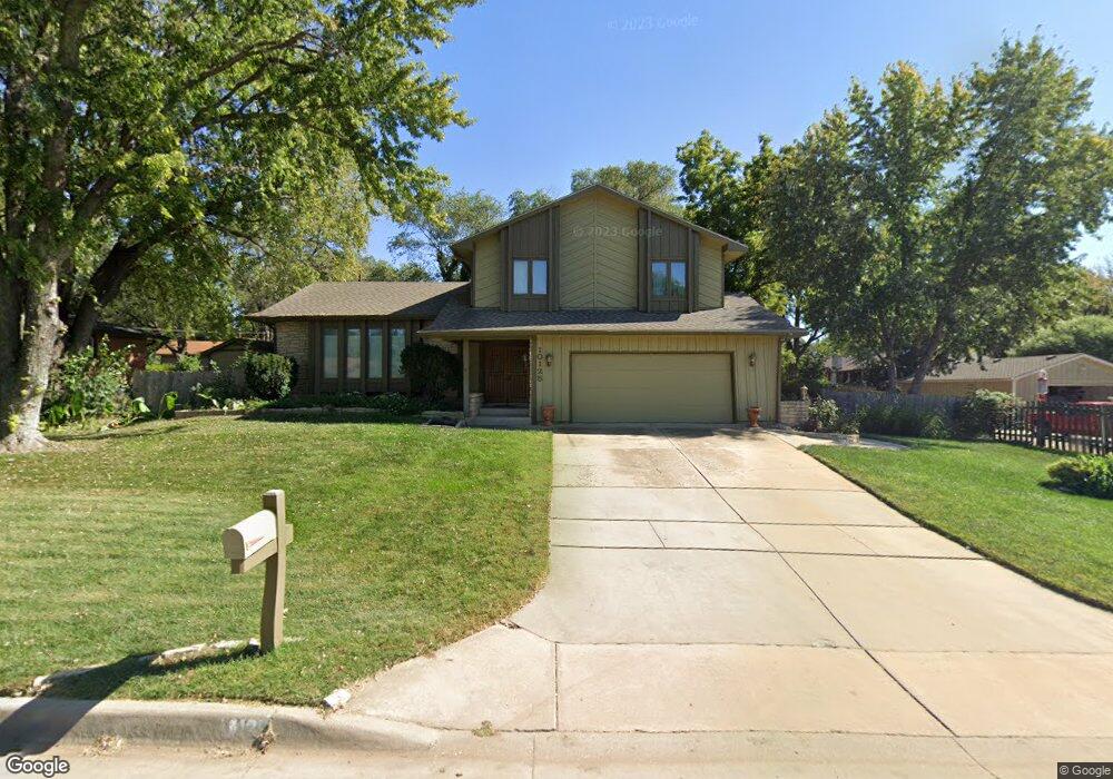
10125 W Suncrest St Wichita, KS 67212
Westlink NeighborhoodEstimated Value: $143,000 - $305,000
3
Beds
3
Baths
2,272
Sq Ft
$107/Sq Ft
Est. Value
About This Home
This home is located at 10125 W Suncrest St, Wichita, KS 67212 and is currently estimated at $243,251, approximately $107 per square foot. 10125 W Suncrest St is a home located in Sedgwick County with nearby schools including Peterson Elementary School, Wilbur Middle School, and Wichita Northwest High School.
Ownership History
Date
Name
Owned For
Owner Type
Purchase Details
Closed on
Mar 18, 2005
Sold by
Berg Susan R
Bought by
Koop Norma Jean
Current Estimated Value
Purchase Details
Closed on
Feb 24, 1999
Sold by
Peterson Virgil H and Peterson Barbara E
Bought by
Komp Norma Jean
Home Financials for this Owner
Home Financials are based on the most recent Mortgage that was taken out on this home.
Original Mortgage
$124,900
Interest Rate
6.12%
Create a Home Valuation Report for This Property
The Home Valuation Report is an in-depth analysis detailing your home's value as well as a comparison with similar homes in the area
Home Values in the Area
Average Home Value in this Area
Purchase History
| Date | Buyer | Sale Price | Title Company |
|---|---|---|---|
| Koop Norma Jean | -- | None Available | |
| Komp Norma Jean | -- | Columbian Natl Title Ins Co |
Source: Public Records
Mortgage History
| Date | Status | Borrower | Loan Amount |
|---|---|---|---|
| Previous Owner | Komp Norma Jean | $124,900 |
Source: Public Records
Tax History Compared to Growth
Tax History
| Year | Tax Paid | Tax Assessment Tax Assessment Total Assessment is a certain percentage of the fair market value that is determined by local assessors to be the total taxable value of land and additions on the property. | Land | Improvement |
|---|---|---|---|---|
| 2025 | $3,114 | $30,119 | $8,798 | $21,321 |
| 2023 | $3,114 | $26,117 | $7,360 | $18,757 |
| 2022 | $2,616 | $23,449 | $6,946 | $16,503 |
| 2021 | $2,484 | $21,712 | $4,600 | $17,112 |
| 2020 | $2,396 | $20,873 | $5,566 | $15,307 |
| 2019 | $2,400 | $20,873 | $5,566 | $15,307 |
| 2018 | $2,312 | $20,068 | $3,381 | $16,687 |
| 2017 | $2,171 | $0 | $0 | $0 |
| 2016 | $2,168 | $0 | $0 | $0 |
| 2015 | $2,152 | $0 | $0 | $0 |
| 2014 | $2,108 | $0 | $0 | $0 |
Source: Public Records
Map
Nearby Homes
- 1138 N Chipper Ln
- 860 N Valleyview St
- 1106 N Lark Ln
- 10701 W Harvest Ct
- 1109 N Lark Ln
- 9801 W 12th St N
- 9804 W 12th St N
- 10726 W Ponderosa Cir
- 1112 N Westfield Ave
- 1102 N Prescott Cir
- 9221 W Suncrest St
- 11110 W Central Ave
- 9336 W Briarwood Ct
- 9620 W Tee Ln
- 1534 N Valleyview Ct
- 11005 W Taylor Cir
- 1544 N Westgate St
- 1548 N Amarado Ct
- 9026 W Harvest Ct
- 11218 W Taylor St
- 10119 W Suncrest St
- 980 N Toh N Hah Trail
- 10111 W Suncrest St
- 961 N Crestline St
- 967 N Crestline St
- 10120 W Suncrest Ave
- 10120 W Suncrest St
- 950 N Toh N Hah Trail
- 10110 W 9th St N
- 10303 W Harvest Ct
- 953 N Crestline St
- 10315 W Harvest Ct
- 981 N Valleyview St
- 991 N Valleyview St
- 944 N Toh N Hah Trail
- 955 N Toh N Hah Ct
- 945 N Crestline St
- 945 N Crestline Ave
- 10319 W Harvest Ct
- 10105 W 9th St N