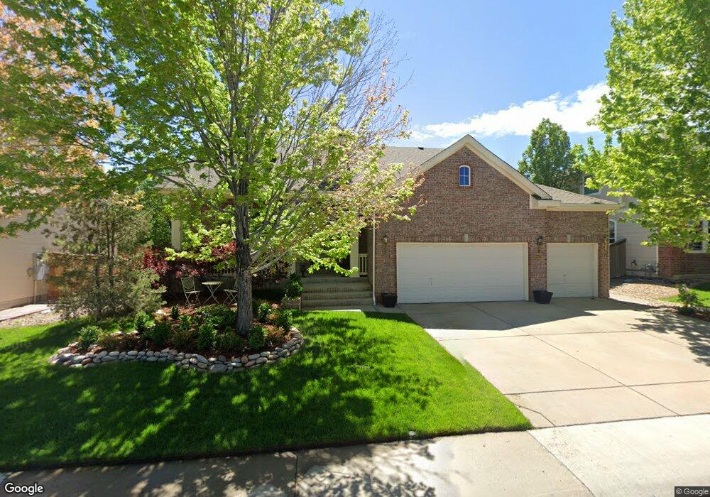
10126 Riverstone Dr Parker, CO 80134
Clarke Farms NeighborhoodEstimated Value: $690,504 - $727,000
About This Home
This home is located at 10126 Riverstone Dr, Parker, CO 80134 and is currently estimated at $705,126, approximately $213 per square foot. 10126 Riverstone Dr is a home located in Douglas County with nearby schools including Cherokee Trail Elementary School, Sierra Middle School, and Chaparral High School.
Ownership History
We collect this data history from publicly available records. To have your information removed, we recommend requesting removal directly through your county’s website.
Purchase Details
Home Financials for this Owner
Home Financials are based on the most recent Mortgage that was taken out on this home.Purchase Details
Home Financials for this Owner
Home Financials are based on the most recent Mortgage that was taken out on this home.Purchase Details
Purchase Details
Home Financials for this Owner
Home Financials are based on the most recent Mortgage that was taken out on this home.Purchase Details
Purchase Details
Home Financials for this Owner
Home Financials are based on the most recent Mortgage that was taken out on this home.Purchase Details
Home Values in the Area
Average Home Value in this Area
Purchase History
We collect this data history from publicly available records. To have your information removed, we recommend requesting removal directly through your county’s website.
| Date | Buyer | Sale Price | Title Company |
|---|---|---|---|
| $490,000 | Fidelity National Title | ||
| $426,000 | Land Title Guarantee | ||
| $341,500 | Guardian Title Agency Llc | ||
| $325,000 | Chicago Title Co | ||
| -- | -- | ||
| $301,700 | Stewart Title | ||
| $130,300 | -- |
Mortgage History
We collect this data history from publicly available records. To have your information removed, we recommend requesting removal directly through your county’s website.
| Date | Status | Borrower | Loan Amount |
|---|---|---|---|
| Open | $465,500 | ||
| Previous Owner | $404,700 | ||
| Previous Owner | $125,000 | ||
| Previous Owner | $271,500 |
Tax History
We collect this data history from publicly available records. To have your information removed, we recommend requesting removal directly through your county’s website.
| Year | Tax Paid | Tax Assessment Tax Assessment Total Assessment is a certain percentage of the fair market value that is determined by local assessors to be the total taxable value of land and additions on the property. | Land | Improvement |
|---|---|---|---|---|
| 2026 | $5,167 | $46,380 | $11,090 | $35,290 |
| 2025 | $5,167 | $46,380 | $11,090 | $35,290 |
| 2024 | $5,167 | $51,930 | $9,360 | $42,570 |
| 2023 | $5,211 | $51,930 | $9,360 | $42,570 |
| 2022 | $3,854 | $34,910 | $6,330 | $28,580 |
| 2021 | $3,964 | $34,910 | $6,330 | $28,580 |
| 2020 | $3,730 | $33,690 | $6,940 | $26,750 |
| 2019 | $3,640 | $33,690 | $6,940 | $26,750 |
| 2018 | $3,309 | $30,210 | $6,260 | $23,950 |
| 2017 | $3,120 | $30,210 | $6,260 | $23,950 |
| 2016 | $3,099 | $29,530 | $5,570 | $23,960 |
| 2015 | $1,579 | $29,530 | $5,570 | $23,960 |
| 2014 | $1,523 | $25,680 | $5,410 | $20,270 |
Map
- 17351 Cornerstone Dr
- 17193 Opal Hill Dr
- 10267 Amethyst Way
- 10270 Amethyst Way
- 17130 Opal Hill Dr
- 10318 Severance Dr
- 10330 Severance Dr
- 9678 Deerhorn Ct Unit 116
- 9646 Deerhorn Ct Unit 99
- 9685 Deerhorn Ct Unit 129
- 9608 Deerhorn Ct Unit 81
- 9582 Deerhorn Ct Unit 58
- 9515 S Bluebead Way
- 9570 Deerhorn Ct Unit 46
- 10612 Clarke Farms Dr
- 17211 Niwot Place
- 9561 Deerhorn Ct Unit 10
- 11634 Masonville Dr
- 10019 Boca Cir
- 11517 Wray Ct
- 10132 Riverstone Dr
- 10120 Riverstone Dr
- 10115 Amethyst Way
- 17505 Celestine Ct
- 10125 Riverstone Dr
- 10140 Riverstone Dr
- 10131 Riverstone Dr
- 10119 Riverstone Dr
- 17525 Celestine Ct
- 10123 Amethyst Way
- 10139 Riverstone Dr
- 10111 Riverstone Dr
- 10106 Amethyst Way
- 10150 Riverstone Dr
- 10114 Amethyst Way
- 10145 Riverstone Dr
- 17545 Celestine Ct
- 10129 Amethyst Way
- 17506 Celestine Ct
- 10154 Riverstone Dr
Ask me questions while you tour the home.