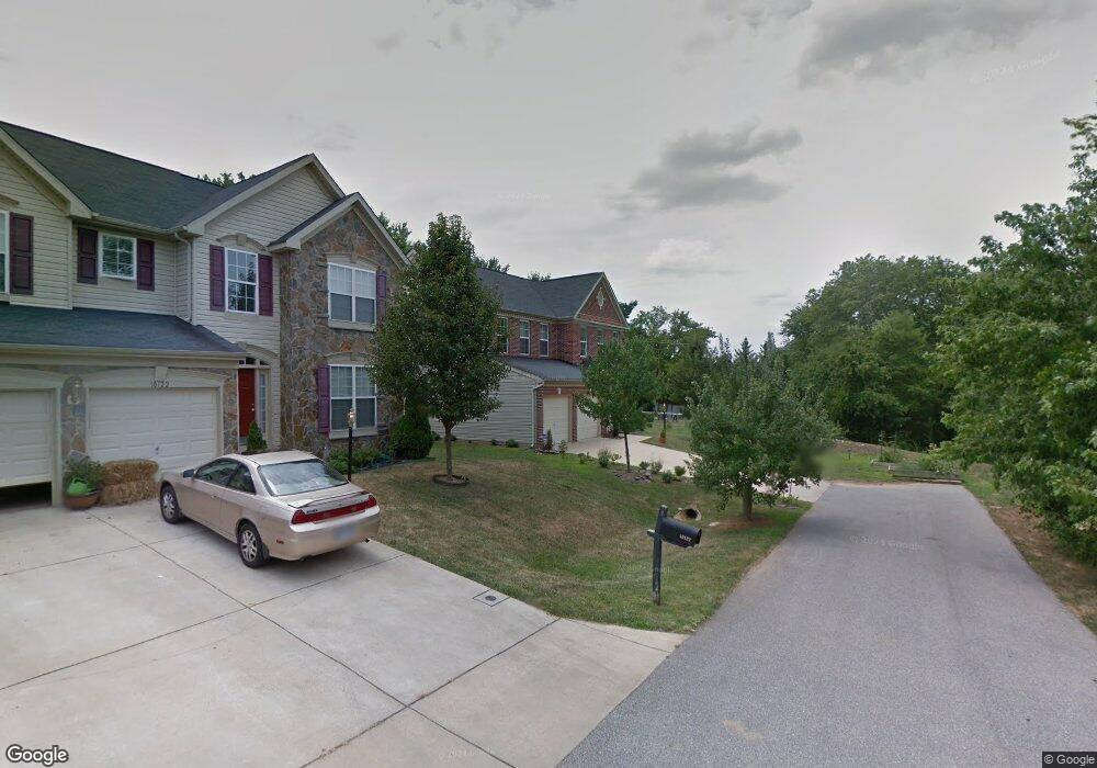
10126 Wilnor Way Laurel, MD 20723
North Laurel NeighborhoodEstimated Value: $749,000 - $822,000
4
Beds
3
Baths
2,320
Sq Ft
$334/Sq Ft
Est. Value
About This Home
This home is located at 10126 Wilnor Way, Laurel, MD 20723 and is currently estimated at $774,172, approximately $333 per square foot. 10126 Wilnor Way is a home located in Howard County with nearby schools including Gorman Crossing Elementary School, Hammond Middle School, and Reservoir High School.
Ownership History
Date
Name
Owned For
Owner Type
Purchase Details
Closed on
Nov 14, 2012
Sold by
Midon Raul S and Kausch Midon Kathleen Ann
Bought by
Midon Raul S and Kausch Midon Kathleen
Current Estimated Value
Purchase Details
Closed on
May 5, 2008
Sold by
Indymac Bank Fsb
Bought by
Midon Raul S and Midon Ann Kausch
Purchase Details
Closed on
Mar 20, 2008
Sold by
Lee Joo H
Bought by
Indymac Bank Fsb
Purchase Details
Closed on
Sep 7, 2007
Sold by
Lee Joo H
Bought by
Indymac Bank Fsb
Purchase Details
Closed on
Mar 1, 2006
Sold by
Patriot Homes
Bought by
Lee Joo H
Create a Home Valuation Report for This Property
The Home Valuation Report is an in-depth analysis detailing your home's value as well as a comparison with similar homes in the area
Home Values in the Area
Average Home Value in this Area
Purchase History
| Date | Buyer | Sale Price | Title Company |
|---|---|---|---|
| Midon Raul S | -- | None Available | |
| Midon Raul S | $520,000 | -- | |
| Indymac Bank Fsb | $512,000 | -- | |
| Indymac Bank Fsb | $512,000 | -- | |
| Lee Joo H | $619,900 | -- |
Source: Public Records
Mortgage History
| Date | Status | Borrower | Loan Amount |
|---|---|---|---|
| Closed | Lee Joo H | -- |
Source: Public Records
Tax History Compared to Growth
Tax History
| Year | Tax Paid | Tax Assessment Tax Assessment Total Assessment is a certain percentage of the fair market value that is determined by local assessors to be the total taxable value of land and additions on the property. | Land | Improvement |
|---|---|---|---|---|
| 2025 | $9,186 | $636,000 | $198,200 | $437,800 |
| 2024 | $9,186 | $606,833 | $0 | $0 |
| 2023 | $8,627 | $577,667 | $0 | $0 |
| 2022 | $8,204 | $548,500 | $203,200 | $345,300 |
| 2021 | $7,474 | $516,967 | $0 | $0 |
| 2020 | $7,474 | $485,433 | $0 | $0 |
| 2019 | $7,131 | $453,900 | $123,600 | $330,300 |
| 2018 | $6,662 | $445,200 | $0 | $0 |
| 2017 | $6,519 | $453,900 | $0 | $0 |
| 2016 | -- | $427,800 | $0 | $0 |
| 2015 | -- | $427,800 | $0 | $0 |
| 2014 | -- | $427,800 | $0 | $0 |
Source: Public Records
Map
Nearby Homes
- 9256 Laurens Way
- 9260 Old Scaggsville Rd
- 9420 Fairview Ave
- 9422 Fairview Ave
- 211 Patuxent Rd
- 7709 Brooklyn Bridge Rd
- 200 1/2 11th St
- 9401 Riverbrink Ct
- 1103 Montgomery St
- 9351 Cabot Ct
- 8719 Susini Dr
- 9786 Whiskey Run
- 1106 Snowden Place
- 1210 Westview Terrace
- 7209 Brooklyn Bridge Rd
- Dorchester IV Plan at Cole's Manor
- Tidewater Plan at Cole's Manor
- Stratton Plan at Cole's Manor
- Adrienne's Honneur II Plan at Cole's Manor
- Mount Vernon IV Villa 2 Plan at Cole's Manor
- 10136 High Ridge Rd
- 10118 Wilnor Way
- 10175 High Ridge Rd
- 10179 High Ridge Rd
- 10171 High Ridge Rd
- 10114 Wilnor Way
- 10121 Stansfield Rd
- 10113 Wilnor Way
- 10181 High Ridge Rd
- 10169 High Ridge Rd
- 10115 Stansfield Rd
- 10110 Wilnor Way
- 10125 Stansfield Rd
- 10132 High Ridge Rd
- 10128 High Ridge Rd
- 10126 High Ridge Rd
- 10150 High Ridge Rd
- 10124 High Ridge Rd
- 10129 Stansfield Rd
- 10105 Wilnor Way