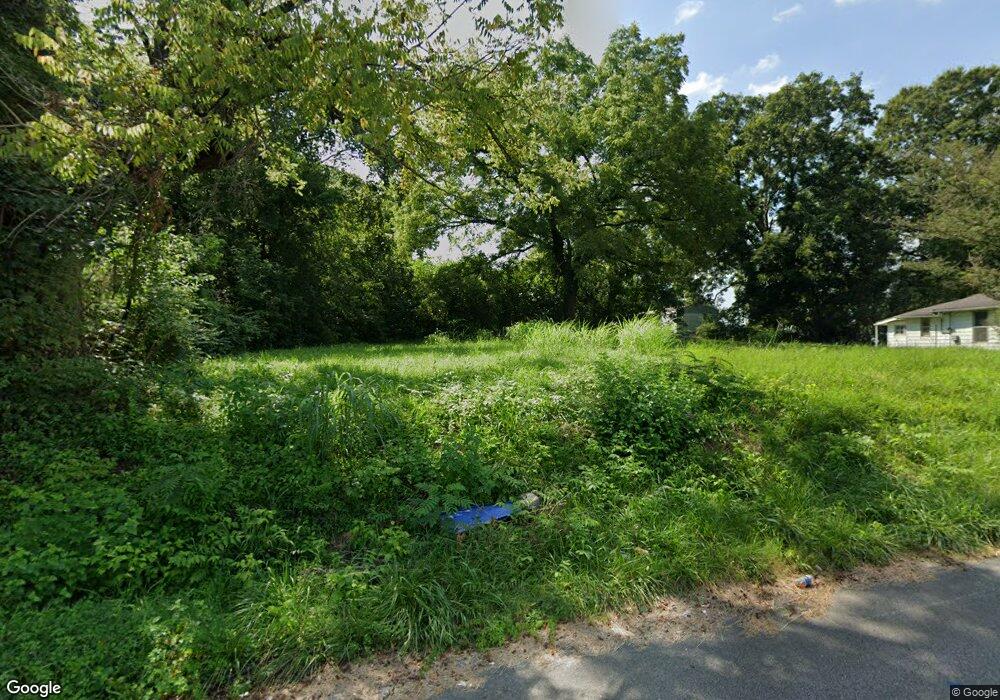
1013 N 12th Ave Humboldt, TN 38343
Estimated Value: $67,000 - $193,000
--
Bed
1
Bath
1,140
Sq Ft
$119/Sq Ft
Est. Value
About This Home
This home is located at 1013 N 12th Ave, Humboldt, TN 38343 and is currently estimated at $135,333, approximately $118 per square foot. 1013 N 12th Ave is a home located in Gibson County with nearby schools including Stigall Primary School, East Elementary School, and Humboldt Middle School.
Ownership History
Date
Name
Owned For
Owner Type
Purchase Details
Closed on
Jan 19, 2022
Sold by
Amanda Brown
Current Estimated Value
Purchase Details
Closed on
May 8, 2020
Sold by
Bradford Kim
Bought by
City Of Humboldt
Purchase Details
Closed on
Jun 6, 2015
Sold by
Baker Robert
Bought by
Due Season Womens Resource Center & Shel
Purchase Details
Closed on
Jun 18, 2012
Sold by
Dennis Michael
Bought by
Baker Robert
Purchase Details
Closed on
Aug 7, 2009
Sold by
Algee Pearlie
Bought by
Baker Tyran
Purchase Details
Closed on
Mar 7, 2007
Sold by
Triggs O C
Bought by
Algee Pearlie M
Create a Home Valuation Report for This Property
The Home Valuation Report is an in-depth analysis detailing your home's value as well as a comparison with similar homes in the area
Home Values in the Area
Average Home Value in this Area
Purchase History
| Date | Buyer | Sale Price | Title Company |
|---|---|---|---|
| -- | $784 | Smith Jeffrey A | |
| -- | $784 | Smith Jeffrey A | |
| City Of Humboldt | -- | None Available | |
| Due Season Womens Resource Center & Shel | -- | -- | |
| Baker Robert | -- | -- | |
| Baker Tyran | $1,000 | -- | |
| Algee Pearlie M | $3,000 | -- |
Source: Public Records
Tax History Compared to Growth
Tax History
| Year | Tax Paid | Tax Assessment Tax Assessment Total Assessment is a certain percentage of the fair market value that is determined by local assessors to be the total taxable value of land and additions on the property. | Land | Improvement |
|---|---|---|---|---|
| 2025 | $48 | $1,750 | $0 | $0 |
| 2024 | $48 | $1,750 | $1,750 | $0 |
| 2023 | $15 | $1,375 | $1,375 | $0 |
| 2022 | $13 | $1,300 | $1,300 | $0 |
| 2021 | $0 | $0 | $0 | $0 |
| 2020 | $55 | $0 | $0 | $0 |
| 2019 | $157 | $4,175 | $1,375 | $2,800 |
| 2018 | $153 | $3,775 | $1,375 | $2,400 |
| 2017 | $167 | $3,775 | $1,375 | $2,400 |
| 2016 | $167 | $4,175 | $1,375 | $2,800 |
| 2015 | $166 | $4,175 | $1,375 | $2,800 |
| 2014 | -- | $4,175 | $1,375 | $2,800 |
Source: Public Records
Map
Nearby Homes
- 0 Calhoun Etheridge & Rr Unit 246886
- 1509 Vine St
- 1325 N 17th Ave
- 214 Vine St
- 405 N 16th Ave
- 1416 N 18th Ave
- 700 N 18th Ave
- 1635 Osborne St
- 76 Etheridge St Unit R
- 73 Etheridge St
- 0 W Main St
- 106 S 13th Ave
- 1438 N 19th Ave
- 580 Westside Dr
- 000 Gibson Wells Rd
- 1907 E Mitchell St
- 0 MacLin St Unit 224868
- 2107 Campbell St
- 112 S 17th Ave
- 0 Humboldt Bypass Hwy
- 1101 N 12th Ave
- 1018 N 10th Ave
- 1012 N 12th Ave
- 1016 N 12th Ave
- 1113 N 12th Ave
- 1112 N 12th Ave
- 1101 N 10th Ave
- 917 N 12th Ave
- 1204 McLin St
- 1110 MacLin St
- 1203 N 12th Ave
- 911 MacLin St Unit 1005
- 916 N 10th Ave
- 1206 MacLin St
- 913 N 12th Ave
- 1215 MacLin St
- 912 N 12th Ave
- 912 N 10th Ave
- 1109 Brown St
- 1011 N 13th Ave
