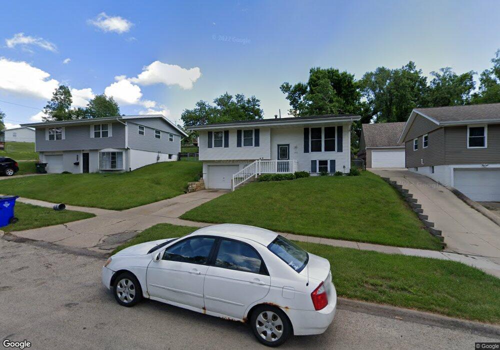
1013 Sioux Dr NW Cedar Rapids, IA 52405
Estimated Value: $172,731 - $194,000
3
Beds
2
Baths
1,005
Sq Ft
$184/Sq Ft
Est. Value
About This Home
This home is located at 1013 Sioux Dr NW, Cedar Rapids, IA 52405 and is currently estimated at $184,683, approximately $183 per square foot. 1013 Sioux Dr NW is a home located in Linn County with nearby schools including Junction City Elementary School, Harrison Elementary School, and Kentucky Tech - Ashland Reg Tech Center.
Ownership History
Date
Name
Owned For
Owner Type
Purchase Details
Closed on
May 31, 2001
Sold by
Harms Michael M
Bought by
Harms Michael M and Harms Glenda R
Current Estimated Value
Home Financials for this Owner
Home Financials are based on the most recent Mortgage that was taken out on this home.
Original Mortgage
$61,500
Interest Rate
7.23%
Create a Home Valuation Report for This Property
The Home Valuation Report is an in-depth analysis detailing your home's value as well as a comparison with similar homes in the area
Home Values in the Area
Average Home Value in this Area
Purchase History
| Date | Buyer | Sale Price | Title Company |
|---|---|---|---|
| Harms Michael M | -- | -- |
Source: Public Records
Mortgage History
| Date | Status | Borrower | Loan Amount |
|---|---|---|---|
| Closed | Harms Michael M | $61,500 |
Source: Public Records
Tax History Compared to Growth
Tax History
| Year | Tax Paid | Tax Assessment Tax Assessment Total Assessment is a certain percentage of the fair market value that is determined by local assessors to be the total taxable value of land and additions on the property. | Land | Improvement |
|---|---|---|---|---|
| 2025 | $2,314 | $169,000 | $31,800 | $137,200 |
| 2024 | $2,582 | $141,200 | $31,800 | $109,400 |
| 2023 | $2,582 | $141,200 | $31,800 | $109,400 |
| 2022 | $2,462 | $131,300 | $31,800 | $99,500 |
| 2021 | $2,524 | $127,800 | $27,000 | $100,800 |
| 2020 | $2,524 | $123,000 | $27,000 | $96,000 |
| 2019 | $2,376 | $118,800 | $25,400 | $93,400 |
| 2018 | $2,308 | $118,800 | $25,400 | $93,400 |
| 2017 | $2,391 | $118,900 | $25,400 | $93,500 |
| 2016 | $2,391 | $112,500 | $25,400 | $87,100 |
| 2015 | $2,383 | $112,031 | $25,440 | $86,591 |
| 2014 | $2,198 | $112,031 | $25,440 | $86,591 |
| 2013 | $1,074 | $112,031 | $25,440 | $86,591 |
Source: Public Records
Map
Nearby Homes
- 1814 Shawnee Ct NW
- 1015 Pawnee Dr NW
- 1126 13th St NW
- 1130 13th St NW
- 1073 G Ave NW
- 1860 E Ave NW
- 1016 H Ave NW
- 1424 N Ave NW
- 816 9th St NW
- 949 Westwood Dr NW
- 0 O Ave NW
- 1624 O Ave NW
- 1649 B Ave NW
- 290 Highland Dr NW
- 819 G Ave NW
- 1222 8th St NW
- 263 Highland Dr NW
- 451 23rd St NW
- 820 M Ave NW
- 716 F Ave NW
- 1007 Sioux Dr NW
- 1019 Sioux Dr NW
- 1531 Yuma Dr NW
- 1001 Sioux Dr NW
- 1035 Sioux Dr NW
- 1525 Yuma Dr NW
- 1012 Sioux Dr NW
- 1018 Sioux Dr NW
- 1006 Sioux Dr NW
- 1000 Sioux Dr NW
- 1519 Yuma Dr NW
- 1034 Sioux Dr NW
- 1518 Yuma Dr NW
- 1041 Sioux Dr NW
- 1022 Yuma Ct NW
- 1610 Seminole Ave NW Unit 2
- 1610 Seminole Ave NW Unit 1
- 1610 Seminole Ave NW
- 1007 Cheyenne Rd NW
- 1001 Cheyenne Rd NW