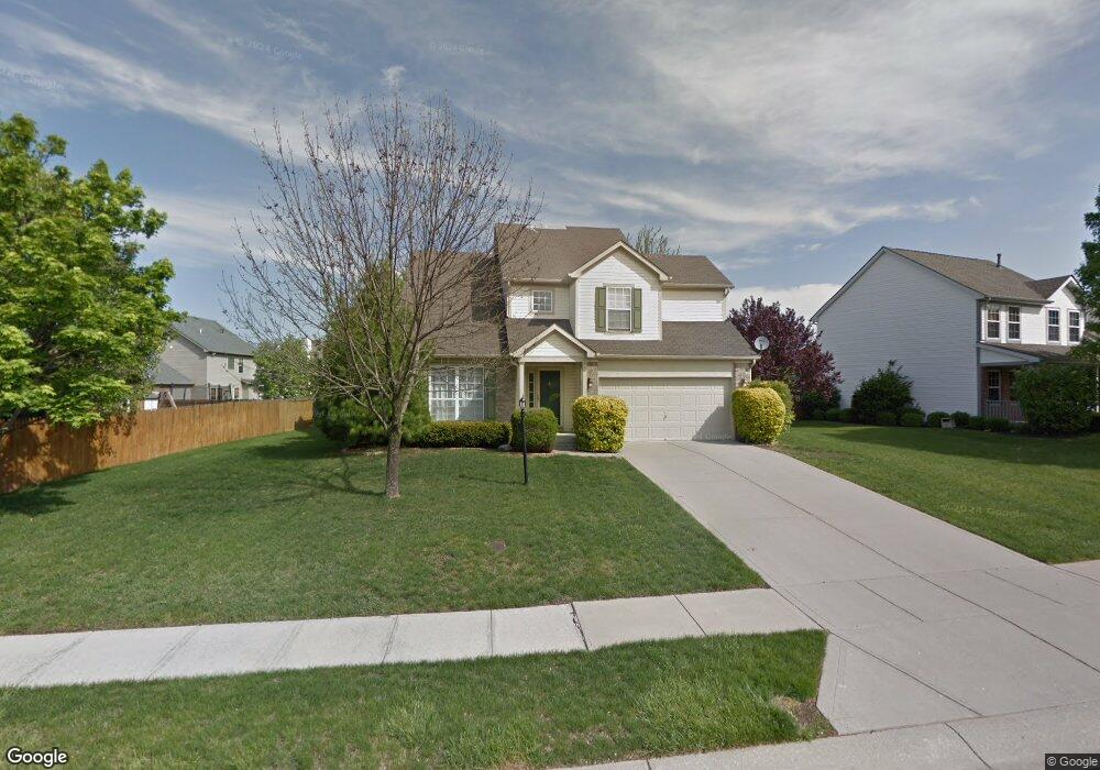
10138 Red Tail Dr Fishers, IN 46037
Estimated Value: $405,000 - $444,000
4
Beds
3
Baths
1,863
Sq Ft
$227/Sq Ft
Est. Value
About This Home
This home is located at 10138 Red Tail Dr, Fishers, IN 46037 and is currently estimated at $423,614, approximately $227 per square foot. 10138 Red Tail Dr is a home located in Hamilton County with nearby schools including Sigourney Elementary School, Lantern Road Elementary School, and Riverside Junior High School.
Ownership History
Date
Name
Owned For
Owner Type
Purchase Details
Closed on
Mar 1, 2005
Sold by
Sims James E
Bought by
Burton Tori Ann
Current Estimated Value
Home Financials for this Owner
Home Financials are based on the most recent Mortgage that was taken out on this home.
Original Mortgage
$185,000
Outstanding Balance
$105,428
Interest Rate
7.75%
Mortgage Type
Stand Alone First
Estimated Equity
$318,186
Purchase Details
Closed on
Aug 9, 2002
Sold by
Homestead Guarantees Llc
Bought by
Sims James E
Home Financials for this Owner
Home Financials are based on the most recent Mortgage that was taken out on this home.
Original Mortgage
$147,050
Interest Rate
6.64%
Mortgage Type
Purchase Money Mortgage
Purchase Details
Closed on
Mar 18, 2002
Sold by
Lynch Michael S and Lynch Sherry L
Bought by
Homestead Guarantee Llc
Create a Home Valuation Report for This Property
The Home Valuation Report is an in-depth analysis detailing your home's value as well as a comparison with similar homes in the area
Home Values in the Area
Average Home Value in this Area
Purchase History
| Date | Buyer | Sale Price | Title Company |
|---|---|---|---|
| Burton Tori Ann | -- | Ltic | |
| Sims James E | -- | -- | |
| Homestead Guarantee Llc | -- | -- |
Source: Public Records
Mortgage History
| Date | Status | Borrower | Loan Amount |
|---|---|---|---|
| Open | Burton Tori Ann | $185,000 | |
| Previous Owner | Sims James E | $147,050 |
Source: Public Records
Tax History Compared to Growth
Tax History
| Year | Tax Paid | Tax Assessment Tax Assessment Total Assessment is a certain percentage of the fair market value that is determined by local assessors to be the total taxable value of land and additions on the property. | Land | Improvement |
|---|---|---|---|---|
| 2024 | $4,224 | $366,200 | $51,200 | $315,000 |
| 2023 | $3,975 | $353,700 | $51,200 | $302,500 |
| 2022 | $3,101 | $316,300 | $51,200 | $265,100 |
| 2021 | $3,101 | $261,300 | $51,200 | $210,100 |
| 2020 | $3,143 | $261,000 | $51,200 | $209,800 |
| 2019 | $2,953 | $245,600 | $39,200 | $206,400 |
| 2018 | $2,595 | $220,500 | $39,200 | $181,300 |
| 2017 | $2,862 | $241,300 | $39,200 | $202,100 |
| 2016 | $2,789 | $236,700 | $39,200 | $197,500 |
| 2014 | $2,259 | $212,500 | $39,200 | $173,300 |
| 2013 | $2,259 | $218,300 | $39,200 | $179,100 |
Source: Public Records
Map
Nearby Homes
- 10244 Red Tail Dr
- 10518 Greenway Dr
- 10737 Springston Ct
- 10384 Glenn Abbey Ln
- 10272 Whitetail Cir
- 10334 Hillsborough Dr
- 10026 Parkway Dr
- 10290 Glenn Abbey Ln
- 10515 Collingswood Rd
- 10132 Lauren Pass
- 10844 Fairwoods Dr
- 9972 Woods Edge Dr
- 10331 Blue Fin Dr
- 10946 Geist Woods South Dr
- 10602 Fall Rd
- 9831 Carefree Dr
- 10661 Burning Ridge Ln
- 11011 Brigantine Dr
- 10919 Brigantine Dr
- 10846 Hamilton Pass
- 10148 Red Tail Dr
- 10147 Night Hawk Dr
- 10167 Night Hawk Dr
- 10158 Red Tail Dr
- 10415 Fox Run Ct
- 10425 Fox Run Ct
- 10187 Night Hawk Dr
- 10135 Red Tail Dr
- 10125 Red Tail Dr
- 10115 Red Tail Dr
- 10168 Red Tail Dr
- 10505 Hawks Ridge Ct
- 10105 Red Tail Dr
- 10405 Fox Run Ct
- 10446 Fox Run Ct
- 10174 Night Hawk Dr
- 10106 Hawks Lake Dr
- 10553 Greenway Dr
- 10551 Greenway Dr
- 10184 Night Hawk Dr