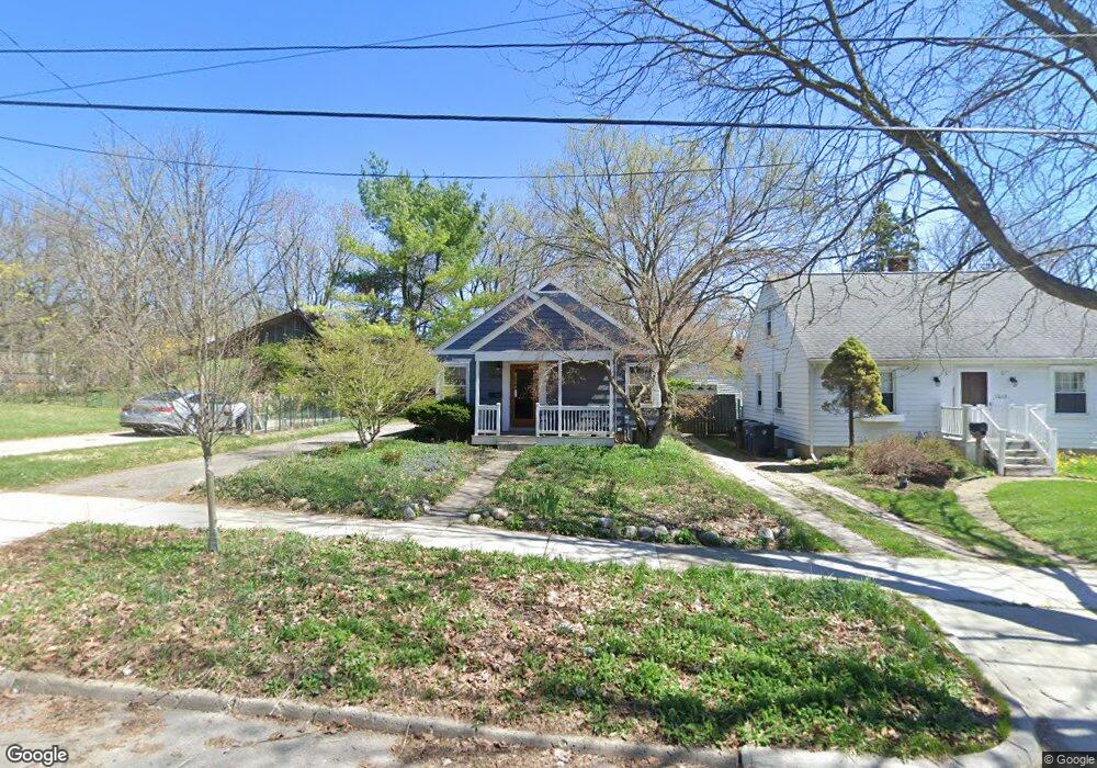
1014 Miner St Ann Arbor, MI 48103
Water Hill NeighborhoodEstimated Value: $391,161 - $449,000
3
Beds
1
Bath
957
Sq Ft
$439/Sq Ft
Est. Value
About This Home
This home is located at 1014 Miner St, Ann Arbor, MI 48103 and is currently estimated at $420,290, approximately $439 per square foot. 1014 Miner St is a home located in Washtenaw County with nearby schools including Wines Elementary School, Forsythe Middle School, and Skyline High School.
Ownership History
Date
Name
Owned For
Owner Type
Purchase Details
Closed on
Nov 4, 2011
Sold by
Forman Jane H
Bought by
Tatara Andrew J and Clark Zoe M
Current Estimated Value
Home Financials for this Owner
Home Financials are based on the most recent Mortgage that was taken out on this home.
Original Mortgage
$141,920
Outstanding Balance
$96,776
Interest Rate
4.02%
Mortgage Type
New Conventional
Estimated Equity
$323,514
Purchase Details
Closed on
Jul 12, 2002
Sold by
Shaw Karen
Bought by
Forman Jane H
Purchase Details
Closed on
Jul 20, 1999
Sold by
Kelleher Laura A
Bought by
Lawrence Karen Joanne
Create a Home Valuation Report for This Property
The Home Valuation Report is an in-depth analysis detailing your home's value as well as a comparison with similar homes in the area
Home Values in the Area
Average Home Value in this Area
Purchase History
| Date | Buyer | Sale Price | Title Company |
|---|---|---|---|
| Tatara Andrew J | $177,400 | Liberty Title | |
| Forman Jane H | $203,500 | -- | |
| Lawrence Karen Joanne | $146,000 | -- |
Source: Public Records
Mortgage History
| Date | Status | Borrower | Loan Amount |
|---|---|---|---|
| Open | Tatara Andrew J | $141,920 |
Source: Public Records
Tax History Compared to Growth
Tax History
| Year | Tax Paid | Tax Assessment Tax Assessment Total Assessment is a certain percentage of the fair market value that is determined by local assessors to be the total taxable value of land and additions on the property. | Land | Improvement |
|---|---|---|---|---|
| 2025 | $5,382 | $179,600 | $0 | $0 |
| 2024 | $5,249 | $158,900 | $0 | $0 |
| 2023 | $4,840 | $145,600 | $0 | $0 |
| 2022 | $4,950 | $136,300 | $0 | $0 |
| 2021 | $4,759 | $128,300 | $0 | $0 |
| 2020 | $4,663 | $130,900 | $0 | $0 |
| 2019 | $4,437 | $126,200 | $126,200 | $0 |
| 2018 | $4,375 | $123,500 | $0 | $0 |
| 2017 | $4,256 | $114,600 | $0 | $0 |
| 2016 | $4,106 | $85,105 | $0 | $0 |
| 2015 | $3,910 | $84,851 | $0 | $0 |
| 2014 | $3,910 | $82,200 | $0 | $0 |
| 2013 | -- | $82,200 | $0 | $0 |
Source: Public Records
Map
Nearby Homes
- 601 Cressfield Ln
- 508 W Summit St
- 822 Brooks St
- 518 Hiscock St
- 207 Sunset Rd
- 118 W Summit St
- 408 Felch St
- 701 Pomona Rd
- 1132 Longshore Dr Unit 2
- 1328 Miller Ave
- 651 N 5th Ave
- 611 N 4th Ave
- 410 N 1st St Unit 301
- 121 W Kingsley St Unit 502
- 610 N 5th Ave
- 212 Miller Ave Unit 102
- 212 Miller Ave Unit 203
- 212 Miller Ave Unit 302
- 212 Miller Ave Unit 101
- 212 Miller Ave Unit 201