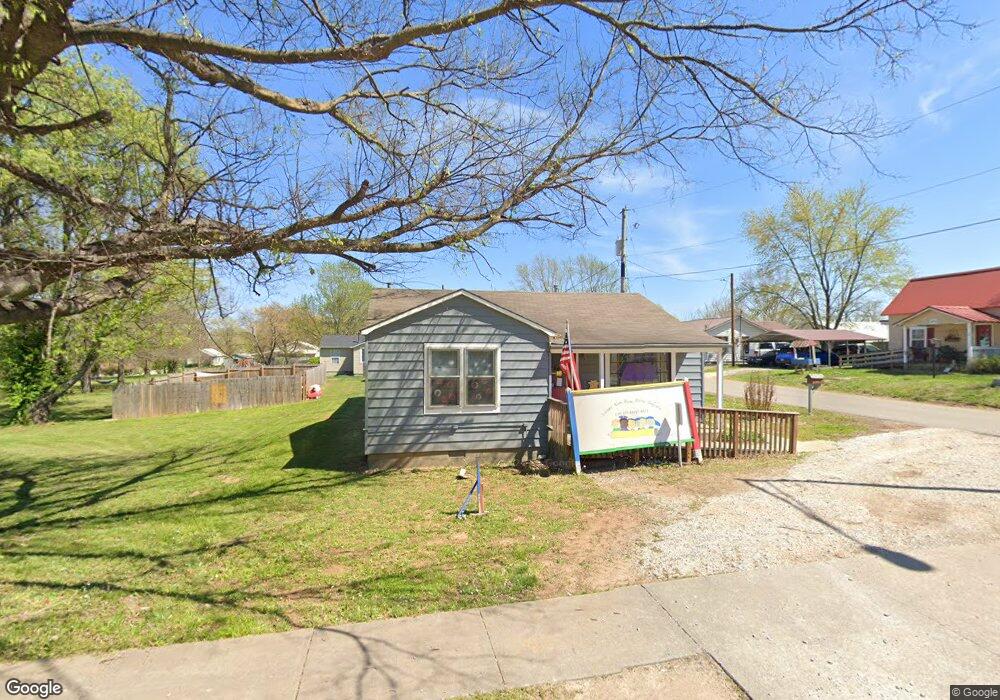
1014 N Curtis Ave Pea Ridge, AR 72751
--
Bed
--
Bath
1,690
Sq Ft
9,583
Sq Ft Lot
About This Home
This home is located at 1014 N Curtis Ave, Pea Ridge, AR 72751. 1014 N Curtis Ave is a home located in Benton County with nearby schools including Pea Ridge Intermediate School, Pea Ridge Primary School, and Pea Ridge Middle School.
Ownership History
Date
Name
Owned For
Owner Type
Purchase Details
Closed on
Jul 18, 2000
Bought by
Rollins
Purchase Details
Closed on
Apr 17, 2000
Bought by
First Preston
Purchase Details
Closed on
Mar 21, 2000
Bought by
Hud
Purchase Details
Closed on
Feb 24, 2000
Bought by
Regions Mort
Purchase Details
Closed on
Feb 17, 1998
Bought by
Brown
Purchase Details
Closed on
Jan 15, 1996
Bought by
Lewis
Purchase Details
Closed on
Oct 13, 1989
Bought by
Pratt
Purchase Details
Closed on
Oct 11, 1989
Bought by
N and A
Purchase Details
Closed on
Sep 2, 1975
Bought by
Snow
Create a Home Valuation Report for This Property
The Home Valuation Report is an in-depth analysis detailing your home's value as well as a comparison with similar homes in the area
Home Values in the Area
Average Home Value in this Area
Purchase History
| Date | Buyer | Sale Price | Title Company |
|---|---|---|---|
| Rollins | -- | -- | |
| First Preston | -- | -- | |
| Hud | -- | -- | |
| Regions Mort | -- | -- | |
| Brown | $48,000 | -- | |
| Lewis | $30,000 | -- | |
| Pratt | $30,000 | -- | |
| N | -- | -- | |
| Snow | $7,000 | -- |
Source: Public Records
Tax History Compared to Growth
Tax History
| Year | Tax Paid | Tax Assessment Tax Assessment Total Assessment is a certain percentage of the fair market value that is determined by local assessors to be the total taxable value of land and additions on the property. | Land | Improvement |
|---|---|---|---|---|
| 2025 | $1,032 | $24,509 | $9,755 | $14,754 |
| 2024 | $971 | $24,509 | $9,755 | $14,754 |
| 2023 | $883 | $15,510 | $4,560 | $10,950 |
| 2022 | $921 | $15,510 | $4,560 | $10,950 |
| 2021 | $913 | $15,510 | $4,560 | $10,950 |
| 2020 | $862 | $14,170 | $4,560 | $9,610 |
| 2019 | $862 | $14,170 | $4,560 | $9,610 |
| 2018 | $862 | $14,170 | $4,560 | $9,610 |
| 2017 | $806 | $14,170 | $4,560 | $9,610 |
| 2016 | $806 | $14,170 | $4,560 | $9,610 |
| 2015 | $753 | $13,240 | $4,560 | $8,680 |
| 2014 | $753 | $13,240 | $4,560 | $8,680 |
Source: Public Records
Map
Nearby Homes
- 117 Van Dorn St
- 287 Mcintosh St
- 264 Mcintosh St
- 1809 Abbott Ln
- 2000 Decker Rd
- 2310 Carper Ln
- 340 Baker St
- 1051 Asboth St
- 296 Van Dorn St
- 825 Baker St
- 745 Harrison St
- 646 Lynn Dr
- 195 W Pickens Rd
- 820 Eagle Crest
- 625 Eagle Crest
- 339 N Davis St
- 1285 Weston St
- 446 W Pickens Rd
- 378 Lee Town Rd
- 516 Greer St
- 266 E Watie St
- 211 E Watie St
- 273 E Watie St
- 1003 N Curtis Ave
- 293 E Watie St
- 1136 N Curtis Ave
- 955, 981 N Curtis Ave
- 981 N Curtis Ave
- 106 W Watie St
- 987 N Davis St Unit A
- 1089 N Davis St
- 1137 N Curtis Ave
- 932 N Curtis Ave
- 1154 N Curtis Ave
- 955,981 N Curtis Ave
- 955 N Curtis Ave
- 118 W Watie St
- 0 N Curtis Ave Unit 487258
- 0 N Curtis Ave Unit 558939
- 0 N Curtis Ave Unit 649340