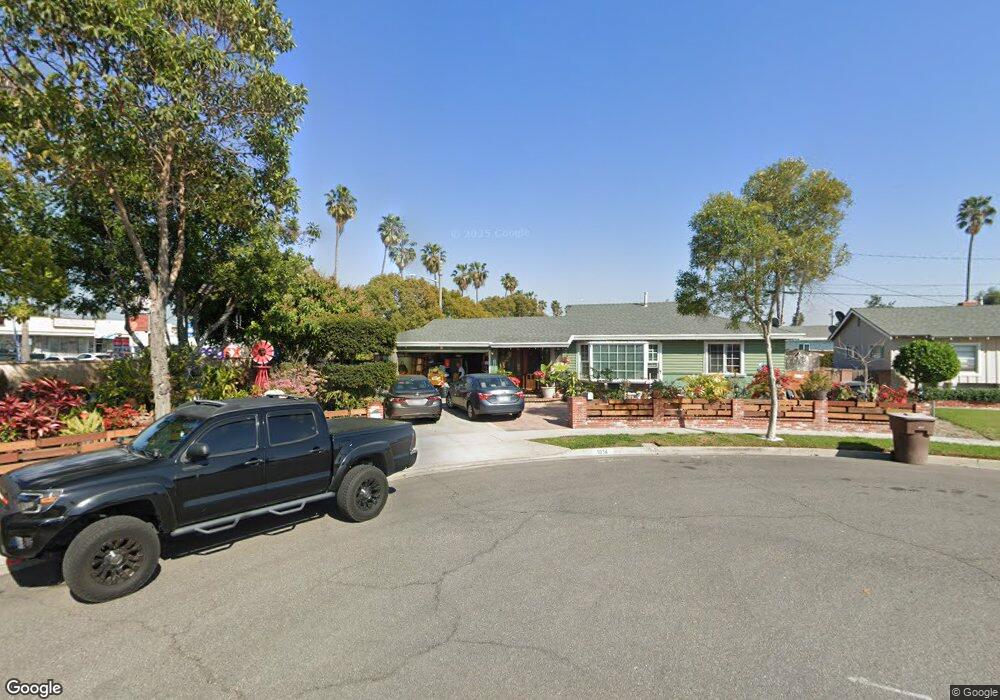
1014 N Mohawk Ave Anaheim, CA 92801
Northwest Anaheim NeighborhoodEstimated Value: $804,000 - $873,000
3
Beds
2
Baths
1,146
Sq Ft
$724/Sq Ft
Est. Value
About This Home
This home is located at 1014 N Mohawk Ave, Anaheim, CA 92801 and is currently estimated at $829,347, approximately $723 per square foot. 1014 N Mohawk Ave is a home located in Orange County with nearby schools including Adelaide Price Elementary School, Brookhurst Junior High School, and Savanna High School.
Ownership History
Date
Name
Owned For
Owner Type
Purchase Details
Closed on
Jun 26, 2002
Sold by
Peebles James M
Bought by
Sanjurjo Jaime W and Sanjurjo Mercybelle
Current Estimated Value
Home Financials for this Owner
Home Financials are based on the most recent Mortgage that was taken out on this home.
Original Mortgage
$257,450
Outstanding Balance
$109,061
Interest Rate
6.7%
Estimated Equity
$720,286
Purchase Details
Closed on
Apr 27, 2000
Sold by
Goodale Lyla J Trust
Bought by
Peebles James M and James M Peebles Trust
Create a Home Valuation Report for This Property
The Home Valuation Report is an in-depth analysis detailing your home's value as well as a comparison with similar homes in the area
Home Values in the Area
Average Home Value in this Area
Purchase History
| Date | Buyer | Sale Price | Title Company |
|---|---|---|---|
| Sanjurjo Jaime W | $271,000 | Stewart Title | |
| Peebles James M | -- | -- |
Source: Public Records
Mortgage History
| Date | Status | Borrower | Loan Amount |
|---|---|---|---|
| Open | Sanjurjo Jaime W | $257,450 |
Source: Public Records
Tax History Compared to Growth
Tax History
| Year | Tax Paid | Tax Assessment Tax Assessment Total Assessment is a certain percentage of the fair market value that is determined by local assessors to be the total taxable value of land and additions on the property. | Land | Improvement |
|---|---|---|---|---|
| 2025 | $4,605 | $398,296 | $320,661 | $77,635 |
| 2024 | $4,605 | $390,487 | $314,374 | $76,113 |
| 2023 | $4,506 | $382,831 | $308,210 | $74,621 |
| 2022 | $4,447 | $375,325 | $302,167 | $73,158 |
| 2021 | $4,453 | $367,966 | $296,242 | $71,724 |
| 2020 | $4,433 | $364,193 | $293,204 | $70,989 |
| 2019 | $4,301 | $357,052 | $287,454 | $69,598 |
| 2018 | $4,212 | $350,051 | $281,817 | $68,234 |
| 2017 | $4,046 | $343,188 | $276,291 | $66,897 |
| 2016 | $4,033 | $336,459 | $270,873 | $65,586 |
| 2015 | $3,996 | $331,406 | $266,805 | $64,601 |
| 2014 | $3,590 | $310,000 | $250,889 | $59,111 |
Source: Public Records
Map
Nearby Homes
- 1723 W Francis Dr
- 1128 N Voyager Ln
- 919 N Onondaga Ave
- 1802 W Glenoaks Ave
- 1757 W Greenleaf Ave
- 1875 W Falmouth Ave Unit 58
- 1866 W Falmouth Ave Unit 36
- 1302 N Mako Ln Unit 2
- 1854 W Falmouth Ave Unit 3
- 1846 W Falmouth Ave Unit 4
- 1850 W Greenleaf Ave Unit G
- 1236 N Dresden Place
- 1384 N Schooner Ln Unit 85
- 1800 W Gramercy Ave Unit 54
- 1827 W Gramercy Ave
- 1984 W Catalpa Ave
- 2025 W Dogwood Ave
- 1786 W Crescent Ave
- 1919 W Coronet Ave Unit 126
- 1919 W Coronet Ave Unit 221
- 1010 N Mohawk Ave
- 1015 N Mohican Ave
- 1011 N Mohican Ave
- 1015 N Mohawk Ave
- 1007 N Mohican Ave
- 1011 N Mohawk Ave
- 1761 W La Palma Ave
- 1002 N Mohawk Ave
- 1003 N Mohican Ave
- 1014 N Iroquois Ave
- 1003 N Mohawk Ave
- 1010 N Iroquois Ave
- 1006 N Iroquois Ave
- 948 N Mohawk Ave
- 1768 W Glen Ave
- 1762 W Glen Ave
- 1743 W La Palma Ave
- 949 N Mohican Ave
- 1772 W Glen Ave