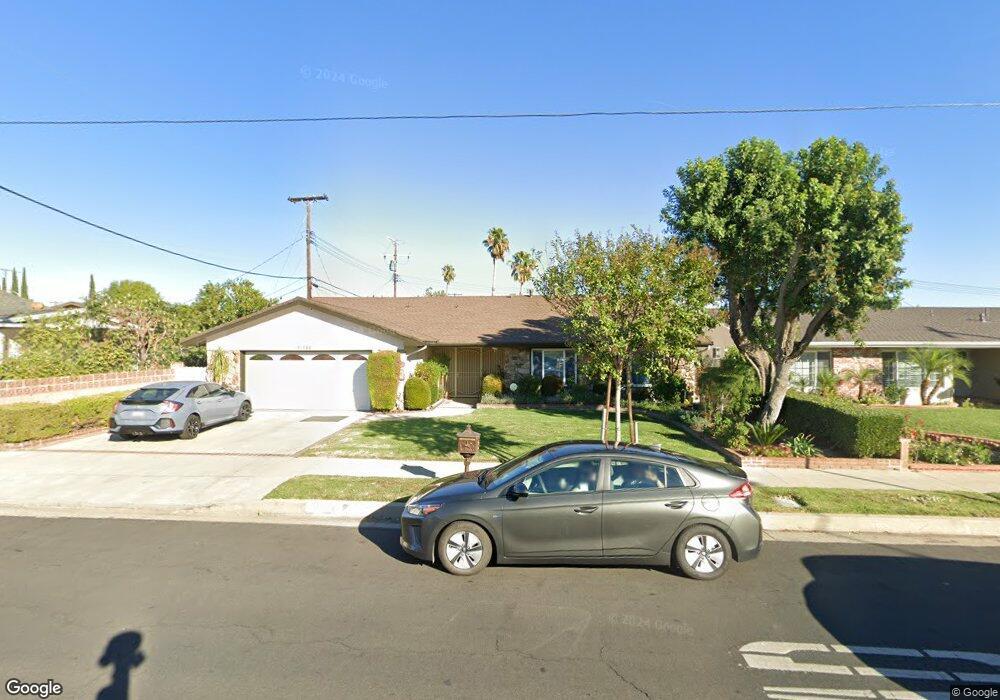
10144 Lurline Ave Chatsworth, CA 91311
Estimated Value: $1,000,059 - $1,058,000
4
Beds
3
Baths
2,236
Sq Ft
$457/Sq Ft
Est. Value
About This Home
This home is located at 10144 Lurline Ave, Chatsworth, CA 91311 and is currently estimated at $1,021,015, approximately $456 per square foot. 10144 Lurline Ave is a home located in Los Angeles County with nearby schools including Ernest Lawrence Middle School, Superior Street Elementary School, and Chatsworth Charter High School.
Ownership History
Date
Name
Owned For
Owner Type
Purchase Details
Closed on
Feb 9, 2009
Sold by
Bellinder Catherine L
Bought by
Duong Pat K and Duong Ivy
Current Estimated Value
Home Financials for this Owner
Home Financials are based on the most recent Mortgage that was taken out on this home.
Original Mortgage
$260,000
Interest Rate
5.03%
Mortgage Type
Purchase Money Mortgage
Purchase Details
Closed on
May 20, 1997
Sold by
Bellinder Joseph B
Bought by
Bellinder Joseph B and Bellinder Catherine L
Create a Home Valuation Report for This Property
The Home Valuation Report is an in-depth analysis detailing your home's value as well as a comparison with similar homes in the area
Home Values in the Area
Average Home Value in this Area
Purchase History
| Date | Buyer | Sale Price | Title Company |
|---|---|---|---|
| Duong Pat K | $460,000 | Lawyers Title | |
| Bellinder Joseph B | -- | -- |
Source: Public Records
Mortgage History
| Date | Status | Borrower | Loan Amount |
|---|---|---|---|
| Closed | Duong Pat K | $260,000 |
Source: Public Records
Tax History Compared to Growth
Tax History
| Year | Tax Paid | Tax Assessment Tax Assessment Total Assessment is a certain percentage of the fair market value that is determined by local assessors to be the total taxable value of land and additions on the property. | Land | Improvement |
|---|---|---|---|---|
| 2025 | $7,327 | $592,355 | $353,485 | $238,870 |
| 2024 | $7,327 | $580,741 | $346,554 | $234,187 |
| 2023 | $7,189 | $569,355 | $339,759 | $229,596 |
| 2022 | $6,862 | $558,193 | $333,098 | $225,095 |
| 2021 | $6,770 | $547,249 | $326,567 | $220,682 |
| 2019 | $6,570 | $531,020 | $316,882 | $214,138 |
| 2018 | $6,440 | $520,609 | $310,669 | $209,940 |
| 2016 | $6,141 | $500,395 | $298,606 | $201,789 |
| 2015 | $6,052 | $492,879 | $294,121 | $198,758 |
| 2014 | $6,076 | $483,225 | $288,360 | $194,865 |
Source: Public Records
Map
Nearby Homes
- 20718 Devonshire St Unit C
- 10220 De Soto Ave Unit 24
- 10042 Sunnybrae Ave
- 0 De Soto Unit OC25120663
- 20656 Septo St
- 10159 De Soto Ave Unit 202
- 10122 Jovita Ave
- 10501 Oklahoma Ave
- 20652 Lassen St Unit 125 1/2
- 10234 Variel Ave Unit 12
- 21108 Mayall St
- 10215 Variel Ave Unit 11
- 10229 Variel Ave Unit 16
- 20500 Blairmoore St
- 20236 Foix Place
- 20306 Tau Place
- 20323 Kinzie St
- 20158 Septo St
- 21326 Romar St
- 21241 Lassen St Unit 1
- 10138 Lurline Ave
- 20662 Lemarsh St
- 20656 Lemarsh St
- 10134 Lurline Ave
- 20643 Romar St
- 20650 Lemarsh St
- 10132 Lurline Ave
- 20647 Romar St
- 20644 Lemarsh St
- 10124 Lurline Ave
- 20637 Romar St
- 20648 Romar St
- 20638 Lemarsh St
- 10118 Lurline Ave
- 20631 Romar St
- 20661 Lemarsh St
- 20655 Lemarsh St
- 20644 Romar St
- 20632 Lemarsh St
- 20649 Lemarsh St