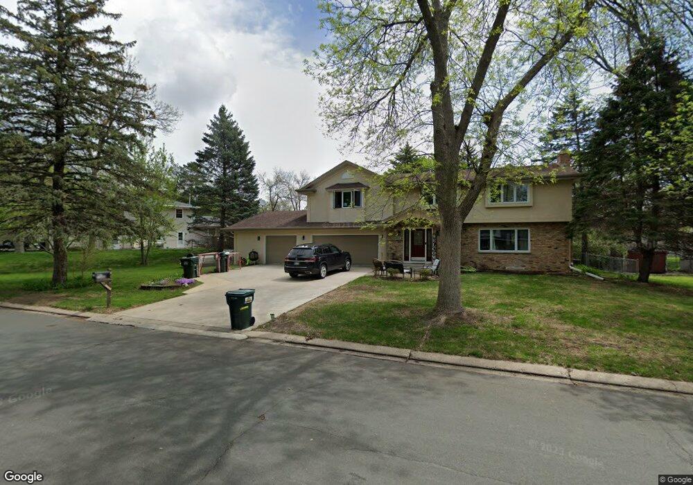
10145 Goodrich Rd Bloomington, MN 55437
West Bloomington NeighborhoodEstimated Value: $471,000 - $702,000
5
Beds
4
Baths
1,004
Sq Ft
$567/Sq Ft
Est. Value
About This Home
This home is located at 10145 Goodrich Rd, Bloomington, MN 55437 and is currently estimated at $569,450, approximately $567 per square foot. 10145 Goodrich Rd is a home located in Hennepin County with nearby schools including Olson Elementary School, Olson Middle School, and Jefferson Senior High School.
Ownership History
Date
Name
Owned For
Owner Type
Purchase Details
Closed on
Feb 1, 2018
Sold by
Davis Michael P and Davis Joan R
Bought by
Martinson Amanda M and Martinson Derek H
Current Estimated Value
Home Financials for this Owner
Home Financials are based on the most recent Mortgage that was taken out on this home.
Original Mortgage
$374,000
Outstanding Balance
$316,744
Interest Rate
3.99%
Mortgage Type
New Conventional
Estimated Equity
$252,706
Create a Home Valuation Report for This Property
The Home Valuation Report is an in-depth analysis detailing your home's value as well as a comparison with similar homes in the area
Home Values in the Area
Average Home Value in this Area
Purchase History
| Date | Buyer | Sale Price | Title Company |
|---|---|---|---|
| Martinson Amanda M | $440,000 | Titlesmart Inc |
Source: Public Records
Mortgage History
| Date | Status | Borrower | Loan Amount |
|---|---|---|---|
| Open | Martinson Amanda M | $374,000 |
Source: Public Records
Tax History
| Year | Tax Paid | Tax Assessment Tax Assessment Total Assessment is a certain percentage of the fair market value that is determined by local assessors to be the total taxable value of land and additions on the property. | Land | Improvement |
|---|---|---|---|---|
| 2024 | $6,902 | $525,300 | $144,500 | $380,800 |
| 2023 | $6,376 | $523,700 | $145,900 | $377,800 |
| 2022 | $5,674 | $510,700 | $145,900 | $364,800 |
| 2021 | $5,248 | $441,500 | $136,300 | $305,200 |
| 2020 | $5,590 | $412,400 | $132,400 | $280,000 |
| 2019 | $5,556 | $426,800 | $132,400 | $294,400 |
| 2018 | $4,478 | $416,000 | $131,100 | $284,900 |
| 2017 | $4,345 | $325,500 | $117,700 | $207,800 |
| 2016 | $4,189 | $299,800 | $111,300 | $188,500 |
| 2015 | $4,192 | $289,300 | $108,000 | $181,300 |
| 2014 | -- | $267,000 | $104,700 | $162,300 |
Source: Public Records
Map
Nearby Homes
- 3709 W 102nd St
- 10016 Irwin Rd
- 10042 Irwin Cir
- 9912 Little Rd
- 10318 York Ln
- 4317 W 98th St
- 9865 Beard Ave S
- 4009 Heritage Hills Dr Unit 202
- 4001 Heritage Hills Dr Unit 304
- 4009 Heritage Hills Dr Unit 108
- 3801 W 98th St Unit 402
- 4708 W 102nd St
- 10212 Xerxes Ave S
- 3009 W 100th St
- 3213 W Old Shakopee Rd
- 9500 Collegeview Rd Unit 112
- 2414 W Old Shakopee Rd
- 10234 Berkshire Rd
- 10817 Xerxes Ave S
- 9622 Toledo Cir
- 10133 Goodrich Cir
- 3924 W 102nd St
- 10129 Goodrich Cir
- 3916 W 102nd St
- 10148 Goodrich Rd
- 10140 Goodrich Rd
- 3908 W 102nd St
- 4000 W 102nd St
- 10132 Goodrich Rd
- 10125 Goodrich Cir
- 10113 Goodrich Cir
- 3900 W 102nd St
- 10124 Goodrich Rd
- 10121 Goodrich Cir
- 10149 Harrison Rd
- 10141 Harrison Rd
- 10117 Goodrich Cir
- 10157 Harrison Rd
- 10133 Harrison Rd
- 10116 Goodrich Rd
Your Personal Tour Guide
Ask me questions while you tour the home.