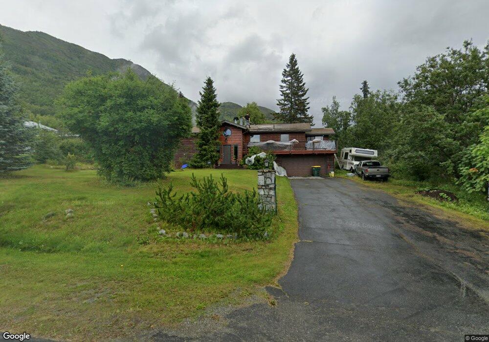
10145 Preuss Ln Eagle River, AK 99577
Eagle River Valley NeighborhoodEstimated Value: $597,400 - $746,000
3
Beds
2
Baths
3,200
Sq Ft
$203/Sq Ft
Est. Value
About This Home
This home is located at 10145 Preuss Ln, Eagle River, AK 99577 and is currently estimated at $648,100, approximately $202 per square foot. 10145 Preuss Ln is a home located in Anchorage Municipality with nearby schools including Ravenwood Elementary School, Gruening Middle School, and Chugiak High School.
Ownership History
Date
Name
Owned For
Owner Type
Purchase Details
Closed on
Jun 14, 2021
Sold by
Kalkowski Melvin P and Kalkowski Melvin Peter
Bought by
Kalkowski Melvin Peter and Mumaw Sharilyn I
Current Estimated Value
Home Financials for this Owner
Home Financials are based on the most recent Mortgage that was taken out on this home.
Original Mortgage
$298,000
Outstanding Balance
$269,214
Interest Rate
2.9%
Mortgage Type
New Conventional
Estimated Equity
$378,886
Purchase Details
Closed on
Feb 8, 1995
Sold by
Patrick James Donadio Revocable Trust and Ruth S Donadio Revocable Trust
Bought by
Kalkowski Melvin P and Mumaw Sharilyn I
Home Financials for this Owner
Home Financials are based on the most recent Mortgage that was taken out on this home.
Original Mortgage
$110,000
Interest Rate
9.21%
Mortgage Type
New Conventional
Create a Home Valuation Report for This Property
The Home Valuation Report is an in-depth analysis detailing your home's value as well as a comparison with similar homes in the area
Home Values in the Area
Average Home Value in this Area
Purchase History
| Date | Buyer | Sale Price | Title Company |
|---|---|---|---|
| Kalkowski Melvin Peter | -- | None Listed On Document | |
| Kalkowski Melvin P | -- | -- |
Source: Public Records
Mortgage History
| Date | Status | Borrower | Loan Amount |
|---|---|---|---|
| Open | Kalkowski Melvin Peter | $298,000 | |
| Previous Owner | Kalkowski Melvin P | $110,000 |
Source: Public Records
Tax History
| Year | Tax Paid | Tax Assessment Tax Assessment Total Assessment is a certain percentage of the fair market value that is determined by local assessors to be the total taxable value of land and additions on the property. | Land | Improvement |
|---|---|---|---|---|
| 2025 | $5,261 | $563,400 | $135,800 | $427,600 |
| 2024 | $5,261 | $554,400 | $120,100 | $434,300 |
| 2023 | $8,320 | $505,800 | $116,500 | $389,300 |
| 2022 | $4,816 | $490,300 | $112,500 | $377,800 |
| 2021 | $7,987 | $451,500 | $112,500 | $339,000 |
| 2020 | $2,800 | $385,500 | $112,500 | $273,000 |
| 2019 | $2,917 | $381,600 | $112,500 | $269,100 |
| 2018 | $3,899 | $442,600 | $109,800 | $332,800 |
| 2017 | $4,265 | $439,600 | $104,300 | $335,300 |
| 2016 | $5,784 | $442,200 | $98,800 | $343,400 |
| 2015 | $5,784 | $443,400 | $100,000 | $343,400 |
| 2014 | $5,784 | $439,500 | $96,700 | $342,800 |
Source: Public Records
Map
Nearby Homes
- 20786 Melody Ln
- 9545 Grey Owl Way
- L7 Grey Owl Way
- 20514 Birch Crest Ln
- 20779 Mountain Vista Dr
- L4 Sheppard Dr
- 20413 Icefall Dr
- 19413 First St
- 20638 Driftwood Bay Dr
- 8935 Birch Park Cir
- 19950 Driftwood Bay Dr Unit 7
- 19962 Driftwood Bay Dr Unit 10
- 19862 Driftwood Bay Dr
- 19351 Verdant Cir
- 9607 Saint George Cir
- 19110 War Admiral Rd
- 9500 Puffin Cir
- 10821 Sushana Cir
- 19407 Trail Bay Dr
- 18909 Sarichef Loop
- 10129 Preuss Ln
- 10213 Preuss Ln
- 10213 Preuss Ln Unit B
- LT 4 Uplands Ph 3
- L3 Uplands Ph 3
- 10144 Preuss Ln
- 10233 Preuss Ln
- 10109 Preuss Ln
- 10126 Preuss Ln
- 10228 Preuss Ln
- L4 Uplands Ph 3
- 10133 Donald Place
- LT 3 Uplands Ph 3
- 10207 Donald Place
- 10047 Preuss Ln
- 20714 Lucas Ave
- 20611 David Ave
- 20891 Upper Lowland Ave
- 20714 David Ave
- L4 Upper Lowland Ave
Your Personal Tour Guide
Ask me questions while you tour the home.