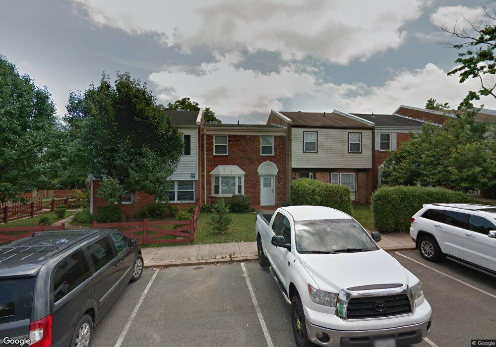
10148 Cannon Ball Ct Manassas, VA 20109
Estimated Value: $335,000 - $365,000
3
Beds
2
Baths
1,332
Sq Ft
$267/Sq Ft
Est. Value
About This Home
This home is located at 10148 Cannon Ball Ct, Manassas, VA 20109 and is currently estimated at $355,663, approximately $267 per square foot. 10148 Cannon Ball Ct is a home located in Prince William County with nearby schools including West Gate Elementary School, Unity Braxton Middle School, and Unity Reed High School.
Ownership History
Date
Name
Owned For
Owner Type
Purchase Details
Closed on
Oct 22, 2008
Sold by
Bank Of Ny Tr
Bought by
Mansour Hamid
Current Estimated Value
Purchase Details
Closed on
Jul 27, 2000
Sold by
U D H
Bought by
Elbardisi Tabet and Elbardisi Elbardisi,Faith
Purchase Details
Closed on
Jan 28, 1994
Sold by
Sec Hud
Bought by
Raybuck K A
Home Financials for this Owner
Home Financials are based on the most recent Mortgage that was taken out on this home.
Original Mortgage
$53,451
Interest Rate
7.11%
Create a Home Valuation Report for This Property
The Home Valuation Report is an in-depth analysis detailing your home's value as well as a comparison with similar homes in the area
Home Values in the Area
Average Home Value in this Area
Purchase History
| Date | Buyer | Sale Price | Title Company |
|---|---|---|---|
| Mansour Hamid | $66,500 | -- | |
| Elbardisi Tabet | $60,000 | -- | |
| Raybuck K A | $53,500 | -- |
Source: Public Records
Mortgage History
| Date | Status | Borrower | Loan Amount |
|---|---|---|---|
| Previous Owner | Raybuck K A | $53,451 |
Source: Public Records
Tax History Compared to Growth
Tax History
| Year | Tax Paid | Tax Assessment Tax Assessment Total Assessment is a certain percentage of the fair market value that is determined by local assessors to be the total taxable value of land and additions on the property. | Land | Improvement |
|---|---|---|---|---|
| 2025 | $2,901 | $308,200 | $92,000 | $216,200 |
| 2024 | $2,901 | $291,700 | $90,000 | $201,700 |
| 2023 | $2,758 | $265,100 | $65,500 | $199,600 |
| 2022 | $2,856 | $257,900 | $60,000 | $197,900 |
| 2021 | $2,768 | $223,400 | $54,600 | $168,800 |
| 2020 | $3,123 | $201,500 | $54,600 | $146,900 |
| 2019 | $3,044 | $196,400 | $54,500 | $141,900 |
| 2018 | $2,210 | $183,000 | $50,500 | $132,500 |
| 2017 | $2,273 | $180,700 | $50,500 | $130,200 |
| 2016 | $2,230 | $178,900 | $50,500 | $128,400 |
| 2015 | $1,981 | $173,400 | $48,500 | $124,900 |
| 2014 | $1,981 | $154,700 | $48,500 | $106,200 |
Source: Public Records
Map
Nearby Homes
- 8355 Irongate Way
- 8393 Scotland Loop
- 9920 Whitemoss Dr
- 8555 Fortrose Dr
- 8429 Girvan Ct
- Matisse Plan at Lomond Village - Condos
- Picasso Plan at Lomond Village - Condos
- Strauss End Unit Plan at Lomond Village
- 8310 Rolling Rd
- 8323 Rolling Rd
- 9902 Grapewood Ct
- 10625 Provincial Dr Unit E
- 8720 Sugarwood Ln Unit 1
- 8513 Thomas Dr
- 7905 Brighton Way
- 10014 Willow Grove Trail
- 7832 Brookview Ct
- 7823 Brookview Ct
- 8827 Oak Hollow Ct
- 9699 Copeland Dr
- 10146 Cannon Ball Ct
- 10150 Cannon Ball Ct
- 10144 Cannon Ball Ct
- 10142 Cannon Ball Ct
- 10140 Cannon Ball Ct
- 10152 Cannon Ball Ct
- 10154 Cannon Ball Ct
- 10138 Shiloh Ct
- 10156 Cannon Ball Ct
- 10158 Cannon Ball Ct
- 10136 Shiloh Ct
- 10160 Cannon Ball Ct
- 10134 Shiloh Ct
- 10170 Cannon Ball Ct
- 10172 Cannon Ball Ct
- 10162 Cannon Ball Ct
- 7906 Sharpsburg Ct
- 10132 Shiloh Ct
- 10174 Cannon Ball Ct
- 10176 Cannon Ball Ct