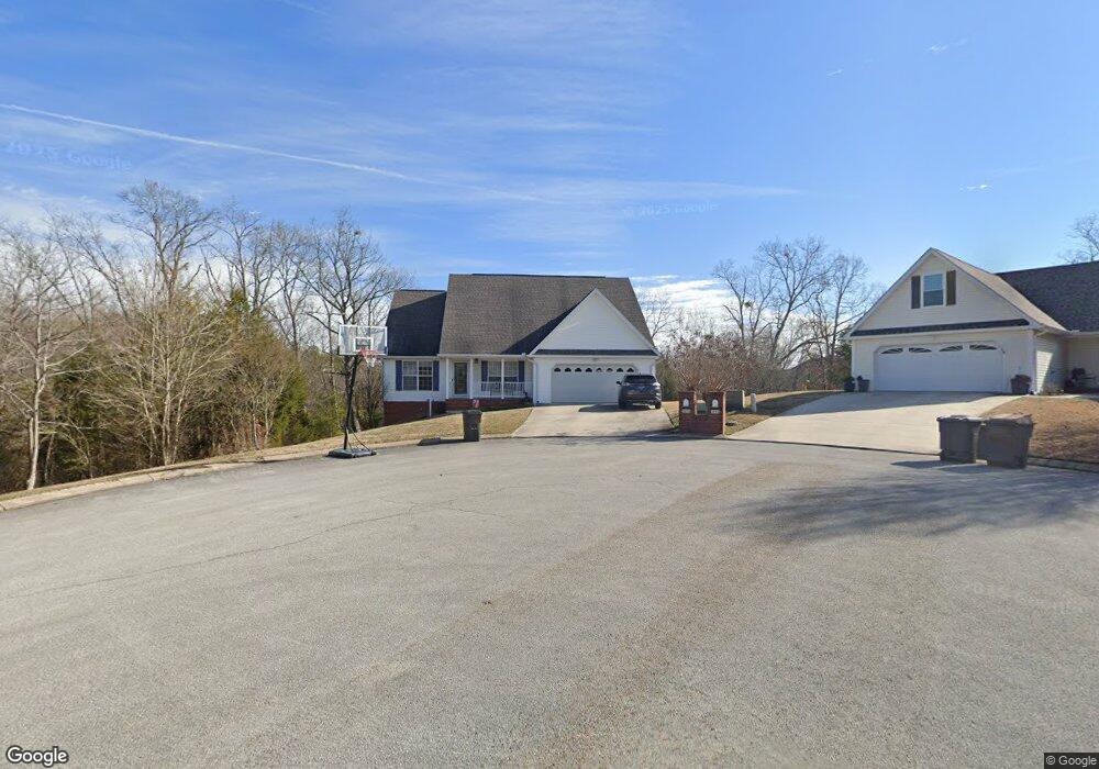
1015 Chariot Dr Soddy Daisy, TN 37379
Estimated Value: $348,053 - $377,000
3
Beds
2
Baths
1,568
Sq Ft
$231/Sq Ft
Est. Value
About This Home
This home is located at 1015 Chariot Dr, Soddy Daisy, TN 37379 and is currently estimated at $362,513, approximately $231 per square foot. 1015 Chariot Dr is a home located in Hamilton County.
Ownership History
Date
Name
Owned For
Owner Type
Purchase Details
Closed on
Apr 13, 2017
Sold by
Benoit James A and Benoit Deborah E
Bought by
Williams Thomas Earl and Williams Sheila
Current Estimated Value
Home Financials for this Owner
Home Financials are based on the most recent Mortgage that was taken out on this home.
Original Mortgage
$144,000
Outstanding Balance
$74,137
Interest Rate
4.1%
Mortgage Type
New Conventional
Estimated Equity
$288,376
Purchase Details
Closed on
Jul 29, 2005
Sold by
Molloy Neil T and Molloy Maureen J
Bought by
Benoit James A and Benoit Deborah E
Purchase Details
Closed on
Aug 3, 2001
Sold by
Wilson Dewayne and Wilson Debbie
Bought by
Molloy Neil T and Molloy Maureen J
Home Financials for this Owner
Home Financials are based on the most recent Mortgage that was taken out on this home.
Original Mortgage
$119,200
Interest Rate
7.09%
Create a Home Valuation Report for This Property
The Home Valuation Report is an in-depth analysis detailing your home's value as well as a comparison with similar homes in the area
Home Values in the Area
Average Home Value in this Area
Purchase History
| Date | Buyer | Sale Price | Title Company |
|---|---|---|---|
| Williams Thomas Earl | $180,000 | None Available | |
| Benoit James A | $155,250 | Legal Title | |
| Molloy Neil T | $149,000 | Century Title & Escrow Inc |
Source: Public Records
Mortgage History
| Date | Status | Borrower | Loan Amount |
|---|---|---|---|
| Open | Williams Thomas Earl | $144,000 | |
| Previous Owner | Molloy Neil T | $119,200 |
Source: Public Records
Tax History Compared to Growth
Tax History
| Year | Tax Paid | Tax Assessment Tax Assessment Total Assessment is a certain percentage of the fair market value that is determined by local assessors to be the total taxable value of land and additions on the property. | Land | Improvement |
|---|---|---|---|---|
| 2024 | $1,229 | $54,925 | $0 | $0 |
| 2023 | $1,851 | $54,925 | $0 | $0 |
| 2022 | $1,851 | $54,925 | $0 | $0 |
| 2021 | $1,851 | $54,925 | $0 | $0 |
| 2020 | $1,837 | $44,400 | $0 | $0 |
| 2019 | $1,837 | $44,400 | $0 | $0 |
| 2018 | $1,837 | $44,400 | $0 | $0 |
| 2017 | $1,837 | $44,400 | $0 | $0 |
| 2016 | $1,737 | $0 | $0 | $0 |
| 2015 | $1,737 | $41,975 | $0 | $0 |
| 2014 | $1,737 | $0 | $0 | $0 |
Source: Public Records
Map
Nearby Homes
- 10496 Sovereign Pointe Dr
- 10627 Jeneva Ln
- 1055 Apollo Dr
- 10428 Jeneva Ln
- 1052 Trojan Run Dr
- 1270 Jacob Dr
- 1230 Green Pond Rd
- 1524 Green Pond Rd
- 10224 Tommys Ln
- 11008 Lovell Rd
- 11312 Hixson Pike
- 11036 High River Dr
- 10192 Big Pine Ln
- 11734 Armstrong Rd
- 11015 High River Dr
- 10280 Card Rd
- 874 Ponderosa Dr
- 10947 High River Dr
- 10206 Card Rd
- 13212 Dayton Pike
- 1016 Chariot Dr
- 1013 Chariot Dr
- 1013 Chariot Dr Unit Lt 12
- 1011 Chariot Dr
- 1012 Chariot Dr
- 1009 Chariot Dr
- 1010 Chariot Dr
- 1149 Old Thatcher Rd
- 1008 Chariot Dr
- 1007 Chariot Dr
- 1016 Trojan Run Dr
- 1014 Trojan Run Dr
- 1006 Chariot Dr
- 10825 Callie Marie Dr
- 10735 Emperor Ct
- 10735 Emperor Ct Unit 4
- 1012 Trojan Run Dr
- 10841 Callie Marie Dr
- 10809 Callie Marie Dr
- 1010 Trojan Run Dr