Estimated Value: $369,372 - $963,000
3
Beds
2
Baths
2,220
Sq Ft
$266/Sq Ft
Est. Value
About This Home
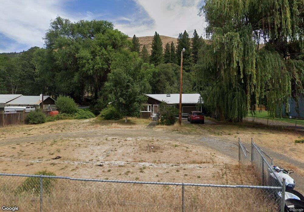
This home is located at 1015 Highway 142, Lyle, WA 98635 and is currently estimated at $589,593, approximately $265 per square foot. 1015 Highway 142 is a home located in Klickitat County with nearby schools including Klickitat School.
Ownership History
Date
Name
Owned For
Owner Type
Purchase Details
Closed on
Dec 11, 2012
Sold by
Moon Sonia M and Moon Sonia M
Bought by
Lewis Kenneth A and Lewis Shirley A
Current Estimated Value
Home Financials for this Owner
Home Financials are based on the most recent Mortgage that was taken out on this home.
Original Mortgage
$150,000
Outstanding Balance
$103,926
Interest Rate
3.37%
Estimated Equity
$485,667
Purchase Details
Closed on
Mar 12, 2009
Sold by
Moon Norman L and Moon Sonia M
Bought by
Moon Norman L and Moon Sonia M
Create a Home Valuation Report for This Property
The Home Valuation Report is an in-depth analysis detailing your home's value as well as a comparison with similar homes in the area
Home Values in the Area
Average Home Value in this Area
Purchase History
| Date | Buyer | Sale Price | Title Company |
|---|---|---|---|
| Lewis Kenneth A | -- | Amerititle | |
| Moon Norman L | -- | -- |
Source: Public Records
Mortgage History
| Date | Status | Borrower | Loan Amount |
|---|---|---|---|
| Open | Lewis Kenneth A | $150,000 |
Source: Public Records
Tax History Compared to Growth
Tax History
| Year | Tax Paid | Tax Assessment Tax Assessment Total Assessment is a certain percentage of the fair market value that is determined by local assessors to be the total taxable value of land and additions on the property. | Land | Improvement |
|---|---|---|---|---|
| 2025 | $272 | $273,000 | $50,000 | $223,000 |
| 2023 | $272 | $248,200 | $45,000 | $203,200 |
| 2022 | $309 | $191,800 | $30,000 | $161,800 |
| 2021 | $344 | $192,880 | $30,980 | $161,900 |
| 2020 | $344 | $172,880 | $30,980 | $141,900 |
| 2018 | $332 | $162,100 | $20,200 | $141,900 |
| 2017 | $338 | $147,200 | $20,200 | $127,000 |
| 2016 | $339 | $146,600 | $20,200 | $126,400 |
| 2015 | $34 | $153,100 | $20,200 | $132,900 |
| 2013 | $34 | $145,700 | $20,200 | $125,500 |
Source: Public Records
Map
Nearby Homes
- 850 Highway 142
- 610 Bluff Rd
- 604 Bluff Ave
- 517 N Main St
- 409 Main St
- 101 N Main St
- 955 High Prairie Rd
- 959 High Prairie Rd
- 0 Secluded Way Unit 3 24197199
- 0 Secluded Way Unit 2 24300029
- 0 Secluded Way Unit 4 24180959
- 110 Morris Rd
- 272 Johnson Rd
- 401 Johnson Rd
- 17 Canyon Loop Rd
- 31 Knoll Ridge Rd
- 0 Oak Knoll Ridge Rd Unit 11
- 38 Meadows Loop
- 627 Canyon Rd
- 476 Sleepy Hollow Rd
- 1017 Highway 142
- 1011 Highway 142
- 1011 Highway 142
- 1019 Highway 142
- 1023 Highway 142
- 1021 Highway 142
- 1021 Washington 142
- 0 Lot 3 Steelhead Run
- 4 Incline Dr Unit 1
- 10 Incline Dr Unit 2
- 16 Incline Dr
- 16 Incline Dr Unit 3
- 4 Incline Dr
- 10 Incline Dr
- 20 Incline Dr
- 20 Incline Dr Unit 1
- 20 Incline Dr
- 50 Fish On Rd
- 30 Incline Dr
- 0 Incline Dr Unit 4B 19379766