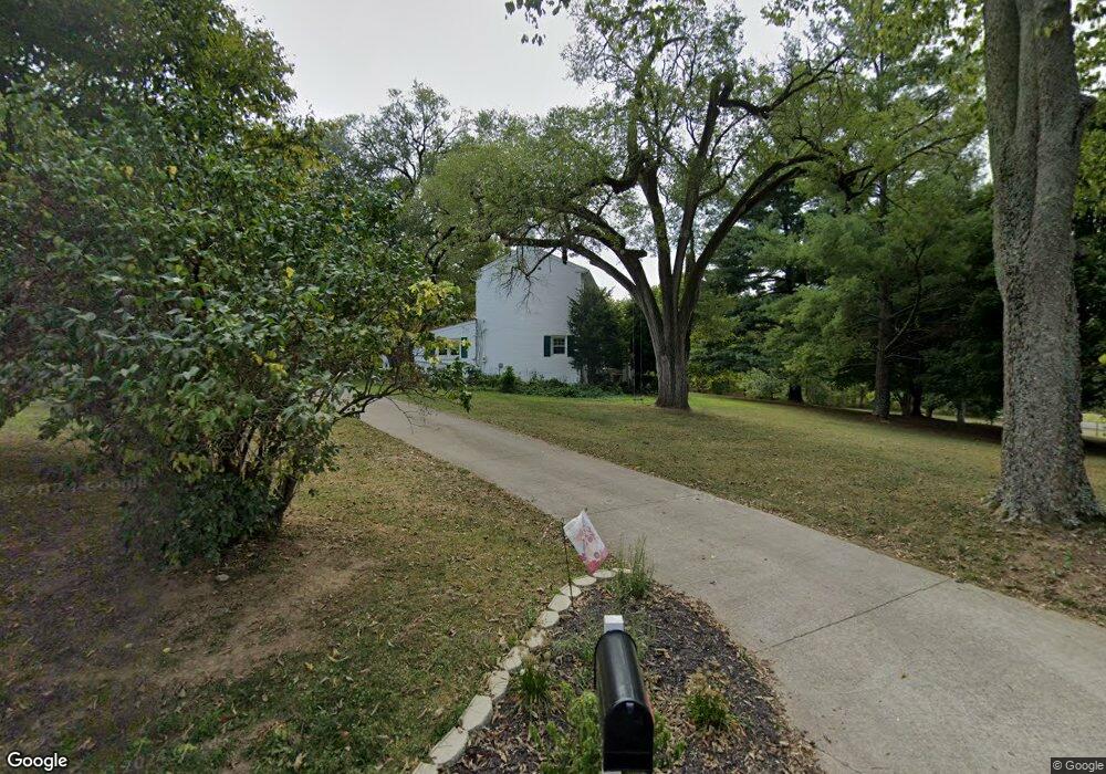
1015 Independence Rd Walton, KY 41094
Estimated Value: $505,000 - $630,000
4
Beds
2
Baths
3,510
Sq Ft
$162/Sq Ft
Est. Value
About This Home
This home is located at 1015 Independence Rd, Walton, KY 41094 and is currently estimated at $570,010, approximately $162 per square foot. 1015 Independence Rd is a home located in Kenton County with nearby schools including Kenton Elementary School, Twenhofel Middle School, and Simon Kenton High School.
Ownership History
Date
Name
Owned For
Owner Type
Purchase Details
Closed on
Mar 7, 2024
Sold by
Tipton Lesley A and Tipton Bradley
Bought by
Roberts Ricky L and Roberts Debbie A
Current Estimated Value
Purchase Details
Closed on
Jun 26, 2020
Sold by
Collins Tom and Collins Margaret
Bought by
Roberts Ricky L and Roberts Debbie A
Purchase Details
Closed on
Jun 2, 2003
Sold by
Dickman Joseph L and Dickman Sheila D
Bought by
Collins Tom and Collins Margaret
Home Financials for this Owner
Home Financials are based on the most recent Mortgage that was taken out on this home.
Original Mortgage
$181,840
Interest Rate
5.79%
Mortgage Type
Unknown
Create a Home Valuation Report for This Property
The Home Valuation Report is an in-depth analysis detailing your home's value as well as a comparison with similar homes in the area
Home Values in the Area
Average Home Value in this Area
Purchase History
| Date | Buyer | Sale Price | Title Company |
|---|---|---|---|
| Roberts Ricky L | -- | None Listed On Document | |
| Roberts Ricky L | -- | None Listed On Document | |
| Roberts Ricky L | $385,000 | None Available | |
| Collins Tom | $227,300 | Advanced Land Title Agency L |
Source: Public Records
Mortgage History
| Date | Status | Borrower | Loan Amount |
|---|---|---|---|
| Previous Owner | Collins Tom | $181,840 | |
| Closed | Collins Tom | $18,184 |
Source: Public Records
Tax History
| Year | Tax Paid | Tax Assessment Tax Assessment Total Assessment is a certain percentage of the fair market value that is determined by local assessors to be the total taxable value of land and additions on the property. | Land | Improvement |
|---|---|---|---|---|
| 2025 | $4,478 | $385,000 | $60,000 | $325,000 |
| 2024 | $4,716 | $385,000 | $55,000 | $330,000 |
| 2023 | $4,859 | $385,000 | $55,000 | $330,000 |
| 2022 | $4,904 | $385,000 | $55,000 | $330,000 |
| 2021 | $4,978 | $385,000 | $55,000 | $330,000 |
| 2020 | $3,032 | $227,300 | $55,000 | $172,300 |
| 2019 | $3,040 | $227,300 | $55,000 | $172,300 |
| 2018 | $3,057 | $227,300 | $55,000 | $172,300 |
| 2017 | $2,973 | $227,300 | $55,000 | $172,300 |
| 2015 | $2,891 | $227,300 | $40,000 | $187,300 |
| 2014 | $2,850 | $227,300 | $40,000 | $187,300 |
Source: Public Records
Map
Nearby Homes
- 2009 Cedora Ln
- 11050 Pinebrook Place
- 11061 Pinebrook Place
- 1413 Greenoaks Dr
- 1422 Greenoaks Dr
- 11108 Woodmont Way
- 1712 Cherry Blossom Dr
- 1368 Independence Rd
- 1368 Independence Rd
- 1372 Independence Rd
- 1372 Independence Rd
- 1707 Cherry Blossom Dr
- 1736 Cherry Blossom Dr
- 1727 Cherry Blossom Dr
- 1748 Cherry Blossom Dr
- 1739 Cherry Blossom Dr
- 11108 Woodmont Way
- 1211 Wellford Dr
- 11079 Woodmont Way
- 1202 Wellford Dr
- 1015 Independence Rd
- 737 Independence Rd
- 11047 Banklick Rd
- 1028 Independence Rd
- 10257 Old Banklick Rd
- 1038 Independence Rd
- 11025 Banklick Rd
- 1056 Independence Rd
- 11015 Banklick Rd
- 1068 Independence Rd
- 11001 Banklick Rd
- 11209 Banklick Rd
- 10883 Banklick Rd
- 2009 Cedora Ln
- 10859 Banklick Rd
- 817 Wright Rd
- 2017 Cedora Ln
- 10831 Banklick Rd
- 1162 Bramlage Rd
- 1192 Bramlage Rd
Your Personal Tour Guide
Ask me questions while you tour the home.