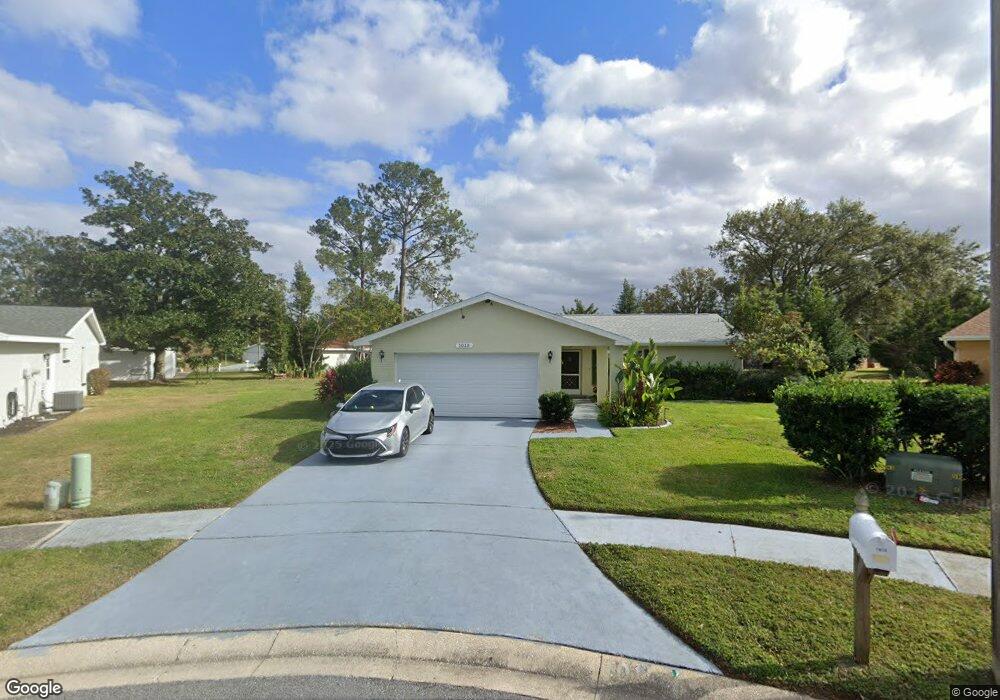
1015 Mctavish Way Palm Harbor, FL 34684
Estimated Value: $339,000 - $368,000
2
Beds
2
Baths
1,296
Sq Ft
$273/Sq Ft
Est. Value
About This Home
This home is located at 1015 Mctavish Way, Palm Harbor, FL 34684 and is currently estimated at $354,353, approximately $273 per square foot. 1015 Mctavish Way is a home located in Pinellas County with nearby schools including Highland Lakes Elementary School, Joseph L. Carwise Middle School, and Palm Harbor University High.
Ownership History
Date
Name
Owned For
Owner Type
Purchase Details
Closed on
Dec 30, 2015
Sold by
Hernandez Purita
Bought by
Lemieux Daniel B and Lemieux Judith
Current Estimated Value
Home Financials for this Owner
Home Financials are based on the most recent Mortgage that was taken out on this home.
Original Mortgage
$182,841
Outstanding Balance
$145,465
Interest Rate
3.97%
Mortgage Type
VA
Estimated Equity
$208,888
Purchase Details
Closed on
Dec 14, 2009
Sold by
Murray Juanita
Bought by
Hernandez Purita
Create a Home Valuation Report for This Property
The Home Valuation Report is an in-depth analysis detailing your home's value as well as a comparison with similar homes in the area
Home Values in the Area
Average Home Value in this Area
Purchase History
| Date | Buyer | Sale Price | Title Company |
|---|---|---|---|
| Lemieux Daniel B | $177,000 | Elite Title Agency Inc | |
| Hernandez Purita | -- | None Available |
Source: Public Records
Mortgage History
| Date | Status | Borrower | Loan Amount |
|---|---|---|---|
| Open | Lemieux Daniel B | $182,841 |
Source: Public Records
Tax History Compared to Growth
Tax History
| Year | Tax Paid | Tax Assessment Tax Assessment Total Assessment is a certain percentage of the fair market value that is determined by local assessors to be the total taxable value of land and additions on the property. | Land | Improvement |
|---|---|---|---|---|
| 2024 | $2,821 | $200,675 | -- | -- |
| 2023 | $2,821 | $194,830 | $0 | $0 |
| 2022 | $2,810 | $189,155 | $0 | $0 |
| 2021 | $2,530 | $168,035 | $0 | $0 |
| 2020 | $2,520 | $165,715 | $0 | $0 |
| 2019 | $2,473 | $161,989 | $0 | $0 |
| 2018 | $2,435 | $158,969 | $0 | $0 |
| 2017 | $2,409 | $155,699 | $0 | $0 |
| 2016 | $2,384 | $152,497 | $0 | $0 |
| 2015 | $2,771 | $136,343 | $0 | $0 |
| 2014 | $2,560 | $125,969 | $0 | $0 |
Source: Public Records
Map
Nearby Homes
- 2820 Lomond Dr
- 1130 Orange Tree Cir W Unit C
- 1131 Orange Tree Cir W Unit C
- 1160 Orange Tree Cir W Unit D
- 1107 Queen Anne Dr Unit D
- 1163 Orange Tree Cir W Unit D
- 1472 Queen Anne Dr
- 2700 Nebraska Ave Unit 3-201
- 2700 Nebraska Ave Unit 5-101
- 2700 Nebraska Ave Unit 2-203
- 2740 Whitebridge Dr Unit A
- 2828 Sherbrooke Ln Unit C
- 2824 Rustic Oaks Dr
- 2722 Sherbrooke Ln Unit D
- 2846 Highlands Blvd Unit D
- 2738 Sherbrooke Ln Unit C
- 0 Blackstone Dr Unit MFRTB8409690
- 2690 Coral Landings Blvd Unit 535
- 2690 Coral Landings Blvd Unit 538
- 2690 Coral Landings Blvd Unit 631
- 1008 Mctavish Way
- 1016 Brae Ct
- 1023 Mctavish Way
- 2831 Paddock Dr
- 2837 Paddock Dr
- 2825 Paddock Dr
- 2843 Paddock Dr
- 1014 Mctavish Way
- 1010 Brae Ct
- 2819 Paddock Dr
- 2849 Paddock Dr
- 1439 Queen Anne Blvd
- 1441 Queen Anne Blvd
- 1443 Queen Anne Blvd
- 1013 Tarns Ct
- 1017 Brae Ct
- 2813 Paddock Dr
- 1435 Queen Anne Blvd
- 1025 Brae Ct
- 2830 Paddock Dr