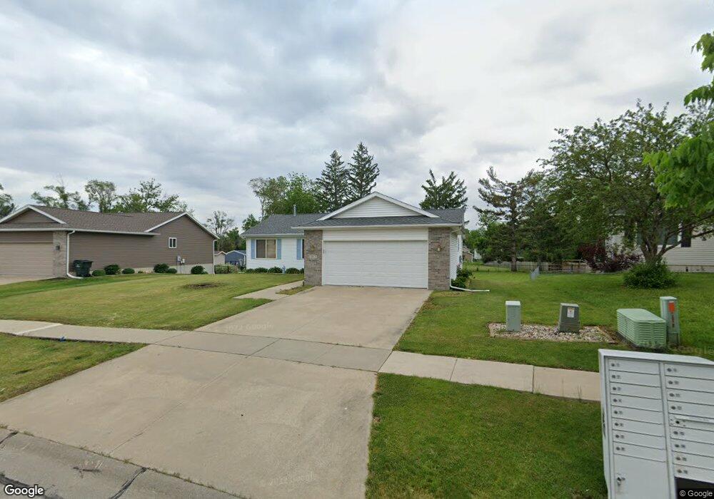
1015 Moose Dr NW Cedar Rapids, IA 52405
Estimated Value: $249,000 - $279,000
3
Beds
2
Baths
1,400
Sq Ft
$193/Sq Ft
Est. Value
About This Home
This home is located at 1015 Moose Dr NW, Cedar Rapids, IA 52405 and is currently estimated at $269,723, approximately $192 per square foot. 1015 Moose Dr NW is a home located in Linn County with nearby schools including Maple Grove Elementary School, North Middletown Elementary School, and Ponderosa Elementary School.
Ownership History
Date
Name
Owned For
Owner Type
Purchase Details
Closed on
Jan 10, 2000
Sold by
Kacs Lc
Bought by
Regan Patrick R
Current Estimated Value
Home Financials for this Owner
Home Financials are based on the most recent Mortgage that was taken out on this home.
Original Mortgage
$110,000
Outstanding Balance
$34,950
Interest Rate
7.84%
Estimated Equity
$234,773
Create a Home Valuation Report for This Property
The Home Valuation Report is an in-depth analysis detailing your home's value as well as a comparison with similar homes in the area
Home Values in the Area
Average Home Value in this Area
Purchase History
| Date | Buyer | Sale Price | Title Company |
|---|---|---|---|
| Regan Patrick R | $137,500 | -- |
Source: Public Records
Mortgage History
| Date | Status | Borrower | Loan Amount |
|---|---|---|---|
| Open | Regan Patrick R | $110,000 |
Source: Public Records
Tax History Compared to Growth
Tax History
| Year | Tax Paid | Tax Assessment Tax Assessment Total Assessment is a certain percentage of the fair market value that is determined by local assessors to be the total taxable value of land and additions on the property. | Land | Improvement |
|---|---|---|---|---|
| 2025 | $3,758 | $251,700 | $64,500 | $187,200 |
| 2024 | $4,018 | $229,800 | $60,800 | $169,000 |
| 2023 | $4,018 | $229,800 | $60,800 | $169,000 |
| 2022 | $3,792 | $199,400 | $53,500 | $145,900 |
| 2021 | $3,854 | $192,000 | $46,100 | $145,900 |
| 2020 | $3,854 | $183,300 | $46,100 | $137,200 |
| 2019 | $3,378 | $165,200 | $36,900 | $128,300 |
| 2018 | $3,280 | $165,200 | $36,900 | $128,300 |
| 2017 | $3,487 | $165,400 | $36,900 | $128,500 |
| 2016 | $3,487 | $164,100 | $36,900 | $127,200 |
| 2015 | $3,677 | $172,785 | $36,863 | $135,922 |
| 2014 | $3,492 | $172,785 | $36,863 | $135,922 |
| 2013 | $1,706 | $172,785 | $36,863 | $135,922 |
Source: Public Records
Map
Nearby Homes
- 1608 Morris Ave NW
- 4819 Fruitwood Ln NW
- 1722 Gardner Dr NW
- 3802 Richland Dr NW
- 3313 Crestwood Dr NW
- 327* Edgewood Rd NW
- 4819 Ford Ave NW
- 272 Peace Ave NW
- 281 Jacolyn Dr NW
- 3312 G Ave NW
- 3507 E Ave NW Unit F
- 3509 E Ave NW Unit D
- 208 Lenora Dr NW
- 1613 Southview Dr NW
- 4975 Kesler Rd NW
- 1322 Woodside Dr NW
- 229 Jacolyn Dr NW
- 3600 Midway Dr NW
- 1410 Adair Ct SW Unit Lot 2
- 1733 Hillside Dr NW
- 1021 Moose Dr NW
- 1009 Moose Dr NW
- 1105 Moose Dr NW
- 1003 Moose Dr NW
- 1018 Moose Dr NW
- 1111 Moose Dr NW
- 1024 Moose Dr NW
- 1012 Moose Dr NW
- 927 Moose Dr NW
- 1102 Moose Dr NW
- 1117 Moose Dr NW
- 1108 Moose Dr NW
- 921 Moose Dr NW
- 1019 Wolf Dr NW
- 1013 Wolf Dr NW
- 1007 Wolf Dr NW
- 1114 Moose Dr NW
- 1025 Wolf Dr NW
- 1123 Moose Dr NW
- 1001 Wolf Dr NW