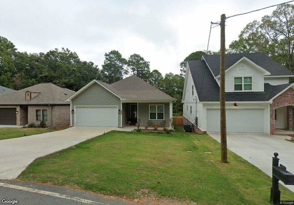
1015 Nix Rd Little Rock, AR 72211
Chenal NeighborhoodEstimated Value: $332,000 - $452,514
--
Bed
1
Bath
3,591
Sq Ft
$110/Sq Ft
Est. Value
About This Home
This home is located at 1015 Nix Rd, Little Rock, AR 72211 and is currently estimated at $393,379, approximately $109 per square foot. 1015 Nix Rd is a home located in Pulaski County with nearby schools including Terry Elementary School, Pinnacle View Middle School, and LISA Academy West Elementary School.
Ownership History
Date
Name
Owned For
Owner Type
Purchase Details
Closed on
Apr 10, 2025
Sold by
Commissioner Of State Lands
Bought by
Midsouth Property Management Llc
Current Estimated Value
Purchase Details
Closed on
Jul 3, 2019
Sold by
Rountree Gerorge E
Bought by
Icon Homes Llc
Home Financials for this Owner
Home Financials are based on the most recent Mortgage that was taken out on this home.
Original Mortgage
$115,000
Interest Rate
4%
Mortgage Type
Commercial
Purchase Details
Closed on
Feb 24, 2015
Sold by
Rountree Carolyn S
Bought by
Rountree George E
Purchase Details
Closed on
Jun 6, 2014
Sold by
Rountree Carolyn S
Bought by
Rountree Carolyn S
Purchase Details
Closed on
Jul 28, 2000
Sold by
Clement Ralph G and Clement Lavern B
Bought by
Clement Ralph G
Create a Home Valuation Report for This Property
The Home Valuation Report is an in-depth analysis detailing your home's value as well as a comparison with similar homes in the area
Home Values in the Area
Average Home Value in this Area
Purchase History
| Date | Buyer | Sale Price | Title Company |
|---|---|---|---|
| Midsouth Property Management Llc | $4,684 | None Listed On Document | |
| Icon Homes Llc | $115,000 | Lenders Title Company | |
| Rountree George E | -- | None Available | |
| Rountree Carolyn S | -- | None Available | |
| Clement Ralph G | -- | -- |
Source: Public Records
Mortgage History
| Date | Status | Borrower | Loan Amount |
|---|---|---|---|
| Previous Owner | Icon Homes Llc | $115,000 |
Source: Public Records
Tax History Compared to Growth
Tax History
| Year | Tax Paid | Tax Assessment Tax Assessment Total Assessment is a certain percentage of the fair market value that is determined by local assessors to be the total taxable value of land and additions on the property. | Land | Improvement |
|---|---|---|---|---|
| 2025 | $5,911 | $84,437 | $9,600 | $74,837 |
| 2024 | $3,241 | $84,437 | $9,600 | $74,837 |
| 2023 | $3,241 | $46,297 | $9,600 | $36,697 |
| 2022 | $362 | $9,646 | $9,600 | $46 |
| 2021 | $331 | $4,696 | $4,650 | $46 |
| 2020 | $329 | $9,300 | $9,300 | $0 |
| 2019 | $651 | $9,300 | $9,300 | $0 |
| 2018 | $1,311 | $18,730 | $9,300 | $9,430 |
| 2017 | $1,311 | $18,730 | $9,300 | $9,430 |
| 2016 | $2,577 | $36,820 | $24,800 | $12,020 |
| 2015 | $2,581 | $36,820 | $24,800 | $12,020 |
| 2014 | $2,581 | $24,800 | $24,800 | $0 |
Source: Public Records
Map
Nearby Homes
- 13100 Kanis Rd
- 13204 Laurel Oaks Dr
- 000 Coleman Ave
- 624 Gamble Rd
- 814 Atkins Rd
- 714 Atkins Rd
- 12901 Westglen Dr
- 12825 Westglen Dr
- 13611 Ivy Point Dr
- 47 Taylor Park Loop
- 23 Wagon Wheel Ct
- 1509 Gamble Rd
- 13408 Teton Dr
- 2 Timber Ridge Ct
- 13020 Archer Ln
- 400 Nix Rd
- 602 Timber Hill Dr
- 1610 Calgary Trail
- 310 Nix Rd
- 311 Nix Rd