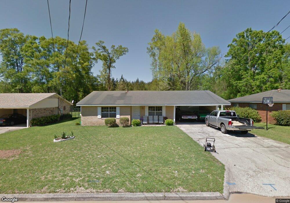
1015 Pinehurst Dr Columbia, MS 39429
Estimated Value: $102,400 - $172,000
3
Beds
2
Baths
1,731
Sq Ft
$78/Sq Ft
Est. Value
About This Home
This home is located at 1015 Pinehurst Dr, Columbia, MS 39429 and is currently estimated at $135,850, approximately $78 per square foot. 1015 Pinehurst Dr is a home located in Marion County with nearby schools including Columbia Primary School, Columbia Elementary School, and Jefferson Middle School.
Ownership History
Date
Name
Owned For
Owner Type
Purchase Details
Closed on
May 16, 2007
Sold by
Lewis Victoria J
Bought by
Magee Christopher M and Magee Livinia S
Current Estimated Value
Home Financials for this Owner
Home Financials are based on the most recent Mortgage that was taken out on this home.
Original Mortgage
$92,500
Interest Rate
6.12%
Purchase Details
Closed on
May 11, 2007
Sold by
Lewis Randall and Lewis Victoria J
Bought by
Lewis Victoria J
Home Financials for this Owner
Home Financials are based on the most recent Mortgage that was taken out on this home.
Original Mortgage
$92,500
Interest Rate
6.12%
Create a Home Valuation Report for This Property
The Home Valuation Report is an in-depth analysis detailing your home's value as well as a comparison with similar homes in the area
Home Values in the Area
Average Home Value in this Area
Purchase History
| Date | Buyer | Sale Price | Title Company |
|---|---|---|---|
| Magee Christopher M | -- | -- | |
| Lewis Victoria J | -- | -- |
Source: Public Records
Mortgage History
| Date | Status | Borrower | Loan Amount |
|---|---|---|---|
| Open | Lewis Victoria J | $92,500 | |
| Closed | Lewis Victoria J | $92,500 |
Source: Public Records
Tax History
| Year | Tax Paid | Tax Assessment Tax Assessment Total Assessment is a certain percentage of the fair market value that is determined by local assessors to be the total taxable value of land and additions on the property. | Land | Improvement |
|---|---|---|---|---|
| 2025 | $1,505 | $9,429 | $0 | $0 |
| 2024 | $1,242 | $7,248 | $0 | $0 |
| 2023 | $1,233 | $7,198 | $0 | $0 |
| 2022 | $1,233 | $7,198 | $0 | $0 |
| 2021 | $1,233 | $7,198 | $0 | $0 |
| 2020 | $1,120 | $6,752 | $0 | $0 |
| 2019 | $1,127 | $6,726 | $0 | $0 |
| 2018 | $1,127 | $6,726 | $0 | $0 |
| 2017 | $1,114 | $6,726 | $0 | $0 |
| 2016 | $971 | $7,034 | $0 | $0 |
| 2015 | -- | $7,496 | $0 | $0 |
| 2014 | -- | $7,496 | $0 | $0 |
Source: Public Records
Map
Nearby Homes
- 1016 Pinehurst Dr
- 1406 Meadowbrook Ave
- 1123 Aztec Trail
- 1114 Juniper Dr
- 1116 West Ave
- 902 Lafayette St
- 915 N Park Ave
- 1314 Martin Luther King Dr
- 813 Greymont Dr
- 1005 Beatrice Ave
- 1223 Meadowood Rd
- 2106 Ridgewood Dr
- 1510 Hickory Bend
- 903 Alberta Ave
- 151 Old Sumrall Rd
- 1019 Gill St
- 820 Rogers Ave
- 721 Dale St
- 1209 Gill St
- 1015 Church St
- 1013 Pinehurst Dr
- 1017 Pinehurst Dr
- 1014 Pinehurst Dr
- 1011 Pinehurst Dr
- 1019 Pinehurst Dr
- 1012 Pinehurst Dr
- 1311 Meadowbrook Ave
- 1009 Pinehurst Dr
- 1010 Pinehurst Dr
- 1309 Meadowbrook Ave
- 1321 Meadowbrook Ave
- 915 Sunset Cir
- 1316 Meadowbrook Ave
- 1314 Meadowbrook Ave
- 1314 Meadowbrook Ave
- 1007 Pinehurst Dr
- 1312 Meadowbrook Ave
- 913 Sunset Cir
- 917 Sunset Cir
- 1310 Meadowbrook Ave
Your Personal Tour Guide
Ask me questions while you tour the home.