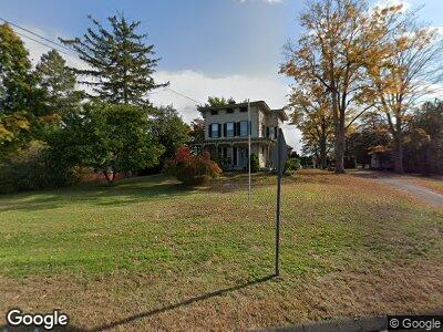
1015 Randolph Rd Middletown, CT 06457
Estimated Value: $377,047 - $462,000
4
Beds
2
Baths
3,790
Sq Ft
$110/Sq Ft
Est. Value
About This Home
This home is located at 1015 Randolph Rd, Middletown, CT 06457 and is currently estimated at $417,012, approximately $110 per square foot. 1015 Randolph Rd is a home located in Middlesex County with nearby schools including Wesley School, Middletown High School, and St John Paul II School.
Ownership History
Date
Name
Owned For
Owner Type
Purchase Details
Closed on
Oct 23, 2023
Sold by
Parrett Jeanette C
Bought by
Parrett Ft and Parrett
Current Estimated Value
Purchase Details
Closed on
Mar 23, 2023
Sold by
Parrett Jeanette C
Bought by
Parrett Ft and Parrett
Purchase Details
Closed on
Aug 13, 1976
Bought by
Parrett Jeanette C
Create a Home Valuation Report for This Property
The Home Valuation Report is an in-depth analysis detailing your home's value as well as a comparison with similar homes in the area
Home Values in the Area
Average Home Value in this Area
Purchase History
| Date | Buyer | Sale Price | Title Company |
|---|---|---|---|
| Parrett Ft | -- | None Available | |
| Parrett Ft | -- | None Available | |
| Parrett Jeanette C | -- | -- |
Source: Public Records
Mortgage History
| Date | Status | Borrower | Loan Amount |
|---|---|---|---|
| Previous Owner | Parrett Jeanette C | $9,500 |
Source: Public Records
Tax History Compared to Growth
Tax History
| Year | Tax Paid | Tax Assessment Tax Assessment Total Assessment is a certain percentage of the fair market value that is determined by local assessors to be the total taxable value of land and additions on the property. | Land | Improvement |
|---|---|---|---|---|
| 2024 | $7,663 | $216,410 | $71,390 | $145,020 |
| 2023 | $7,274 | $216,410 | $71,390 | $145,020 |
| 2022 | $7,268 | $176,180 | $45,090 | $131,090 |
| 2021 | $7,236 | $176,180 | $45,090 | $131,090 |
| 2020 | $7,224 | $176,180 | $45,090 | $131,090 |
| 2019 | $7,259 | $176,180 | $45,090 | $131,090 |
| 2018 | $7,009 | $176,180 | $45,090 | $131,090 |
| 2017 | $7,356 | $190,170 | $54,740 | $135,430 |
| 2016 | $7,208 | $190,170 | $54,740 | $135,430 |
| 2015 | $7,049 | $190,170 | $54,740 | $135,430 |
| 2014 | $7,042 | $190,170 | $54,740 | $135,430 |
Source: Public Records
Map
Nearby Homes
- 0 Arbutus St Unit 24075922
- 0 Arbutus St Unit 24065180
- 601 Hunting Hill Ave
- 139 Arbutus St
- 515 Hunting Hill Ave
- 25 Arnold St
- 94 E Ridge Rd
- 222 Maple Shade Rd
- 85 Lorelei Cir
- 56 Jefferson Ave
- 65 Stevens Ln
- 25 Sunnyslope Dr
- 412 Pine St
- 175 Millbrook Rd
- 207 Brown St
- 155 Dorothy Dr
- 191 Long Hill Rd
- 10 Jack English Dr
- 116 Front St
- 50 Andrew St
- 1015 Randolph Rd
- 000 Arbutus St
- 00 Arbutus St
- 0 Arbutus St Unit M9108989
- 0 Arbutus St Unit G489215
- 0 Arbutus St Unit G513117
- 0 Arbutus St Unit G515033
- 0 Arbutus St Unit M9115664
- 0 Arbutus St Unit G526351
- 0 Arbutus St Unit G544144
- 0 Arbutus St Unit G559551
- 0 Arbutus St Unit G573636
- 0 Arbutus St Unit G583231
- 0 Arbutus St Unit G583227
- 0 Arbutus St Unit G604605
- 0 Arbutus St Unit G604603
- 0 Arbutus St Unit G608827
- 0 Arbutus St Unit G638580
- 0 Arbutus St Unit G691692
- 0 Arbutus St