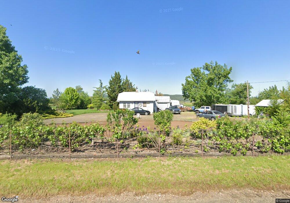
1015 Reese Creek Rd Eagle Point, OR 97524
Estimated Value: $252,449 - $441,000
2
Beds
1
Bath
820
Sq Ft
$415/Sq Ft
Est. Value
About This Home
This home is located at 1015 Reese Creek Rd, Eagle Point, OR 97524 and is currently estimated at $340,150, approximately $414 per square foot. 1015 Reese Creek Rd is a home located in Jackson County with nearby schools including Eagle Rock Elementary School, Eagle Point Middle School, and White Mountain Middle School.
Ownership History
Date
Name
Owned For
Owner Type
Purchase Details
Closed on
Jun 10, 1999
Sold by
Hukill Ryan R and Hukill Tammy A
Bought by
Boren Matthew H and Boren Karol A
Current Estimated Value
Home Financials for this Owner
Home Financials are based on the most recent Mortgage that was taken out on this home.
Original Mortgage
$98,800
Outstanding Balance
$25,735
Interest Rate
6.9%
Estimated Equity
$314,415
Purchase Details
Closed on
Dec 21, 1998
Sold by
Lown Lonzo L and Lown Joan
Bought by
Hukill Ryan R and Hukill Tammy A
Create a Home Valuation Report for This Property
The Home Valuation Report is an in-depth analysis detailing your home's value as well as a comparison with similar homes in the area
Home Values in the Area
Average Home Value in this Area
Purchase History
| Date | Buyer | Sale Price | Title Company |
|---|---|---|---|
| Boren Matthew H | $123,500 | Amerititle | |
| Hukill Ryan R | $85,000 | Amerititle |
Source: Public Records
Mortgage History
| Date | Status | Borrower | Loan Amount |
|---|---|---|---|
| Open | Boren Matthew H | $98,800 |
Source: Public Records
Tax History Compared to Growth
Tax History
| Year | Tax Paid | Tax Assessment Tax Assessment Total Assessment is a certain percentage of the fair market value that is determined by local assessors to be the total taxable value of land and additions on the property. | Land | Improvement |
|---|---|---|---|---|
| 2025 | $1,706 | $145,150 | $119,660 | $25,490 |
| 2024 | $1,706 | $140,930 | $103,670 | $37,260 |
| 2023 | $1,649 | $136,830 | $100,660 | $36,170 |
| 2022 | $1,540 | $136,830 | $100,660 | $36,170 |
| 2021 | $1,494 | $132,850 | $97,730 | $35,120 |
| 2020 | $1,617 | $128,990 | $94,890 | $34,100 |
| 2019 | $1,596 | $121,600 | $89,450 | $32,150 |
| 2018 | $1,559 | $118,060 | $86,850 | $31,210 |
| 2017 | $1,521 | $118,060 | $86,850 | $31,210 |
| 2016 | $1,481 | $111,300 | $81,880 | $29,420 |
| 2015 | $1,430 | $111,300 | $81,880 | $29,420 |
| 2014 | $1,388 | $104,920 | $77,190 | $27,730 |
Source: Public Records
Map
Nearby Homes
- 0 Reese Creek Rd Unit 23882206
- 407 Canyon Way
- 417 E Rolling Hills Dr
- 628 Barton Rd
- 4 Meadowfield Cir
- 700 Nottingham Terrace
- 611 Andrea Way
- 686 Sheffield Dr
- 712 Nottingham Terrace
- 208 Northview Dr Unit 1B
- 144 Reese Creek Rd
- 990 Win Way
- 2795 Ball Rd
- 1023 Highlands Dr
- 276 Candis Dr
- 507 Sienna Hills Dr
- 633 E Archwood Dr Unit 89
- 633 E Archwood Dr Unit 1
- 633 E Archwood Dr Unit 60
- 633 E Archwood Dr Unit 44
- 1251 Reese Creek Rd
- 1331 Reese Creek Rd
- 1290 Reese Creek Rd
- TL 1401 Reese Creek Rd
- TL 1401 Reese Creek
- 786 Reese Creek Rd
- 1421 Reese Creek Rd
- 685 E Rolling Hills Dr
- 655 E Rolling Hills Dr
- 655 E 655 E Rolling Hills Dr Dr
- 655 Reese Creek Rd
- 1505 Reese Creek Rd
- 670 E Rolling Hills Dr
- 1587 Reese Creek Rd
- 573 Reese Creek Rd
- 565 Reese Creek Rd
- 565 Reese Creek Rd
- 1299 Barton Rd
- 0 Reese Creek Rd Unit 23809877
- 0 Reese Creek Rd Unit 220201733
