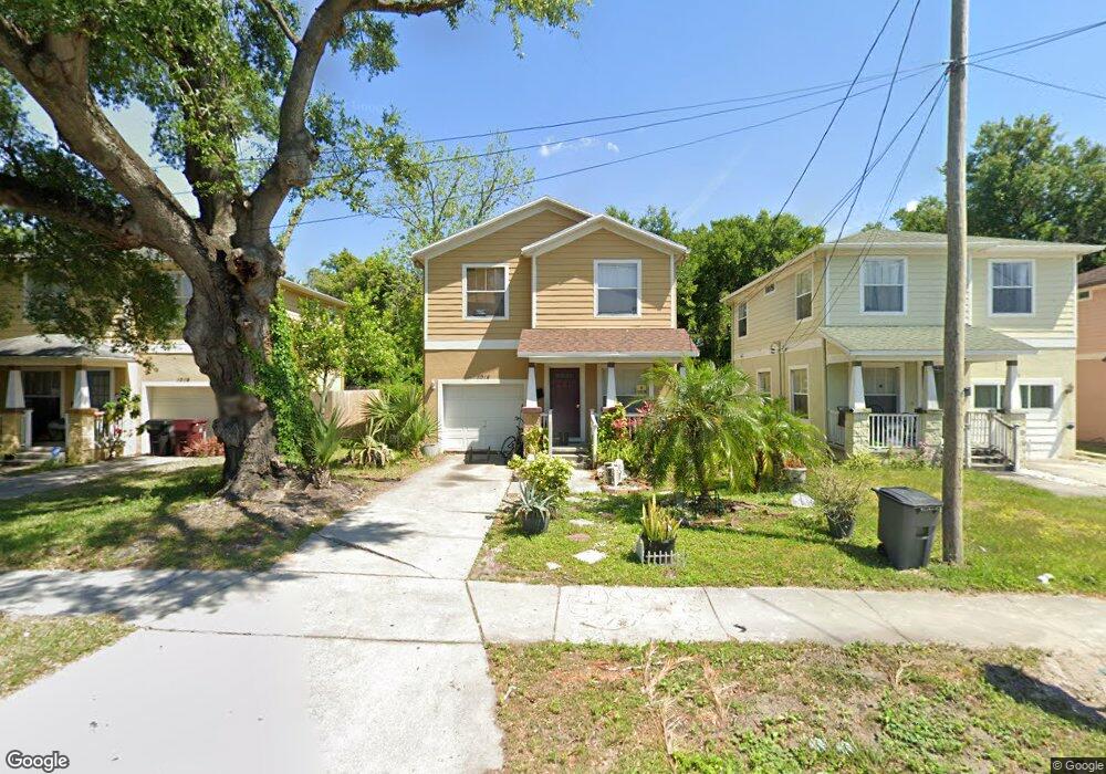
1015 W Anderson St Orlando, FL 32805
Parramore NeighborhoodEstimated Value: $256,815 - $327,000
3
Beds
3
Baths
2,103
Sq Ft
$140/Sq Ft
Est. Value
About This Home
This home is located at 1015 W Anderson St, Orlando, FL 32805 and is currently estimated at $294,704, approximately $140 per square foot. 1015 W Anderson St is a home located in Orange County with nearby schools including OCPS Academic Center for Excellence, Jones High School, and Harvest Baptist Christian Academy.
Ownership History
Date
Name
Owned For
Owner Type
Purchase Details
Closed on
Dec 4, 2009
Sold by
Soj Enterprises Llc
Bought by
Woodson Detrice L
Current Estimated Value
Home Financials for this Owner
Home Financials are based on the most recent Mortgage that was taken out on this home.
Original Mortgage
$49,043
Outstanding Balance
$32,169
Interest Rate
5.01%
Mortgage Type
FHA
Estimated Equity
$262,535
Create a Home Valuation Report for This Property
The Home Valuation Report is an in-depth analysis detailing your home's value as well as a comparison with similar homes in the area
Home Values in the Area
Average Home Value in this Area
Purchase History
| Date | Buyer | Sale Price | Title Company |
|---|---|---|---|
| Woodson Detrice L | $160,000 | Universal Land Title Inc |
Source: Public Records
Mortgage History
| Date | Status | Borrower | Loan Amount |
|---|---|---|---|
| Open | Woodson Detrice L | $49,043 |
Source: Public Records
Tax History Compared to Growth
Tax History
| Year | Tax Paid | Tax Assessment Tax Assessment Total Assessment is a certain percentage of the fair market value that is determined by local assessors to be the total taxable value of land and additions on the property. | Land | Improvement |
|---|---|---|---|---|
| 2025 | $1,039 | $99,054 | -- | -- |
| 2024 | $985 | $96,262 | -- | -- |
| 2023 | $985 | $90,824 | $0 | $0 |
| 2022 | $941 | $88,179 | $0 | $0 |
| 2021 | $912 | $85,611 | $0 | $0 |
| 2020 | $861 | $84,429 | $0 | $0 |
| 2019 | $877 | $82,531 | $0 | $0 |
| 2018 | $859 | $80,992 | $0 | $0 |
| 2017 | $837 | $84,015 | $12,100 | $71,915 |
| 2016 | $824 | $79,198 | $9,500 | $69,698 |
| 2015 | $835 | $77,154 | $9,500 | $67,654 |
| 2014 | $1,138 | $91,401 | $12,000 | $79,401 |
Source: Public Records
Map
Nearby Homes
- 1017 Randall St
- 1013 Randall St
- 1029 Colyer St
- 1025 Colyer St Unit A/B
- 509 Grove Ave
- 811 Colyer St
- 0 Easy Ave
- 433 S Lee Ave
- 724 Grove Ave
- 727 Quill Ave
- 440 Mcfall Ave
- 1232 Conley St
- 1202 Cypress St
- 1023 W Gore St
- 1122 Dewitt Dr
- 107 Garden Ave
- 544 Murphy St
- 210 Kent Ave
- 222 N Parramore Ave
- 1018 Mack Ave
- 500 Albany Ave
- 1011 W Anderson St
- 1019 W Anderson St
- 1007 W Anderson St
- 1021 W Anderson St
- 1016 Randall St
- 446 S Westmoreland Dr
- 1018 Randall St
- 440 Albany Ave
- 517 Albany Ave
- 1025 W Anderson St
- 1008 W Anderson St
- 1026 W Anderson St
- 1004 W Anderson St
- 1002 W Anderson St
- 502 Albany Ave
- 1024 W Anderson St
- 1011 Randall St
- 509 Albany Ave
- 1009 Randall St