Estimated Value: $893,000 - $1,026,000
5
Beds
4
Baths
2,478
Sq Ft
$376/Sq Ft
Est. Value
About This Home
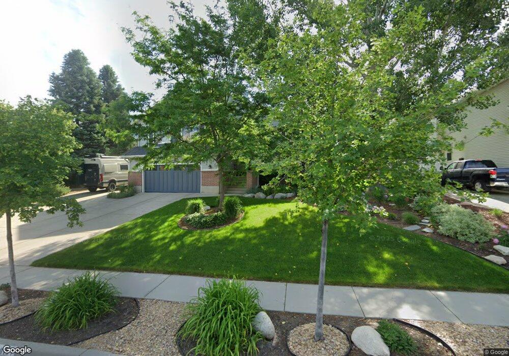
This home is located at 10157 Sunderland Cir, Sandy, UT 84092 and is currently estimated at $932,830, approximately $376 per square foot. 10157 Sunderland Cir is a home located in Salt Lake County with nearby schools including Park Lane Elementary School, Eastmont Middle School, and Jordan High.
Ownership History
Date
Name
Owned For
Owner Type
Purchase Details
Closed on
Oct 25, 2010
Sold by
Lane Michael B and Lane Elizabeth A
Bought by
Lane Michael Brian and Lane Elizabeth Ann
Current Estimated Value
Purchase Details
Closed on
Aug 27, 2009
Sold by
Alex Gregg S and Alex Cynthia S
Bought by
Lane Michael B and Lane Elizabeth A
Home Financials for this Owner
Home Financials are based on the most recent Mortgage that was taken out on this home.
Original Mortgage
$386,650
Outstanding Balance
$251,580
Interest Rate
5.09%
Mortgage Type
New Conventional
Estimated Equity
$681,250
Purchase Details
Closed on
Aug 2, 1999
Sold by
Sluglett Peter
Bought by
Alex Gregg S and Alex Cynthia S
Home Financials for this Owner
Home Financials are based on the most recent Mortgage that was taken out on this home.
Original Mortgage
$203,200
Interest Rate
7.64%
Purchase Details
Closed on
Jun 25, 1997
Sold by
Nelson Karl M and Nelson Jeanne G
Bought by
Sluglett Peter
Home Financials for this Owner
Home Financials are based on the most recent Mortgage that was taken out on this home.
Original Mortgage
$180,000
Interest Rate
7.91%
Create a Home Valuation Report for This Property
The Home Valuation Report is an in-depth analysis detailing your home's value as well as a comparison with similar homes in the area
Home Values in the Area
Average Home Value in this Area
Purchase History
| Date | Buyer | Sale Price | Title Company |
|---|---|---|---|
| Lane Michael Brian | -- | None Available | |
| Lane Michael B | -- | First American Title | |
| Alex Gregg S | -- | Metro National Title | |
| Sluglett Peter | -- | -- |
Source: Public Records
Mortgage History
| Date | Status | Borrower | Loan Amount |
|---|---|---|---|
| Open | Lane Michael B | $386,650 | |
| Previous Owner | Alex Gregg S | $203,200 | |
| Previous Owner | Sluglett Peter | $180,000 |
Source: Public Records
Tax History
| Year | Tax Paid | Tax Assessment Tax Assessment Total Assessment is a certain percentage of the fair market value that is determined by local assessors to be the total taxable value of land and additions on the property. | Land | Improvement |
|---|---|---|---|---|
| 2025 | $4,569 | $883,100 | $306,000 | $577,100 |
| 2024 | $4,569 | $856,500 | $294,600 | $561,900 |
| 2023 | $4,349 | $813,700 | $283,300 | $530,400 |
| 2022 | $4,244 | $781,200 | $277,800 | $503,400 |
| 2021 | $3,814 | $597,700 | $222,200 | $375,500 |
| 2020 | $3,652 | $540,100 | $222,200 | $317,900 |
| 2019 | $3,564 | $514,200 | $212,400 | $301,800 |
| 2016 | $2,844 | $396,800 | $191,400 | $205,400 |
Source: Public Records
Map
Nearby Homes
- 2342 Karalee Way
- 9942 S Altamont Dr
- 2724 Mount Jordan Rd
- 10234 Dimple Dell Ln Unit 8
- 2078 E 10140 S
- 10175 S Dimple Dell Rd
- 2067 E Gyrfalcon Ln
- 10293 Ashley Mesa Ln
- 10665 S 2340 E
- 10279 S Dimple Dell Rd E Unit 103
- 2197 E Thistlewood Way
- 2009 E Sweetbriar Ln
- 9650 S Buttonwood Dr
- 1 Pepperwood Pointe
- 2342 Charros Rd
- 9623 Tannenbaum Cove
- 9472 Fox Hunt Dr
- 10804 S Hiddenwood Dr
- 3064 E Granite Meadow Ln
- 5 Quietwood Ln
- 10157 S Sunderland Cir
- 10145 S Sunderland Cir
- 10145 Sunderland Cir
- 10169 S Sunderland Cir
- 10169 Sunderland Cir
- 10133 S Sunderland Cir
- 10133 Sunderland Cir
- 10156 Sunderland Cir
- 10144 Sunderland Cir
- 10144 S Sunderland Cir
- 10168 Sunderland Cir
- 10168 S Sunderland Cir
- 10197 S 2505 E
- 10132 Sunderland Cir
- 10160 Loridan Ln
- 2555 E Karalee Way
- 2555 Karalee Way
- 10196 S 2505 E
- 10153 S 2460 E
- 10167 S 2460 E