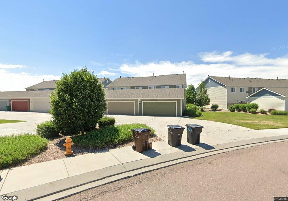
10159 Roughshod Point Colorado Springs, CO 80925
Widefield NeighborhoodEstimated Value: $326,749 - $349,000
2
Beds
3
Baths
1,520
Sq Ft
$224/Sq Ft
Est. Value
About This Home
This home is located at 10159 Roughshod Point, Colorado Springs, CO 80925 and is currently estimated at $340,187, approximately $223 per square foot. 10159 Roughshod Point is a home with nearby schools including Grand Mountain School, Widefield High School, and Valley Christian Academy.
Ownership History
Date
Name
Owned For
Owner Type
Purchase Details
Closed on
Nov 13, 2018
Sold by
Saf Management Llc
Bought by
Kathreia Rima R
Current Estimated Value
Purchase Details
Closed on
May 29, 2013
Sold by
St Aubyn Jared and St Aubyn Megghan H
Bought by
Saf Management Llc
Purchase Details
Closed on
Feb 13, 2013
Sold by
St Aubyn Jared
Bought by
St Aubyn Jared and St Aubyn Meggan H
Home Financials for this Owner
Home Financials are based on the most recent Mortgage that was taken out on this home.
Original Mortgage
$116,900
Interest Rate
3.38%
Mortgage Type
New Conventional
Purchase Details
Closed on
Sep 27, 2012
Sold by
Lrlc Llc #Iv
Bought by
St Aubyn Jared
Create a Home Valuation Report for This Property
The Home Valuation Report is an in-depth analysis detailing your home's value as well as a comparison with similar homes in the area
Home Values in the Area
Average Home Value in this Area
Purchase History
| Date | Buyer | Sale Price | Title Company |
|---|---|---|---|
| Kathreia Rima R | $229,900 | Unified Title Co | |
| Saf Management Llc | -- | None Available | |
| St Aubyn Jared | -- | None Available | |
| St Aubyn Jared | $161,000 | None Available | |
| Lrlc Llc #Iv | $161,000 | None Available |
Source: Public Records
Mortgage History
| Date | Status | Borrower | Loan Amount |
|---|---|---|---|
| Previous Owner | St Aubyn Jared | $116,900 |
Source: Public Records
Tax History Compared to Growth
Tax History
| Year | Tax Paid | Tax Assessment Tax Assessment Total Assessment is a certain percentage of the fair market value that is determined by local assessors to be the total taxable value of land and additions on the property. | Land | Improvement |
|---|---|---|---|---|
| 2025 | $3,159 | $22,670 | -- | -- |
| 2024 | $3,100 | $24,760 | $5,490 | $19,270 |
| 2022 | $2,417 | $17,460 | $3,480 | $13,980 |
| 2021 | $2,516 | $17,960 | $3,580 | $14,380 |
| 2020 | $2,040 | $14,410 | $2,430 | $11,980 |
| 2019 | $2,034 | $14,410 | $2,430 | $11,980 |
| 2018 | $1,848 | $12,890 | $2,020 | $10,870 |
| 2017 | $1,886 | $12,890 | $2,020 | $10,870 |
| 2016 | $1,672 | $12,920 | $1,990 | $10,930 |
| 2015 | $1,762 | $12,920 | $1,990 | $10,930 |
| 2014 | $1,675 | $12,340 | $1,830 | $10,510 |
Source: Public Records
Map
Nearby Homes
- 6071 Old Glory Dr
- 6231 Old Glory Dr
- 6035 White Wolf Point
- 6241 Old Glory Dr
- 6282 Pilgrimage Rd
- 6127 Journey Dr
- 10188 Winter Gem Grove
- 10158 Silver Stirrup Dr
- 6184 Wood Bison Trail
- 6172 Wood Bison Trail
- 6225 Laurel Grass Range Trail
- 6210 Pilgrimage Rd
- 6431 Old Glory Dr
- 6441 Old Glory Dr
- 6106 Wild Turkey Dr
- 6262 Wallowing Way
- 6146 Pilgrimage Rd
- 10732 Deer Meadow Cir
- 6152 Water Trough Trail
- 10868 Deer Meadow Cir
- 10151 Silver Stirrup Dr
- 10167 Roughshod Point
- 10151 Roughshod Place
- 10175 Roughshod Point
- 10183 Roughshod Point
- 6314 Pilgrimage Rd
- 10191 Roughshod Point
- 10191 Silver Stirrup Dr
- 10199 Roughshod Point
- 6306 Pilgrimage Rd
- 10199 Silver Stirrup Dr
- 6302 Pilgrimage Rd
- 6326 Pilgrimage Rd
- 6338 Pilgrimage Rd
- 6330 Pilgrimage Rd
- 6141 Old Glory Dr
- 6151 Old Glory Dr
- 6131 Old Glory Dr
- 6161 Old Glory Dr
- 6121 Old Glory Dr