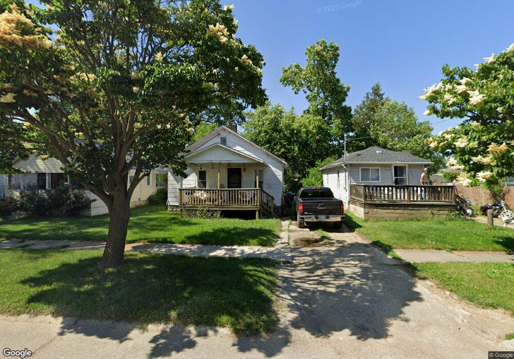
1016 Alvord Ave Flint, MI 48507
South Side NeighborhoodEstimated Value: $37,000 - $48,000
2
Beds
1
Bath
708
Sq Ft
$61/Sq Ft
Est. Value
About This Home
This home is located at 1016 Alvord Ave, Flint, MI 48507 and is currently estimated at $43,231, approximately $61 per square foot. 1016 Alvord Ave is a home located in Genesee County with nearby schools including Neithercut Elementary School, Flint Southwestern Classical Academy, and International Academy of Flint (K-12).
Ownership History
Date
Name
Owned For
Owner Type
Purchase Details
Closed on
Feb 19, 2014
Sold by
Brown Isaic
Bought by
Brown Isaic and King Darletta
Current Estimated Value
Purchase Details
Closed on
Jan 31, 2014
Sold by
Genesee County Land Bank Authority
Bought by
Brown Isaic
Purchase Details
Closed on
Apr 9, 2010
Sold by
The Genesee County Land Bank Authority
Bought by
Brown Isaic
Home Financials for this Owner
Home Financials are based on the most recent Mortgage that was taken out on this home.
Original Mortgage
$6,000
Interest Rate
5.02%
Mortgage Type
Seller Take Back
Purchase Details
Closed on
Dec 21, 2009
Sold by
Kildee Daniel T and Genesee County Treasurer
Bought by
Genesee County Land Bank Authority
Create a Home Valuation Report for This Property
The Home Valuation Report is an in-depth analysis detailing your home's value as well as a comparison with similar homes in the area
Home Values in the Area
Average Home Value in this Area
Purchase History
| Date | Buyer | Sale Price | Title Company |
|---|---|---|---|
| Brown Isaic | -- | None Available | |
| Brown Isaic | $6,000 | None Available | |
| Brown Isaic | $6,000 | None Available | |
| Genesee County Land Bank Authority | -- | None Available |
Source: Public Records
Mortgage History
| Date | Status | Borrower | Loan Amount |
|---|---|---|---|
| Previous Owner | Brown Isaic | $6,000 |
Source: Public Records
Tax History Compared to Growth
Tax History
| Year | Tax Paid | Tax Assessment Tax Assessment Total Assessment is a certain percentage of the fair market value that is determined by local assessors to be the total taxable value of land and additions on the property. | Land | Improvement |
|---|---|---|---|---|
| 2025 | $635 | $12,500 | $0 | $0 |
| 2024 | $587 | $12,800 | $0 | $0 |
| 2023 | $584 | $10,200 | $0 | $0 |
| 2022 | $0 | $8,200 | $0 | $0 |
| 2021 | $599 | $7,400 | $0 | $0 |
| 2020 | $553 | $7,400 | $0 | $0 |
| 2019 | $547 | $7,500 | $0 | $0 |
| 2018 | $519 | $6,000 | $0 | $0 |
| 2017 | $508 | $0 | $0 | $0 |
| 2016 | $505 | $0 | $0 | $0 |
| 2015 | -- | $0 | $0 | $0 |
| 2014 | -- | $0 | $0 | $0 |
| 2012 | -- | $7,100 | $0 | $0 |
Source: Public Records
Map
Nearby Homes
- 1015 Alvord Ave
- 1031 Ingleside Ave
- 1212 Crawford St
- 1234 Huron St
- 4418 Brunswick Ave
- 1122 Markham St
- 1039 Markham St
- 1028 Campbell St
- 1310 Huron St
- 845 Alvord Ave
- 1228 Leland St
- 1318 Ingleside Ave
- 829 Clinton St
- 1329 Huron St
- 1102 W Atherton Rd
- 818 Alvord Ave
- 1416 Blackberry Ln
- 805 Alvord Ave
- 1418 Blueberry Ln
- 1410 Berrywood Ln
- 1012 Alvord Ave
- 1020 Alvord Ave
- 1024 Alvord Ave
- 4118 Fenton Rd
- 4126 Fenton Rd
- 1019 Crawford St
- 4106 Fenton Rd
- 1034 Alvord Ave
- 1027 Crawford St
- 1011 Alvord Ave
- 1019 Alvord Ave
- 1031 Crawford St
- 1027 Alvord Ave
- 1035 Crawford St
- 4202 Fenton Rd Unit Bldg-Unit
- 4202 Fenton Rd
- 1035 Alvord Ave
- 1044 Alvord Ave
- 4100 Fenton Rd
- 1039 Crawford St