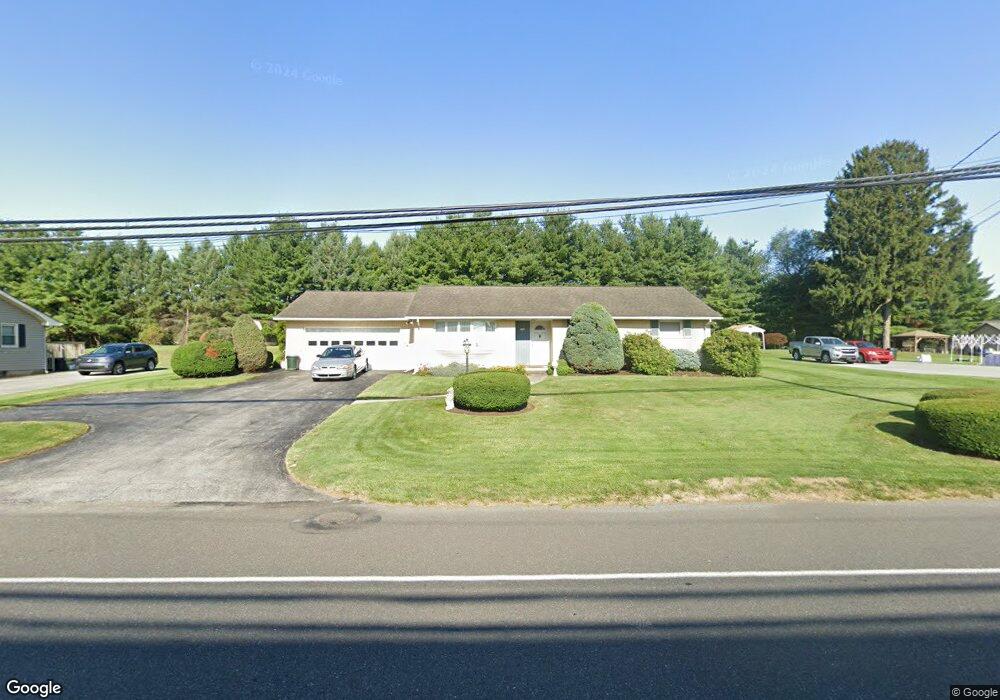
1016 Brookside Rd Allentown, PA 18106
Estimated Value: $351,000 - $424,000
3
Beds
1
Bath
1,326
Sq Ft
$287/Sq Ft
Est. Value
About This Home
This home is located at 1016 Brookside Rd, Allentown, PA 18106 and is currently estimated at $380,521, approximately $286 per square foot. 1016 Brookside Rd is a home located in Lehigh County with nearby schools including Wescosville Elementary School, Lower Macungie Middle School, and Emmaus High School.
Ownership History
Date
Name
Owned For
Owner Type
Purchase Details
Closed on
Sep 5, 2003
Sold by
Mcnabb Allen P and Mcnabb Mary Ann
Bought by
Bittner Ronald H
Current Estimated Value
Home Financials for this Owner
Home Financials are based on the most recent Mortgage that was taken out on this home.
Original Mortgage
$144,000
Outstanding Balance
$65,789
Interest Rate
6.02%
Mortgage Type
Purchase Money Mortgage
Estimated Equity
$314,732
Create a Home Valuation Report for This Property
The Home Valuation Report is an in-depth analysis detailing your home's value as well as a comparison with similar homes in the area
Home Values in the Area
Average Home Value in this Area
Purchase History
| Date | Buyer | Sale Price | Title Company |
|---|---|---|---|
| Bittner Ronald H | $182,500 | -- |
Source: Public Records
Mortgage History
| Date | Status | Borrower | Loan Amount |
|---|---|---|---|
| Open | Bittner Ronald H | $144,000 |
Source: Public Records
Tax History Compared to Growth
Tax History
| Year | Tax Paid | Tax Assessment Tax Assessment Total Assessment is a certain percentage of the fair market value that is determined by local assessors to be the total taxable value of land and additions on the property. | Land | Improvement |
|---|---|---|---|---|
| 2025 | $4,687 | $183,600 | $53,900 | $129,700 |
| 2024 | $4,535 | $183,600 | $53,900 | $129,700 |
| 2023 | $4,444 | $183,600 | $53,900 | $129,700 |
| 2022 | $4,339 | $183,600 | $129,700 | $53,900 |
| 2021 | $4,247 | $183,600 | $53,900 | $129,700 |
| 2020 | $4,206 | $183,600 | $53,900 | $129,700 |
| 2019 | $4,135 | $183,600 | $53,900 | $129,700 |
| 2018 | $4,081 | $183,600 | $53,900 | $129,700 |
| 2017 | $4,009 | $183,600 | $53,900 | $129,700 |
| 2016 | -- | $183,600 | $53,900 | $129,700 |
| 2015 | -- | $183,600 | $53,900 | $129,700 |
| 2014 | -- | $183,600 | $53,900 | $129,700 |
Source: Public Records
Map
Nearby Homes
- 4881 Spruce Rd
- 5300 Hanover Dr
- 997 Village Round Unit K
- 997K Village Round Unit 104K
- 4626 N Hedgerow Dr
- 1037 Village Round Unit L
- 1045 Barnside Rd
- 1385 Brookside Rd
- 1270 Minesite Rd
- 5475 Hamilton Blvd Unit 7
- 5524 Stonecroft Ln
- 5619 Stonecroft Ln
- 5133 Meadow Ln
- 5673 Wedge Ln
- 5736 Greens Dr
- 5280 Townsquare Dr
- 1675 Hamlet Dr
- 6126 Palomino Dr
- 5175 Meadowview Dr
- 5821 Daniel St
- 1004 Brookside Rd
- 1024 Brookside Rd
- 994 Brookside Rd
- 1032 Brookside Rd
- 1005 N Brookside Rd Unit 100
- 976 Brookside Rd
- 1046 Brookside Rd
- 1011 N Brookside Rd Unit 155-C
- 1005 Brookside Rd Unit 100
- 1005 Brookside Rd Unit 307
- 1005 Brookside Rd Unit S80
- 1005 Brookside Rd Unit S50
- 1005 Brookside Rd Unit Suite 80
- 1011 Brookside Rd Unit 155D
- 1011 Brookside Rd Unit 155F
- 1011 Brookside Rd Unit 155C
- 1011 Brookside Rd Unit 155A
- 1011 Brookside Rd Unit Suite 200
- 1011 Brookside Rd Unit Suite 110
- 1011 Brookside Rd Unit Suite 102