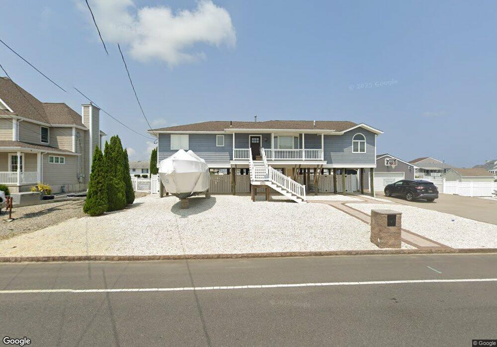
1016 Capstan Dr Forked River, NJ 08731
Estimated Value: $790,648 - $983,000
4
Beds
2
Baths
1,996
Sq Ft
$439/Sq Ft
Est. Value
About This Home
This home is located at 1016 Capstan Dr, Forked River, NJ 08731 and is currently estimated at $876,162, approximately $438 per square foot. 1016 Capstan Dr is a home located in Ocean County with nearby schools including Lacey Township High School.
Ownership History
Date
Name
Owned For
Owner Type
Purchase Details
Closed on
Dec 3, 2021
Sold by
Barnes Eric W and Barnes Margaret L
Bought by
Barnes Eric W and Barnes Margaret L
Current Estimated Value
Home Financials for this Owner
Home Financials are based on the most recent Mortgage that was taken out on this home.
Original Mortgage
$455,000
Outstanding Balance
$346,047
Interest Rate
2.27%
Mortgage Type
New Conventional
Estimated Equity
$530,115
Purchase Details
Closed on
Dec 29, 2005
Sold by
Decastro Manuel and Decastro Jane
Bought by
Barnes Eric W and Sheehan Margaret L
Home Financials for this Owner
Home Financials are based on the most recent Mortgage that was taken out on this home.
Original Mortgage
$400,000
Interest Rate
5.87%
Mortgage Type
Fannie Mae Freddie Mac
Create a Home Valuation Report for This Property
The Home Valuation Report is an in-depth analysis detailing your home's value as well as a comparison with similar homes in the area
Home Values in the Area
Average Home Value in this Area
Purchase History
| Date | Buyer | Sale Price | Title Company |
|---|---|---|---|
| Barnes Eric W | -- | Accommodation | |
| Barnes Eric W | -- | None Listed On Document | |
| Barnes Eric W | $575,000 | Chicago Title Insurance Co |
Source: Public Records
Mortgage History
| Date | Status | Borrower | Loan Amount |
|---|---|---|---|
| Open | Barnes Eric W | $455,000 | |
| Closed | Barnes Eric W | $455,000 | |
| Previous Owner | Barnes Eric W | $400,000 |
Source: Public Records
Tax History
| Year | Tax Paid | Tax Assessment Tax Assessment Total Assessment is a certain percentage of the fair market value that is determined by local assessors to be the total taxable value of land and additions on the property. | Land | Improvement |
|---|---|---|---|---|
| 2025 | $10,820 | $395,600 | $220,000 | $175,600 |
| 2024 | $9,372 | $395,600 | $220,000 | $175,600 |
| 2023 | $8,952 | $395,600 | $220,000 | $175,600 |
| 2022 | $8,952 | $395,600 | $220,000 | $175,600 |
| 2021 | $8,802 | $395,600 | $220,000 | $175,600 |
| 2020 | $8,521 | $395,600 | $220,000 | $175,600 |
| 2019 | $8,371 | $395,600 | $220,000 | $175,600 |
| 2018 | $8,272 | $395,600 | $220,000 | $175,600 |
| 2017 | $8,135 | $398,200 | $220,000 | $178,200 |
| 2016 | $8,103 | $398,200 | $220,000 | $178,200 |
| 2015 | $7,741 | $398,200 | $220,000 | $178,200 |
| 2014 | $8,595 | $499,700 | $320,000 | $179,700 |
Source: Public Records
Map
Nearby Homes
- 1025 Capstan Dr
- 986 Capstan Dr
- 814 Ensign Dr
- 0 Windward Dr Unit NJOC2039288
- 0 Windward Dr Unit 22601526
- 915 Shenandoah Dr
- 715 Richmond Dr
- 709 Richmond Dr
- 510 Conifer Dr
- 0 Union Ct Unit 22605987
- 1029 Bowsprit Point
- 330 Riviera Dr
- 606 Bowsprit Point
- 802 E Hickory Dr
- 826 Hazelton Ave
- 710 Hazelton Ave
- 821 Bunnell St
- 1001 Painter Point
- 207 Sunset Dr
- 502 Teakwood Dr
- 1012 Capstan Dr
- 1022 Capstan Dr
- 1024 Capstan Dr
- 1011 Capstan Dr
- 1013 Capstan Dr
- 1009 Capstan Dr
- 1010 Capstan Dr
- 1026 Capstan Dr
- 1215 Varuna Dr
- 1015 Capstan Dr
- 1007 Capstan Dr
- 1216 Varuna Dr
- 1282 Capstan Dr
- 1028 Capstan Dr
- 1214 Varuna Dr
- 1017 Capstan Dr
- 1005 Capstan Dr
- 1006 Capstan Dr
- 1030 Capstan Dr
- 1280 Capstan Dr
Your Personal Tour Guide
Ask me questions while you tour the home.