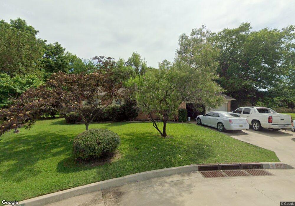
1016 Circle Dr Ardmore, OK 73401
Estimated Value: $136,000 - $151,000
2
Beds
2
Baths
1,221
Sq Ft
$115/Sq Ft
Est. Value
About This Home
This home is located at 1016 Circle Dr, Ardmore, OK 73401 and is currently estimated at $140,229, approximately $114 per square foot. 1016 Circle Dr is a home located in Carter County with nearby schools including Charles Evans Elementary School, Ardmore Middle School, and Ardmore High School.
Ownership History
Date
Name
Owned For
Owner Type
Purchase Details
Closed on
Feb 14, 2012
Sold by
Clark Billy R and Clark Jill L
Bought by
Nunnelee Bob and Nunnelee Carla
Current Estimated Value
Home Financials for this Owner
Home Financials are based on the most recent Mortgage that was taken out on this home.
Original Mortgage
$58,320
Interest Rate
3.95%
Mortgage Type
Commercial
Purchase Details
Closed on
Feb 26, 1999
Sold by
Curtis Lee A and Curtis Margar
Bought by
Clark Billy R and Clark L
Purchase Details
Closed on
Aug 30, 1995
Sold by
Koch Homer and Koch Virgie
Bought by
Curtis Lee A and Curtis Margar
Purchase Details
Closed on
Feb 8, 1993
Sold by
Boyer Shawn
Bought by
Koch Homer and Koch Virgie
Create a Home Valuation Report for This Property
The Home Valuation Report is an in-depth analysis detailing your home's value as well as a comparison with similar homes in the area
Home Values in the Area
Average Home Value in this Area
Purchase History
| Date | Buyer | Sale Price | Title Company |
|---|---|---|---|
| Nunnelee Bob | $73,000 | None Available | |
| Clark Billy R | $60,500 | -- | |
| Curtis Lee A | $58,000 | -- | |
| Koch Homer | $48,000 | -- |
Source: Public Records
Mortgage History
| Date | Status | Borrower | Loan Amount |
|---|---|---|---|
| Closed | Nunnelee Bob | $58,320 |
Source: Public Records
Tax History Compared to Growth
Tax History
| Year | Tax Paid | Tax Assessment Tax Assessment Total Assessment is a certain percentage of the fair market value that is determined by local assessors to be the total taxable value of land and additions on the property. | Land | Improvement |
|---|---|---|---|---|
| 2025 | $1,448 | $14,502 | $3,000 | $11,502 |
| 2024 | $1,448 | $13,548 | $2,984 | $10,564 |
| 2023 | $1,352 | $12,903 | $2,972 | $9,931 |
| 2022 | $1,175 | $12,289 | $2,938 | $9,351 |
| 2021 | $1,181 | $11,704 | $2,854 | $8,850 |
| 2020 | $1,108 | $11,146 | $1,738 | $9,408 |
| 2019 | $1,031 | $10,616 | $1,200 | $9,416 |
| 2018 | $1,048 | $10,620 | $1,200 | $9,420 |
| 2017 | $955 | $10,448 | $1,200 | $9,248 |
| 2016 | $945 | $10,141 | $358 | $9,783 |
| 2015 | $742 | $9,658 | $341 | $9,317 |
| 2014 | $823 | $9,198 | $340 | $8,858 |
Source: Public Records
Map
Nearby Homes
- 923 Maxwell St NW
- 1029 Northwest Blvd
- 1496 US Highway 77
- 912 Elm St
- 912 Maxwell St NW
- 1620 Shenandoah Dr
- 1907 Robison St
- 809 Campbell St
- 723 Maxwell St NW
- 722 Maxwell St NW
- 715 Ash St
- 800 Cottonwood St
- 1717 Red Oak Dr
- 703 Cottonwood St
- 1626 N Cedar Loop
- 1111 Prairie Valley Rd
- 0 Veterans Blvd Unit 2542555
- 818 Northwest Blvd
- 00 N Rockford Rd
- 1412 Healdton Blvd
- 1014 Circle Dr
- 1018 Circle Dr
- 1013 Maxwell St NW
- 1012 Circle Dr
- 1011 Maxwell St NW
- 1017 Circle Dr
- 1020 Circle Dr
- 1010 Circle Dr
- 1009 Maxwell St NW
- 1007 Circle Dr
- 1024 Circle Dr
- 1019 Circle Dr
- 1008 Circle Dr
- 1007 Maxwell St NW
- 1012 Maxwell St NW
- 1005 Circle Dr
- 1010 Maxwell St NW
- 1905 N Commerce St
- 1021 Circle Dr
- 1008 Maxwell St NW