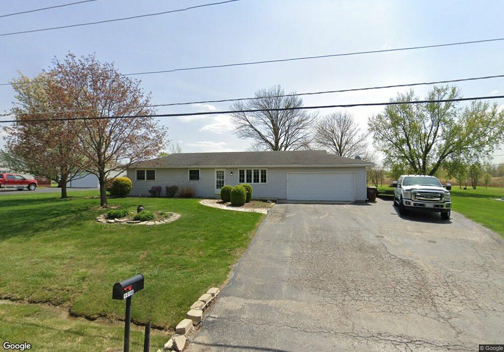
1016 E Illinois Hwy New Lenox, IL 60451
Estimated Value: $286,429 - $373,000
--
Bed
--
Bath
--
Sq Ft
0.7
Acres
About This Home
This home is located at 1016 E Illinois Hwy, New Lenox, IL 60451 and is currently estimated at $323,107. 1016 E Illinois Hwy is a home located in Will County with nearby schools including Spencer Trail, Spencer Crossing Intermediate School, and Spencer Pointe.
Ownership History
Date
Name
Owned For
Owner Type
Purchase Details
Closed on
Jul 10, 2017
Sold by
Briggs Michael D and Briggs Carol A
Bought by
Carduff Joseph R
Current Estimated Value
Home Financials for this Owner
Home Financials are based on the most recent Mortgage that was taken out on this home.
Original Mortgage
$164,000
Outstanding Balance
$83,874
Interest Rate
3%
Mortgage Type
New Conventional
Estimated Equity
$239,233
Purchase Details
Closed on
Sep 27, 2012
Sold by
Briggs Michael D and Telfer Carol A
Bought by
Briggs Michael D and Briggs Carol A
Create a Home Valuation Report for This Property
The Home Valuation Report is an in-depth analysis detailing your home's value as well as a comparison with similar homes in the area
Home Values in the Area
Average Home Value in this Area
Purchase History
| Date | Buyer | Sale Price | Title Company |
|---|---|---|---|
| Carduff Joseph R | $208,000 | Fidelity National Title Ins | |
| Briggs Michael D | -- | None Available |
Source: Public Records
Mortgage History
| Date | Status | Borrower | Loan Amount |
|---|---|---|---|
| Open | Carduff Joseph R | $164,000 |
Source: Public Records
Tax History Compared to Growth
Tax History
| Year | Tax Paid | Tax Assessment Tax Assessment Total Assessment is a certain percentage of the fair market value that is determined by local assessors to be the total taxable value of land and additions on the property. | Land | Improvement |
|---|---|---|---|---|
| 2024 | $5,428 | $77,378 | $25,991 | $51,387 |
| 2023 | $5,428 | $70,536 | $23,693 | $46,843 |
| 2022 | $4,920 | $64,980 | $21,827 | $43,153 |
| 2021 | $4,657 | $61,112 | $20,528 | $40,584 |
| 2020 | $4,515 | $58,932 | $19,796 | $39,136 |
| 2019 | $4,312 | $57,104 | $19,182 | $37,922 |
| 2018 | $4,203 | $55,136 | $18,521 | $36,615 |
| 2017 | $3,982 | $53,551 | $17,989 | $35,562 |
| 2016 | $3,859 | $52,118 | $17,508 | $34,610 |
| 2015 | $3,703 | $50,478 | $16,957 | $33,521 |
| 2014 | $3,703 | $49,855 | $16,748 | $33,107 |
| 2013 | $3,703 | $50,527 | $16,974 | $33,553 |
Source: Public Records
Map
Nearby Homes
- 911 Canongate Ln
- 805 Regent St
- 203 Tonell Ave
- 1535 Glenbrooke Ln
- 117 Walona Ave
- 214 Somerset Ct
- 1981 Stapleton Rd
- 1017 E Lincoln Hwy
- 1978 Stapleton Rd
- 1990 Edgeview Dr
- 1000 S Cedar Rd
- LOT 8 W Laraway Rd
- 701 Bishops Gate
- 2019 Royalglen Dr
- 328 E Lincoln Hwy
- 125 N Anderson Rd
- 1851 Glenlake Ct
- 00 NE Corner Cherry Hill Road and Moss Lane Rd
- 2067 Edgeview Dr
- 1351 E Lincoln Hwy
- 1012 E Illinois Hwy
- 1104 E Illinois Hwy
- 1108 E Illinois Hwy
- 1114 E Illinois Hwy Unit 1
- 2 Saint Clair Ln
- 940 Lake Rd
- 1116 E Illinois Hwy
- 936 Lake Rd
- 932 Lake Rd
- 941 Lake Rd
- 937 Lake Rd
- 901 E Illinois Hwy
- 928 Lake Rd
- 1204 E Illinois Hwy
- 1205 E Illinois Hwy
- 933 Lake Rd
- 924 Lake Rd
- 936 Barnside Rd
- 929 Lake Rd
- 932 Barnside Rd